Spy Lands –Who really discovered the coasts of America

I mentioned last week about spies and maps and government subterfuge as aspects of maps that we rarely think about. Municipal governments still fool residents with streets on maps that are planned, but haven’t been built. Map makers take liberties with place names and add imaginary towns and streets that reflect their biases for and against university football teams. But in the past spies were frequently involved in cartographic subterfuge.
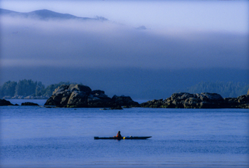
For instance, most of us were schooled that Captain Cook was the first European to lay eyes on the north western coast of North America. However there is mounting evidence that the English privateer (government sanctioned pirate) Sir Francis Drake, not Cook, first saw the coast of Oregon, Washington and British Columbia between 1577 and 1580 – 160 years before Cook’s journey.
Why isn’t this known?
First of all because some historians are hard pressed to let go of old ideas, but second of all because Drake’s journey was likely suppressed and evidence of it hidden, because of disputes with the Spanish that were, later, going to erupt into war. Drake is confirmed to have travelled as far north as Mendocino, California, the farthest north the Spanish had been, but a 412 year old map commemorating Drakes circumnavigation of the globe shows details of the coast of British Columbia that no one could have known unless they had been there. Additionally, archeological evidence – 1571 British coins and equipment – have been found in Oregon and Victoria, B.C. gardens, so that Drake is believed to have travelled as far north as Prince of Wales Island in Alaska. Finally, Drake’s cousin confessed under torture to the Spanish, that a fabled North Pacific island, Nova Albion, had been discovered by Drake and claimed for England 29 years before Samuel Champlain founded Quebec and before there was a Virginia on any map. This is believed to have been Vancouver Island, kept secret.
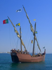
 A further example of cartographic spies, deals with those icons, Christopher Columbus and John Cabot. Columbus, we’re taught, discovered the Americas while looking for China. Cabot’s fame is due to his first North American landfall by a European. Or at least that’s what we’re taught. But in a 1498 letter that was penned just months after Cabot’s historic return from Newfoundland, a spy in England wrote to Columbus and talked about earlier voyages by men from Bristol to the same place Cabot had been and that these earlier voyages had been to an “Island of Brasil” and that Cabot’s landfall “is believed to be the mainland that the men from Bristol found”. The spy’s letter also mentions that these voyages from Bristol were well known to Columbus – something that is further supported because Columbus had spent time in Bristol and Iceland in the 1470s – almost 20 years before he managed to convince the Spanish monarchy to fund his explorations. Did Columbus use this knowledge to convince Isabella? Did he use it to calm his crew on his long crossing?
 We may never know, and even if we do, will it matter? For Columbus IS an icon that history won’t forget, but what this shows is how secrets and spies permeate the European history of maps, so that who really ‘discovered’ the coasts of America may never be known. Of course, just talk to a First Nations/Native American person and they’ll tell you we’ve got it all wrong anyway. North America had been ‘discovered’ long before any European left home.


