Tag: Enbridge Pipeline

Maps, Klondike Gold and Northern Pipelines
Maps, Klondike Gold and Northern Pipelines

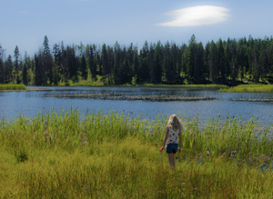
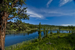
One of the Kane Lakes, Central British Columbia (2012) Photo (c) Karen Abrahamson

I’ve mentioned previously how maps are actually an argument on paper to convey, or propagate, a specific belief system. A good example of this was seen in the late 1800s during the famed Klondike Gold Rush that lured many a man (and woman) north to what was then viewed as the last frontier on the continent.

In the early 1880s little was known of the geography and geological wealth of the north but, extrapolating from gold strikes in places like Cassiar, British Columbia, there were rumors abounding of what might be found. As a result of the lack of real information, the Geological Survey of Canada sent surveyors north and by 1887 a report, with maps, had been completed that outlined the territory’s geological features and mining prospects as well as its geographical features. The report went so far as to predict gold finds in the Yukon and in 1896 that came true, with the discovery of placer gold on Rabbit Creek.

The resulting gold rush led to a demand for maps of the area. When the Geological Survey ran out of official maps, private companies and cities and towns took over. All of them wanted their piece of the Klondike pie, so many cities and private operators developed maps of the Klondike that presented their city, or their route as the best-easiest-most direct (you choose which) way to get to the north. They couldn’t all be right, so of course, they lied or at least doctored the truth to be in their favor.
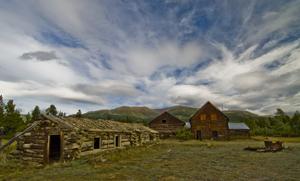
Old farmstead, Yukon (2009) Photo (c) Karen Abrahamson

Case in point were maps that gave the impression it was only two or three days from Edmonton to the Klondike, because the prospector just had to navigate two waterways and they would arrive at their destination. Other maps skewed the projection of the earth (a projection is used to take the landforms of a round earth and place them on a flat map. Every projection skews the land formations to some degree, but different projections can be used to make different part of the land look larger or smaller). These new maps emphasized the huge distances of some routes and made others look shorter. Of course they also failed to mention things like mountain barriers or the high costs associated with steamer passage across lakes that blocked the short way to the promised land.

Which brings me back once more to the Northern Gateway Pipeline. While Enbridge and the Canadian Government show maps of the pipeline route and claim that it will be built to withstand the rigors of northern British Columbia and will pose limited risk to the landscape, the fact is that they haven’t even allowed a full environmental assessment of the area the pipeline proposes to cross. The trouble is, we’re unlikely to ever have such an assessment, because the Canadian Government has failed to provide its scientists with the resources (time, staff, funding) to complete such an assessment within the time the Government’s process now allots.

As a result the rhetoric on safety and responsibility we’re hearing from the Canadian Government sounds an awful lot like the maps to the Klondike from Edmonton. A road trip of two to three days of easy travel.

Right. And we’re supposed to believe it.

The government seems to be hoping that, just like gold on the Klondike did to prospectors, black gold to be sold to China will inflame our imaginations and distort our knowledge of geography – and make us believe anything.

Not going to happen, Mr. Prime Minister.
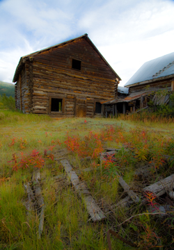
Old homestead, Yukon (2009) Photo (c) Karen Abrahamson


Mystical Dunvegan and the Northern Gateway Pipeline

Mystical Dunvegan and the Northern Gateway Pipeline

Along Kane Lake Road, British Columbia (2012) Photo (c) Karen Abrahamson

The furor in British Columbia about the proposed Northern Gateway Pipeline got a little bit more interesting this past week. First of all we had Enbridge providing the public with maps of the coastal route to be used by oil tankers. Those maps conveniently left out all the islands and difficult narrow ocean channels those same tankers would have to navigate. Then we had the announcement by a B.C. newspaper mogul that he was exploring the potential for building an oil refinery on the Northwest coast of BC. His rationale was that with so many people concerned about oil tankers travelling the treacherous and pristine British Columbia waterways, why not process the oil in BC, create new jobs, and only ship processed gas and diesel. This would alleviate some of the concerns over a potential oil spill as both gasoline and diesel are easier to clean up and don’t pollute like oil does. Of course the reaction has been mixed. Even the oil companies aren’t sure they like his alternative, but Enbridge’s maps and the newspaper mogul’s vision put me in mind of the ‘town’ of Dunvegan.

Abandoned Yukon Homestead (2009) Photo (c) Karen Abrahamson

I say ‘town’ with parentheses because Dunvegan was never actually built, but in the saga of Canadian maps it has a place of ignominy. You see, as the Dominion of Canada was busily surveying and dividing the country to encourage development it led to a boom in land speculation. These high stakes games were trying to anticipate where the next great land boom was going to take place. Dunvegan seemed like a likely place.

Located six hundred and fifty kilometers north of Edmonton, Alberta, Dunvegan was a convergence point for a number of native trails and a regular route for explorers and map makers. Indians camped there. Two creeks met there. A fort was built at the location and provided a jumping off point and point of safety for missionaries, explorers and homesteaders. Dunvegan became one of those mystical places on the map like Finisterre was to the pilgrims on the Camino de Santiago in Spain and France.

So much did Dunvegan enter the public consciousness of the day that it was included in the name of the first railroad to the Peace River in British Columbia, the Edmonton-Dunvegan and British Columbia Railroad. The trouble was, the railway never actually ran to Dunvegan. This was never mentioned in all the real estate material selling land to Englishmen and Easterners. Nope, the material and the maps showed the rail running to the town. Along with the railway the maps showed wharves along the waterways and development. But that wasn’t the only problem with Dunvegan. The many maps of the town being used to sell the land to the unwary, showed quarter sections of land without bothering to mention the topography. Think vertical cliffs and steep drops. Though the land was sold to many, not one lot was built upon because of the many difficulties.

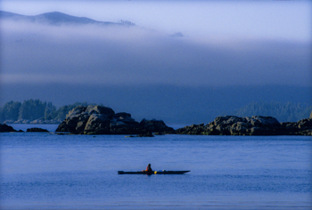
Kayaking Clayoquot Sound, British Columbia (1996) Photo Karen Abrahamson

Which brings me back to the proposal for a pipeline and a world class oil refinery on the north coast of British Columbia. Sure, you could build the refinery, or you can talk about it, but such a refinery is dependent upon a pipeline across the same type of terrain that turned back the land investors in Dunvegan. I like to think that unlike the unsuspecting purchasers of land in Dunvegan, the British Columbia public won’t be taken in by maps and rhetoric that enhance non-existent amenities and that minimize the dangers that do.


Ray Bradbury and Rewriting the Map of Canada

Ray Bradbury and Rewriting the Map of Canada

Woodland trail, Yukon, Canada (2009) Photo (c) Karen Abrahamson

Ray Bradbury died this week and as a science fiction and fantasy writer, his was some of the writing that most inspired me. I will forever be haunted by his horrific short story “All Summer in a Day,” but some of Bradbury’s best work were his cautionary tales like Fahrenheit 451, a terrifying look at the death of freedom and the burning of books in a fictional future. You might wonder what this has to do with the map of Canada, but bear with me.

This post will probably be as close to getting political as I will ever get, but events here in Canada have pushed me to the place where I finally have been forced out of the silent majority. You see the map of Canada is about to change. Not the physical map, perhaps, but the environmental map and the map of our hearts and our place in the world, and our children’s future is under attack so badly that I have to speak out. It feels very strange for a business person and writer who has always focused on fiction. For those of you who don’t live in Canada, here’s what’s at issue.

Small fishing lake in the B.C. Interior. (2011) Photo (c) Karen Abrahamson.

1. Our federal government is currently introducing legislation, Bill C 38, that will abolish most of our environmental protection legislation. They claim that they are trying to clean up the legislation in order to make it ‘make sense’ for municipalities and farmers, but in reality, while they might cut some red tape, they are getting rid of any legislation that might block the immediate implementation of major corporate initiatives, like the Enbridge Pipeline that will cross some of the most rugged and pristine landscape in Canada, from Alberta to the Pacific Ocean. This pipeline will cross hundreds of miles of wilderness and thousands of salmon-spawning streams to bring the dirtiest type of oil to the Pacific Ocean. Once there, this same legislation erases much of the laws in place to protect the pristine waters of British Columbia. It will allow oil tankers to ply the delicate environmental areas of the inland passage to take this dirty oil to China—one of the worst polluting countries in the world. Think Exxon Valdez. The legislation also removes the safeguards in place for many endangered species, because, the new legislation says, these species aren’t really important.

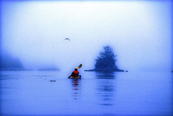
Kayaking the coast of British Columbia (1996) Photo (c) Karen Abrahamson

2. At the same time this government is systematically silencing any opposition. Along with this salvo against the environment which shortens any environmental assessments and limits who can even participate in the discussions, the government has also launched an attack against non-profit societies and charities, by imposing restrictions that stop these charities from any sort of advocacy against government actions. This attack has specifically been leveled at environmental organizations because they receive donations from other countries and this government is threatened by the groundswell of reaction from around the world about what they plan to do. They are changing the rules to hamstring any opposition against the huge oil corporations.

At the same time, they either stop funding scientific research, or they place gag orders on all remaining government scientists who might provide a voice of reason or evidence that government actions are wrong. But then I shouldn’t be surprised. This government doesn’t believe in science.

Even Members of Parliament who try to express what their constituents want are silenced. And when members of the United Nations commented recently on the impoverished state of our First Nations population, this government told them to go away and focus on third world countries. It seems Canada, in this government’s eyes, is beyond criticism.

All of this paints a picture that should terrify anyone concerned for our future. For someone who has always been a proud Canadian these actions are only the tip of a blood-chilling iceberg. It leaves me to think that, instead of the great white north that has stood proudly for freedom, integrity and honour both here and abroad for 145 years, we are being transformed into a country I only read about as in Ray Bradbury’s writing.

Welcome to totalitarian Canada – next comes the book burning.


Mapping Loss: Maps and the Enbridge Pipeline

Mapping Loss: Maps and the Enbridge Pipeline

Last week I wrote about how the cartographers of the early western mapping tradition created North America in the public’s imagination through their tales of the Garden of the World that awaited the person daring enough to travel westward, and through their splendid maps that unrolled the future in the shapes of the landscape.

But maps also set out losses. Ancient maps show the destructive ebb and flow of empires across the landscape as mankind shifted capitals and allegiances or had them imposed by various leaders. We see Tyre and Babylon and Troy washed away by time, but maps of their greatness remain, some etched in stone, some recreated by scholars to hint at the greatness we have lost through time. The same can be said for the great maps drawn by Lewis and Clark and others, for as they rolled the country out for settlers, they marked horrible future losses of North America’s First Peoples. Indeed, you could say that the unfolding of the maps of North America rewrote reality from that of native people, to that of the settlers.

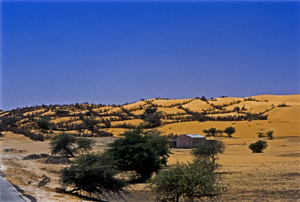
Devouring dunes, Mauritania, West Africa (1994) Photo (c) Karen Abrahamson

In more modern times we’ve seen maps used to show the devastating paths of tsunamis and the epicenters of quakes. Maps show us the destructive forces of nature, like the creeping dread of the Sahara desert, or the paths of hurricanes and tornados and the arcs of loss across the states where those killers touch down. Maps also portrayed manmade disaster like the destruction let loose by the Deepwater Horizon, as its killing oils reached the silver reed coastlines of the Gulf of Mexico. Maps of hydroelectric projects mark the loss of valley’s forests, and Indian villages with the blue lines of deep water.

Equally, or perhaps more, important maps show us future losses. Right now, in Canada, maps abound showing the proposed path of the Enbridge Oil Sands pipeline from the Alberta oil sands all the way across northern British Columbian mountain ranges and muskeg to a narrow fjord at a town called Kitimat on the Pacific Ocean. From there, supertankers will collect crude oil for the industries and cars of China.

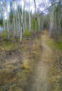
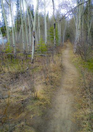
Yukon Path, (2009) Photo (c) Karen Abrahamson

Proponents of the pipeline speak of it as if it marks prosperity across this country, like a vein of money that will bring jobs in the construction phase and open the purse of China right into Canadian government coffers. But an overlay on that map also speaks of potential loss. Supertankers threaten to rewrite our coastlines from the pristine home of orca and sea otter, to the barrens left behind by oil spills. Broken pipelines threaten salmon spawning grounds and the haunts of those icons, the moose and beaver, not to mention the homes of the great, great grandchildren of those same First People we stole the continent from years ago.

The trouble is, most people just look at what is, and they don’t see the competing futures these maps propose anymore than people driving past a proposal sign for local development question the losses that development will cause. Those who propose the development see prosperity in new homes for sale and new retail stores. Whereas, reading the losses, I see the destruction of the trees and the birds and small animals that live within their green space.

So I’m suggesting we need to take the time to reread our maps and recognize the losses our development proposes. Otherwise we threaten to be like our forefathers and repeat their destructions. We need to listen to North America’s First People and remember the animals we share this earth with. Otherwise we threaten the very Garden of the World that caught settlers imaginations so many years ago. If we don’t, we’re likely to end up like the civilizations on those ancient maps – lost in time and remembered only for all the destruction we caused.

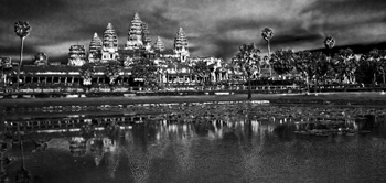
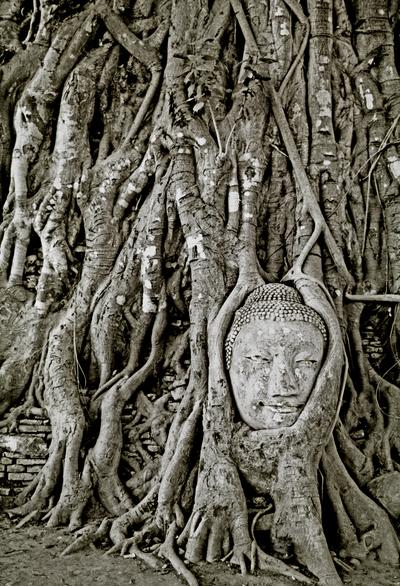
Buddha in ruins, Ayuthaya, Thailand (1997) Photo (c) Karen Abrahamson


Recent Fantasy

Available HERE,

$1.99

Available HERE,
$3.99

Available HERE $1.99


Recent Mystery


Available HERE
$4.99


Available HERE,

$4.99


Available HERE,

$4.99


Available HERE,
$4.99


Recent Romance

Available HERE, $2.99