Tag: Exploration

Andean Civilizations: A Map of a Different Color
Andean Civilizations: A Map of a Different Color

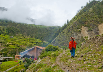
Off to the fields, Pumamarka (2011) Photo (c) Karen Abrahamson

When I think of maps I imagine back to when the first human made their first finger marks in mud to share a game trail, or a watering hole or an especially good berry bush. Surely that must have been the earliest form of map. Of course none of those primeval drawings exist, and so I’ve found myself writing a about the western development of maps over the ages and have tried to give a sense of the European tradition and the contributions of Arab and Chinese explorers and cartographers. This is the easy stuff to research and write about because the maps these cultures used were set down in a manner we are trained to see. Maps, to most of us, are a visual representation, usually on a flat medium like paper, that presents the relationship of one place to another. But other cultures have had other ways of presenting their landscapes, case in point are the great civilizations of the South American Andes.

What most of us think of as the Inca are actually a series of overlapping civilizations that rose and fell in the various livable areas of Peru, Bolivia, Ecuador, Columbia and Chile. After the very effective conquest of South American by the Spanish, not much remains of any Inca records and to date no maps (as we define them) have ever been found. But did these cultures simply not have maps or did they represent their landscapes in a different way?

Anthropologists and Cartographers say that formal mapmaking tends to occur within highly organized, bureaucratic societies as a form of discourse. The conditions necessary for mapmaking include: demands for agriculture, private property, long distance trade, militarism, and tribute relationships, amongst others, all of which are attributes of the various Andean societies.
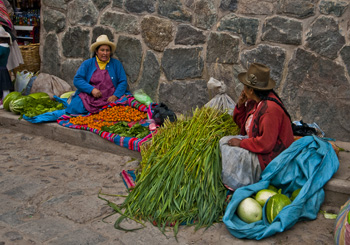
Women at Ollantaytambo market (2011) Photo (c) Karen Abrahamson

Anthropologists studying the various ancient cultures have begun to realize that westerners probably won’t recognize Andean maps until we start to see them through Andean eyes. The structure of maps aren’t only determined by geography, but also by social organization, cultural conventions and human perception. In the Inca worldview, the cosmos was built on a quartered circle, based on the way they viewed the Milky Way divide the heavens. They viewed their world that way as well, with the lands they ruled broken into four distinct quarters.

The Inca also had to map unusual terrain, from the coastal deserts and river oasis, up through the highlands to the alte-plano and Andes mountains and down again into the Amazon basin. Trade and tribute came those long distances, and north and south from Ecuador to Chile. Over those distict terrains there were distinctions of crop and animals at each of the different elevations. So, for an ancient Andean, among the things they needed to represent, were the different elevations, the different foods, and the waters that made life possible across these sometimes inhospitable terrains, as well as capturing the four quarters of the world and social relations.
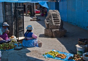
Market Scene, Chivay. Note the Inca rock that shows terracing and irrigation techniques. (2011) Photo (c) Karen Abrahamson

The resulting landscape representations convey things like ownership and elevation. Ancient weavings show the long narrow fields of produce separated by clan-assigned canals. Pottery shows spatial designs that encode critical social structures, and still other sculptures, such as Chieftain Vessels correspond to Andean landscapes with the head of the figure as the summit, the shoulders as central mountain slopes, the lower hips as the coastal plains where mountain rivers diverge on fields. Still other sculptures show realistic representations of the terraced fields and irrigation systems that make up areas of central highland valleys.

So while we might say the Inca made no maps, it doesn’t mean that they didn’t represent their landscape. The difference is that the Inca ‘maps’ were often three dimensional and layered with meaning, both in terms of the landscape, ownership and familial relationships, and the relationship of the landscape to their ancestors, the spirits and the cosmos.


The Star Raft: They came from the rising sun (part 2)

The Star Raft: They came from the rising sun (part 2)

Two weeks ago I wrote about the evidence showing contact between China and Africa long before the Portuguese sailed around the tip of Africa and into the Indian Ocean. More evidence of this appears from maps found in Korea and dating back to 1402 that show the WEST coast of Africa as far north as the Orange River, one of the longest rivers in Africa, which forms the international boundary between modern day South Africa and Namibia. This same map places Africa immediately opposite Indonesia with a string of small islands in between, suggesting that whoever drew the map, didn’t get there via India and the Gulf and down the African coast, but instead by sailing across the Indian Ocean. Records suggest some of these Chinese travelers came by way of a Star Raft. So who were these sailors and what is a Star Raft an how does this have relevance today?

Unlike later generations of Chinese dynasties, the Tang dynasty (A.D. 618-907) was outward looking and venturesome. This continued with the Southern Song Dynasty (A.D. 960-1279)who had lost half their territory to the Tartar hordes of the north. To make up for their property losses, they looked to oversees trade to fill their coffers and China became, for the first time, a maritime nation.

The ships they built had five or six decks, and carried a year’s supply of grain, herds of pigs and jars of fermenting wine. They carried the world’s most advanced seafaring technology in magnetic compasses, water-tight bulkheads, advanced rudder systems, sounding lines, and a sail designed for steering into the wind that could have allowed them to travel into the trade winds that had deterred the Arab seamen. By the end of the twelfth century they were on the edge of the western Indian Ocean and had appeared in the Gulf and off Yemen.

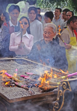
Old woman and Brazier and Xi'an Temple (1998) Photo (c) Karen Abrahamson

While many of these huge boats went no farther than India to trade, accounts from those few who went further also made their way back to China and described the port towns and the people they met. They describe the sources of ivory and rhinoceros horn, of frankincense, ambergris and a red gum resin called ‘dragon’s blood’ as a series of villages down the East African coast. News also came of the landscape and the African wildlife, including the marvelous creature called a camel-ox with a hide like a leopard’s, the hooves of a cow, no hump but a neck nine feet long perched above a body ten feet tall.

The contact between Africa and China continued, including embassies of African traders to the Chinese court. Proof of this comes both from Chinese records and from the diaries of Ibn Battuta, the many travelled Arab who wrote of meeting a man from Mogadishu who had been in China.

With the fall of the Song Dynasty and the coming of the Mongol hordes, the naval trade reduced, but the rise of the Ming Dynasty (A.D. 1368-1644) saw the creation of a huge maritime fleet that in 1414 sailed into the western Indian Ocean led by General Zheng He, Grand Eunuch of the Three Treasures. (See my short story here.) Zheng He was the Chinese Columbus, but the Chinese ships topped Columbus’s ships in every way. While Columbus sailed with three ships with single decks, Zheng He sailed with sixty-two galleons that each outweighed Columbus’s ships three to one. While Columbus had about 100 men, Zheng He had 868 civil officers, 93 commanders and 26,800 soldiers plus numerous others.

But unlike Columbus, who was a man of exploration, Zheng He led a Star Raft – an expedition planned to bring the ‘star-like radiance of the imperial ambassador’ and to win allegiance of distant people for the Chinese emperor. Yes, goods were traded during these voyages, but the symbolism of the exchange was unique to the Chinese. They believed that their trading partners were paying homage to the Chinese sovereign of the world. So unlike Columbus. the Chinese venture was based in looking inward – bringing the homage of other places to the center of the world.

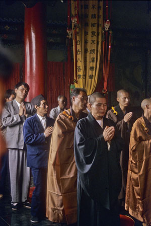
Inside a modern Xi'an Temple (1998) Photo (c) Karen Abrahamson

Which makes me wonder about the state of the world’s economy today as China’s economic engine begins to overtake that of the United States. Are we watching a modern-day version of the Star Raft as western companies and governments seek their trade accords with the new China?


They Came From the Rising Sun

They Came From the Rising Sun

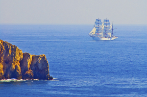
A Portuguese ship off the Algarve. Photo (c) Karen Abrahamson

I’ve spent much of this blog writing about the great European mapmaking tradition and the exploration that went with it, but long before European Kings considered funding a certain wild venture to reach India and China by sailing west across the Atlantic, and long before Vasco de Gama sailed round the Cape of Africa and into the Indian Ocean, the Chinese were venturing westward, too. They sailed from Canton and through the Malay straight and into the Indian Ocean. They mapped it, too.

Chinese records indicate that trade between China and Africa began as early as the Han Dynasty (202 BC to AD 220). Two of Africa’s most powerful nations of the time, Kush and Axum had trade relationships through intermediaries. In Kush the remains of ancient pottery and bronze utensils indicate that they may have been copying the styles of the Chinese goods being brought to its ports by Arab traders. Axum may have been the source of the rhinoceros horn, ivory and tortoise shell that Roman traders took to China in AD166.

But this was trade by intermediary, not face to face trade. The first trade by Chinese with African is thought to have occurred not much later, but it probably didn’t occur on African shores. Accounts of ancient travelers indicate that in places like Ceylon merchants and sailors from as far afield as China, Persia, Homerite countries and Adulis (an African port city) came together to trade. One Chinese trader, Fa Xian, stayed in Ceylon for two years before returning home to write his accounts of the people he met.

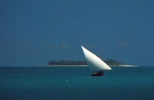
Dhow off Zanzibar Island (1994) Photo (c) Karen Abrahamson

During the time of the Tang Dynasty (618-907) records show that a Chinese did set foot on African soil. Du Huan, was a Chinese military officer who was captured by the Arabs during conflicts near Samarkand. After spending twelve years in the Abbasid Empire, he reappeared and wrote a record of his travels. Of the bits of that memoir that have been preserved over the ages, he speaks of travelling south over a great desert to the land of the black people, where there was little grain and no vegetation and malaria was endemic. Researchers today think this was probably modern-day Eritrea.

A Chinese junk from the 1270s was discovered in Guangzhou harbor in 1974 with cargo such as tortoiseshell, frankincense and ambergris that strongly suggest trade with Africa. Between 800 and 1400 Chinese goods were also making their way to Africa so that Chinese porcelain became common as decorations on houses and mosques and broken porcelain still apparently litters East African beaches. Chinese coins from the Tang Dynasty (the kind with the square hole in the middle) have been found along the coast and on islands like the Bajun and Zanzibar.

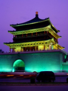
Chinese tower, Xi'an, China (1998) Photo (c) Karen Abrahamson

Of course, the Chinese travelers to these distant shores in these early days weren’t representatives of the Chinese dynasties. No they were merchants and traders. Most of these went as far as India and no farther and were content to trade with the middlemen who brought goods from Africa. But a few travelled further and the routes were known in the Kingdom of Heaven. In the ninth century the Tang Prime Minister and geographer, Jia Dan, knew of the sailing routes that gave 90 days from Canton to Arabia and 20 days for a further voyage southwest to a country called Sanlan.

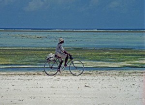
Cyclist on the western Zanzibar beach. (1994) Photo (c) Karen Abrahamson

Of course, if the Chinese were anything like the later Portuguese, this information could have come from Arab sailors as a result of the government confiscating all maps from visiting sailors, but a map compiled between 1311 and 1320 by the Chinese cartographer Zhu Siben clearly shows the triangular southwest pointing African continent at a time when the western world thought that Africa didn’t end, but instead the landmass continued on eastward before joining the mainland again and enclosing the Indian Ocean as a great inland sea.

Just think of what this map suggests: The Chinese were there first. If they had kept going, they could have discovered Europe long before the Europeans ‘discovered’ the route to China.


The Lure of Venturing into the Unknown

The Lure of Venturing into the Unknown

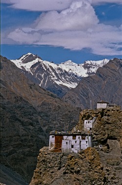
Himalaya Monastery outpost (2000) Photo (c) Karen Abrahamson

The other day I was reminded of something that seems intrinsic to human beings—the need to go where no one has gone before, to discover and map and mark our presence upon the world whether it be by having a place named after us, or by hammering a flag into a mountain top. What reminded me of this phenomenon, was the unending effort of one of my cats.

You see, in my house I have a cupboard that holds my washer and dryer. Above that cupboard is a nine-foot high display ledge that holds three large terra cotta pots and an antique Burmese carriage carving safely out of the way of the carnage of scampering little cat hooves.  My cat, Ben, has known of the shelf. In my arms when we walked past he always strained upwards like a person wishing for wings, but there was no way up.

Or so I thought. I underestimated the lure of adventure into unknown worlds, and the too-keen intelligence in my cat when it comes to reaching the Promised Land. You see, unbeknownst to me, Ben has secretly been in training.

'The boys' watching their first snowfall
'The boys' watching their first snowfall. Photo (c) Karen Abrahamson

Over the past few years he has taken to leaping to the tops of doors and balancing. Over the past few months his training shifted to opening every bifold door in the house, including the one to the washer and dryer. Then, recently, he trained at climbing, and took it upon himself to open my linen closet, climb up the shelves and then climb out the small little ‘V’ of open space at the top of the bifold closet doors. Once there, he’d balance. Shocked the heck out of me the first time I walked in and didn’t see him until he leapt down in front of me.

I’m sure you can see where this is going.

After years of training, much like a mountain climber trains before attempting Mount Everest, or those surveyors before tackling mapping a mountain range, while I was away at Disney World, Ben tackled his adventure.

The result? One smashed terra cotta pot and a cat with a very big smile on his face.

Since I’ve been home he has shown me how he climbs his mountain. Then he sits on the ledge far above my head and meows his accomplishment—until I grab a chair and haul him down. He seems satisfied with himself and content. When I carry him past the ledge he no longer looks up at the Promised Land. After all, he’s been there, and until I can figure out how to lock the door he can get up there any time he wants

So I guess, just like the explorers of old, I’m going to have to find a way to commemorate what he’s accomplished. Guess I’ll dub his ‘Everest’  ‘Benares’ Ledge’.

And cat-proof the remaining terra cotta pots, of course.

Ben. Photo (c) Karen Abrahamson


Maps, Magical Thinking and the Magic Kingdom

Maps, Magical Thinking and the Magic Kingdom

So I’m here at Disney World with my sister and nieces. Yesterday we visited the Magic Kingdom and of course had to orienteer our way around the park with the small maps that they provide. Actually the small map was pretty good and we made our way around the park pretty well, taking in the sights the girls wanted to see. Getting to the park was another thing altogether.

Leaving our resort we thought we had it figured out, except I thought one way and my sister thought another. Given she has been here a whopping four hours longer than me, we went by her directions and soon weren’t sure just where we were going. Glory of glories, she said let’s stop and ask for directions, which we did.

It put me in mind of a wee episode I had in Portugal with my beau of that time. There we were in eastern Portugal with a specific destination in mind (I can’t recall what). We followed the route our map showed and ended up travelling a huge loop that did not take us where we wanted to go and we ended right back at our starting point. At which time I suggested we stop for directions. My beau would not.

So we drove that same loop again. And again. With my beau getting madder – not so much because we were lost, but because I kept suggesting we ask for directions. Such repetitious action—travelling the same route again and again, but expecting different results is a lot like something problem gambling Counselors call magical thinking. People with gambling issues play a game of chance again and again believing that the odds of them winning increase with the number of times they play and don’t win BECAUSE THEY HAVE TO WIN SOMETIME. What they don’t realize is that they are wrong. They have exactly the same odds of winning a gambling game each time they play and the house has stacked the odds against them. Just like taking the same hopeless route again and again doesn’t improve our odds of not getting lost.

So stopping for directions was an auspicious beginning to this trip. Aside from the comedienne gas station clerk (who informed me that if I wanted Disneyland (not Disney World) I’d taken a wrong turn for the east coast somewhere) I got straightforward directions that took us direct to the Magic Kingdom. Here are some photos to prove we were there.

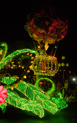
Tinkerbell at the Parade of Lights (2012) Photo (c) Karen Abrahamson
In the Frontierland Stocks (2012) Photo (c) Karen Abrahamson
Jo on the Fantasyland Carousel (2012) Photo (c) Karen L. Abrahamson
The girls at the Magic Castle (2012) Photo (c) Karen Abrahamson
Maps, Highways, and Their Imprint on The World

Maps, Highways, and Their Imprint on The World

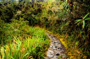
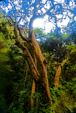
Path through the rain forest on the Camino Inca, Peru (2011) Photo (c) Karen Abrahamson

The ancient T.O. maps didn’t represent reality, but they did map the reality of the Christian spirit at the time. Portolan Charts gave a realistic representation of coastlines and the work of the Indian spy/cartographers, placed rivers on the maps well before aerial mapping existed.

One of the last bastions of ‘unmapped’ territory was the Amazon basin of Brazil. In 1799 Alexander von Humboldt, the son of a Prussian baron, spent five years travelling from Venezuela’s Orinoco river through the Amazon, collecting specimens and surveying. Afterwards he produced 33 volumes of maps and illustrations. That was the last mapping for over a hundred and fifty years except for the occasional scientific or rubber company exploration.

Until 1970.

That’s when the Brazilian government got the idea to construct a highway from the Atlantic Coast, across 5,000 kilometers (about 3,400 miles) of rainforest to the Peruvian border. The construction was a nightmare due to a dearth of maps. The rainforest had too many clouds and—gee, rain in a rainforest?—for aerial mapping to work. The result was construction following ground-based surveyors who were barely ahead of the bulldozers and this led to the construction having to cross the same river multiple times leading to enormous unforeseen costs.

Cloud Forest tree along Camino Inca, Peru (2011) Photo (c) Karen Abrahamson

Enter the cartographers. In this case it was cartographers and the invention of side-looking radar (SLAR). SLAR is an improvement on the radar that helped safe Great Britain during the Battle of Britain. It’s the invention that allows radar to be shot out the side of an aircraft to take long horizontal pictures of the landscape. This technology can ‘see’ through clouds and trees to the landforms. With the help of computers, SLAR can provide accurate pictures of the rise and fall of the landscape.

The survey team with their aircraft arrived in Brazil on the summer of 1971. In just under a year SLAR mapped the Amazon in 32-kilometer-wide swaths which lead to the first detailed maps of the Amazon and an understanding that this huge territory wasn’t the previously-thought Amazon “basin”. Instead they found that only about 20% of the area was lowlands, with most of the landscape being hilly and mountainous.

This ‘sped up’ the construction of the highway which was completed in 2011 except for a single bridge in the Peruvian part of the road. But what has this meant for the area? For some, it replaces weeks of travel on dirt roads to a relatively short drive. For others it promises income from a potential huge influx of tourists. But what it also means is environmental degradation.

Brazil has a long history of environmental issues springing directly from road-building into this relatively delicate biosphere. Previous road building shows that almost 90% of deforestation lies within 50 kilometers of a road (about 23miles). Timber and mineral extraction are followed by hydroelectric dam development and the destruction this causes.

What’s disturbing is that the Amazon is truly the lungs of the world and cartography has provided the data needed to seriously damage those lungs. It places a different perspective on maps; one that undermines the beauty of what I’ve always thought and suggests the need for ethical standards that stand up to the push of corporate greed.

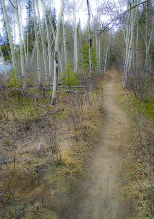
Path along the Yukon River. The quiet places like this are the ones lost in rampant development. (2010) Photo (c) Karen Abrahamson

There are means to ameliorate the potential destructiveness of developments like the Transoceanic Highway or the construction of pipelines like the proposed Northern Gateway pipeline through British Columbia, but it requires people like cartographers, citizens, and government officials to demand agreements that protect the environment BEFORE, planning starts. Otherwise ‘progress’ can just as easily lead to widespread destruction like what is happening in the Amazon.

The new maps of the Amazon not only map progress, but also the destruction of a reality. Unlike the T.O. maps of the Christians that cemented the Christian spirit firmly in Jerusalem, these maps not only mark destruction of biodiversity, but they record the destruction of the spirit of the indigenous people.


Do We Need Maps in Fantasy Books?

Do We Need Maps in Fantasy Books?

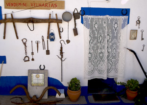
Alentejo house wall, Portugal (2005) Photo (c) KarenAbrahamson

Yesterday I spent part of the afternoon mapping the layout for a community event I’m planning. I found myself confounded (for a bit) about the need for scale, because I needed to be able to estimate the amount of security fencing I needed. What struck me was that I didn’t actually need to make a map. Others could have determined the fencing needs through simple math. But for me, the answer to my fencing needs lay in graphic representation so that I could measure the length of fencing from visualizing the exact boundaries of everything. It raised the question for me of whether maps of fantasy worlds were always necessary.

Controlling the reader’s experience of imaginary places seems to me to be the main purpose of maps in fantasy books – to set hard boundaries around the reader’s imagination. Whether a map is actually necessary has been a topic of discussion among writers. I wonder if the debate about the inclusion of maps couldn’t learn something of benefit from looking at dialogue within the cartographic world.

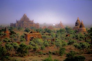
Dhamayagyi Phayto, Pagan, Burma (1997) Photo (c) Karen Abrahamson

You see, there are some pundits who suggest that professional and academic cartography is dying because it has become too cut off from the human experience and too insistent on rules and scales and design constraints, while the human need to map (or simply to talk about location) is under constant evolution. Think about some of the things mapped today. It’s not mountains and rivers and landscapes. In my non-writing life I’m dealing with maps of childhood vulnerability, community asset maps and maps of fast food restaurants placed near high schools.

Not exactly like the maps of the great explorers, which is why I question whether qualities like scale are necessary, or even possible or useful, for many types of maps including those in fantasies. The maps I’m dealing with in my non-writing life are helpful to because they help me express certain phenomena occurring in the community, but I didn’t have to do it with a map. I could have provided a chart or a list, just as the fantasy author can provide description. Was a map even necessary? Is it necessary in a fantasy?

In the past, most of my books have been without maps, instead painting the picture of place with my words. In my epic fantasy, however, (The Warden of Power) I felt that a map was necessary as I wrote the first volume of my epic so that I could ensure place names, etc., were used consistently in the manuscript and its sequels. Did I include the map in the book? Actually, no.

I think the reading experience should be one that transports the reader to a place that they and the writer create together, without a map setting boundaries around the reader’s experience. Let the reader read my words, their brain cells fire, and reinterpret the world in my fiction. It doesn’t matter that they might not imagine the world exactly like me. My words are code and the reader will interpret them from within the context of what matters to them. Isn’t that what

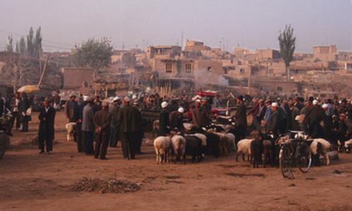
Morning shepards, the Sunday Market, Kashgar (1999) Photo (c) Karen Abrahamson

reading is all about? Creating a world in your head? Some of the most disappointing experiences I’ve ever had involved artists (or Hollywood) providing their interpretation of a book I love. Inevitably their attempt to place boundaries around a character or the landscape wasn’t consistent with what I had in my head.

Mapping, like other forms of communication, reflects a need to express, to create and to understand, but setting a map in a book – like setting rigid rules around mapping — it can stymie the imagination. This applies whether we’re creating new maps to express new ideas or situations, or creating a world in a reader’s mind. Mapping, like dreaming, is a human need. Must we, as writers, place boundaries on that need?


What’s in a Map? Aboriginal Maps and Writer’s Dreams

What’s in a Map? Aboriginal Maps and Writer’s Dreams

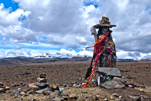
A Huaca, or sacred stone, in the landscape of the Peruvian Altiplano (2011) Photo (c) Karen Abrahamson

Last night I received an article from my local Romance Writers of America chapter about world building for writers and how making a map of a location can help to create your story and your plot. I got thinking about this and how it relates to human history. In particular I got to thinking about how some anthropologists and historians have drawn a line in the sand (the 15th Century) about when true maps came into existence. (See my last post here.) But it got me wondering whether they were short-sighted in their definition.

The authors of this theory have said that prior to the 15th century while people might have made maps, they largely weren’t made for the same purpose of orienting the landscape like maps are used for today. They talked about how maps of older civilizations presented a cosmology, not a spatial map, or were used to show relationships, which could as easily be represented in text or the spoken word. This, they posited, means that earlier map-like creations are not true maps. Whether they are wrong or right is a matter of some debate.

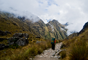
Trail along the Camino Inca, the path to Machu Picchu (2011) Photo (c) Karen Abrahamson

A case in point is Native American cartography. The literature about Native American maps is challenged by the fact that not only is it hard to find maps from pre-European contact (birch bark and leather just don’t stand up to five hundred years of colonization), but most of the records of native maps are colored by the perspectives of those who collected the map. The few maps that do exist require the reader to think of maps in more than one way. For example, records of a Virginian Algonquin map collected by John Smith in 1624 (while he was a prisoner), show a cosmological view of the world, but also a spatial linking of places. The map shows three concentric circles around a fire, with the first circle being a circle of meal representing the Algonquin Territory, the second being an inner circle of corn representing North America, and the third circle of corn representing the edge of the supposedly circular world. To try to understand John Smith’s origins from beyond North America, the Algonquin created a thatched stick island between circle two and three. Clearly this shows a sense of spatial distribution, even if it is not based on any scale a western European would use.

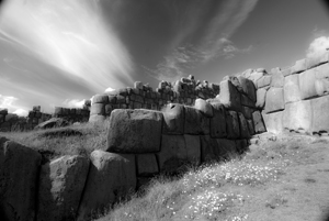
The ruins of Saqcsaywaman, Cusco, once part of the center of the Inca world. (2011) Photo (c) Karen Abrahamson

Another interesting ‘map’ was a gesture used by a Native American Elder to describe the location of his town. The elder held his forefinger and thumb like a not-quite-closed-looped ‘okay’ symbol. The location of his town was between the unclosed tips of the finger and thumb, with Quebec, Montreal, New York, Boston and Halifax all located along the knuckles and joints of the rest of that looped finger set. This again clearly places the Native American town in relation to the major cities. So the question may not be whether Native American’s had maps, but whether they recorded their map information in a different way. Native American communities and living accommodations like the Navajo Hogan, the Pawnee earth lodge and even some longhouses could be said to be map-like in their structural symbolism of the concept of the sky dome or celestial vault providing shelter for a two dimensional geography with the four directions spreading out from a pivotal centre of the house. It might not be written on a piece of paper, but clearly there is a sense of direction and relationship to place within their sacred geography.

Finally, Petroglyphs, a primary source of pre-contact information about Native American culture, have also yielded examples of what could be maps, though there continues to be some debate. Some appear to show river routes and tributaries along with trails. Still other stone paintings appear to represent drive fences (fences used to drive prey animals into capture areas) complete with pictures of the animals that resided in the area.

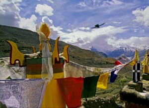
Across the world we look for the sublime meaning of everything. Prayer flags, Tibetan area of Northern India, (2000) Photo (c) Karen Abrahamson

Which brings me back to the RWA article. It spoke about how, for a writer, a map can help you to give a greater sense of place to your writing. The writer will know where the towns and roads and lakes and mountains are in relationship to where the character is. But drawing a map can help the writer to also learn something beyond thethe lay of the land. A writer’s map can help you to understand what monsters live in what areas, what territory belongs to the enemy and what resources there are to harvest, along with your character’s place in the world. This leaves me to think the Native Americans understood modern (writerly) mapping better than the anthropologists and historians think they did, and that the modern writer’s map is based in something much deeper and perhaps more linked to the notion of a sacred human landscape. Both look for something more than just scaled lines on a page to find our way through either our imagination or the world.


When Maps Were Born

When Maps Were Born

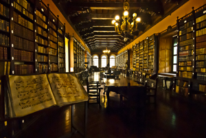
Monastery library, Lima, Peru. (2011) Photo (c) Karen Abrahamson

Writing this series of posts about maps and map makers has brought home that people have been making maps or pictures of places for a very long time, but it has also brought home that what people were making and the reasons they were making them has changed dramatically over the centuries. This change in purpose has led academics to wonder whether maps really were as ubiquitous across human history and they suggest that maps as we know them today really only came into existence in the 15th or 16th century.

What do they base this upon?

First of all it’s the paucity of maps that have remained in existence from earlier times. Sure, time would have destroyed many maps, but surely more than the few we have would have survived, just as art and sculpture and manuscripts survived. Secondly, those ‘maps’ that have survived from earliest times, had purposes that were different than maps today. Some represented a way of seeing the world , for example, the T-O maps I wrote about here, were intended to show Jerusalem as the holy centre of the world. Another example are Mesoamerican maps that didn’t focus on spatial mapping, but instead presented ‘community maps’ that represented history and territory, something like a pictorial genealogy. Native American maps present something similar. Other early maps were diagrams of a monasteries and manors, and still others served as religious icons, mandalas, construction drawings, itineraries and so on. Different maps, different purposes, and definitely not the purpose we put maps to, today.

Porter on the Camino Inca, Peru (2011) Photo (c) Karen Abrahamson

The proponents of the idea that maps as we know them began in the latter half of the second millennium, also point to how the current purpose of maps – namely representing space or relationships, or showing ownership, or pointing out how to get from point A to point B were purposes that had previously been accomplished using means other than maps for as long as there has been history. If people wanted to represent a place, there were paintings and art work. For relationships, there was genealogy. If they wanted to convey ownership, there was text to use, or numbers. And if they wanted to show how to get from point A to point B, well there was word of mouth or text. These had sufficed for centuries. Why did people need these things called maps?

The answer apparently came with the rise of the nation state in the 15th and 16th Century (and possibly as early as the 12th Century in China). As nations expanded, as military ventures demanded, the need for maps became more evident. Rulers such as Henry IV of France were advised that maps could convey an idea of his holdings better than words could. Other rulers such as the Hapsburg emperor Charles V lost vital battles for wont of a map of a strategic area. And this wasn’t just a European experience. In places like Japan there is little evidence of widespread use of national maps until 1591 when suddenly maps were commanded for all geopolitical areas, leading to a national map in the 1630s. And Japan isn’t alone: at the same time that Japanese and European mapmaking blossomed, similar mapmaking flourished in China, Thailand, Russia, Malaysia, Vietnam and the North American Colonies.

Yes, some of this flourishing may have been due to importation of mapmaking from one culture to another as international trade broadened, but academics suggest that the ease of the adoption of these skills speaks to the existence of similar map-making traditions that had sprung up independently across cultures at the same time. Why?

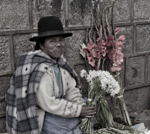
Flower seller, Cusco, Peru (2011) Photo (c) Karen Abrahamson

Map making appears to have proliferated in the new nation-states where it would otherwise be difficult for a central government to ‘know’ the length and breadth of their nation, suggesting maps brought local knowledge from the hinterlands into the center of government, where that knowledge could be used to the service of the central state. So modern maps themselves, just like the lines we draw on them, were an act of control – not just setting boundaries on the landscape, but also establishing boundaries around the people who dwelt there.


Free Fiction

Free Fiction

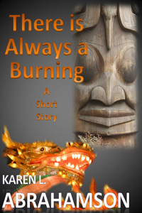
There is Always a Burning –

Karen L. Abrahamson

When an imprisoned djinn offers a eunuch Chinese Admiral his heart’s desire, it threatens the whole history of North America – unless the Admiral can make choices worthy of the man he hasn’t been for a very long time.  To read on click here.

Recent Fantasy

Available HERE,

$1.99

Available HERE,
$3.99

Available HERE $1.99


Recent Mystery


Available HERE
$4.99


Available HERE,

$4.99


Available HERE,

$4.99


Available HERE,
$4.99


Recent Romance

Available HERE, $2.99