Tag: Peru

The World Has Three Points
The World Has Three Points

I mentioned last week how the ancient Egyptian, Eratosthrenes, used a column and a shadow as two sides of a triangle to estimate the size of the earth, which shows the importance of geometry to cartography. Nowhere was this more evident than in mapping the earth, where triangulation, (the process of determining the location of a point by measuring angles to an unknown point from known points at either end of a fixed baseline), was literally used to measure the location of everything in relation to everything else.

Geometry and triangulation had actually proven themselves previous to Eratosthrenes. They’d been used to measure the heights of the pyramids and had also had been highlighted by the ancient Chinese as an important principle of mapmaking. Unfortunately this wasn’t well known in Europe even though the Arabic influence brought such surveying methods into old Spain. Instead, Europe was still transcribing tourist tales and fanciful stories onto paper and selling these for parlor display based on their beautiful illuminations, rather than spending their time surveying the landscape.

Apparently the first European to get serious about the use of triangulation was a Dutchman named Gemma Frisius who suggested using triangulation as a means to pinpoint the location of places on maps. The technique gradually spread through the 1500s, but it wasn’t until the 1600s that Europe got serious. A Dutchman named Snell began the process of surveying the landscape with a chained line of triangles (much like the triangles the American flag is folded into)across the countryside for a distance of 70 miles. The use of Snell’s process led to a rise in the quality of the Dutch maps and, in comparison, the decline of French maps into dependence upon engraving and elegant color as their selling feature – all well and good as a parlor adornment, but not what you want if you actually want to do something with the map you made.
Enter Guillaume Deslisle: In the late 1600s this young Frenchman began to change maps from things of the arts to matters of science. At a time when the great rulers such as Louis XIV knew little about the countries they ruled, he began to use triangulation surveys to permanently shift and fix continents and islands on the map, and even settled the age-old argument about the length of the Mediterranean Sea (41 degrees). The work of Deslisle and his kin led to the first mapping of Russia, or Muscovia as it was known at the time, and eventually influenced the French Minister for Home Affairs and advisor to Louis the XIV, Jean Colbert, to push for the mapping of France.
In 1663, Colbert ordered that each French province’s maps be examined to see if they were of sufficient quality. If they were not, qualified surveys were to be undertaken. This eventually led to Abbe Jean Picard overseeing the first precisely measured chain of triangles and topographical surveys around Paris – the two preliminary foundations to accurate mapping. The extension of this process led to France being mapped and became the standard practice for scientific mapmakers. It was used in the cartographic expeditions used in Lapland and Peru discussed in my last cartographic blog, in mapping the Himalayas, the English countryside and, the Grand Canyon and everywhere else in the world.
But the work of Deslisle and Picard had unforeseen impacts. Like the magic in my books, the new maps seriously revised France’s boundaries and coastal outline. The world’s shape was changed again – all because of three points.
Myths, Latitude and the Financial Shape of the Earth

Myths, Latitude and the Financial Shape of the Earth

Despite the myths and rumors of a flat earth promulgated during the Middle Ages, most scientific minds over the centuries have known the world was a sphere. Clues to this came from the fact that boats sailing away disappeared gradually as if they sank from view, and did not simply diminish in size. The Greek philosopher and mathematician, Pythagoras, hypothesized that earth was a sphere based on the fact that the sphere is ‘the most perfect of forms’. If the sun and moon were such a shape, why not the earth? It was Pythagoras and other Greeks such as Plato and Aristotle who cemented the idea of a spherical earth in European culture.

So people knew the world was round, they just didn’t know the size of it, nor did fully understand its shape.

Estimating the size of the earth also harkens back to the Greeks. Both Aristotle and Archimedes had erroneous estimates of the earth’s circumference, but history hasn’t left any clues as to what those estimates were based on. The

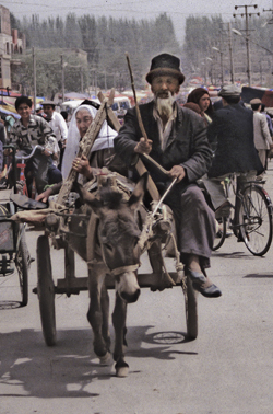
Going to market, Kashgar, China (1998) Photo (c) Karen Abrahamson

Chinese apparently sent two men to measure the earth and they walked it from north to south and east to west before coming up with the result of 134,000 kilometers (hopelessly in error).

The first (known) scientific measurement of the earth’s circumference came from an Egyptian named Eratosthenes during the time of the Ptolemy Kings. He knew of a water well in Southern Egypt where at noon on a certain day of the year the sun shone straight down to the bottom. He also had made observations that on the same day in Alexandria, at noon, there was still a shadow. He hypothesized that if he could measure the angle of the shadow on that day, he should be able to estimate the size of the earth. Using a vertical column he did just that, measuring the distance of the shadow from the base of the column. Then, with the length of the column, and the length of the shadow, he could calculate the third side of the triangle and determine the angel of the sun’s rays. Using basic geometry he was able to hypothesize that the earth was 46,000 kilometers in circumference – too large since we know today that the circumference is about 40,000 kilometers – but not too shabby for a man working with only a shadow and a column.

The debate about the actual size and shape of the earth continued over the centuries, with various other size estimates coming to prominence at different times. Contributing to the issue was the debate over the actual length of a degree, a debate that raged for centuries. This led to numerous ‘thinking men’ attempting to determine the length of a degree through methods ranging from counting the turns of a carriage wheel as it travelled between two points, to taking laborious chain measures of distance across the English countryside. It took debates of Newtonian and Cassini theories to help scientists realize that they were – in a word – wrong – about there being a definitive length of a degree.

You see, Newton formulated the theory of universal gravitation and that centrifugal force would mean that the earth could not be perfectly round. If he was right, due to the earth’s spin, the earth would be flattened at the poles and would bulge at the equator. Refuting this was the work of French scientist, Jacques Cassini, who had found that the length of a degree seemed to get slightly shorter at the poles compared to the equator. He theorized that this meant that the earth was shaped more like an egg, with poles drawn out and the equator flattened.

It took two expeditions in the 1700s, one to Peru and Ecuador, and other to Lapland, to settle the issue. While the trip to Peru dealt with altitude sickness, unfriendly Indians and disease, the expedition to Lapland had to race winters to take measurements. The team in Lapland completed their measurements after two years and found that the length of a degree was significantly longer in the north than a degree measured in France, thus proving that the earth was indeed compressed on the poles and bulging towards the equator. The poor Peruvian team spent nine years completing their mission, and confirming Newton’s theory, only to discover that their work was redundant.
But what they showed was that the length of a degree will depend on the latitude:

  • The east-west degree at the equator = 111.321 kilometers, however the circumference along a meridional circle is 67.2 kilometers shorter.
  • The north-south degree at the equator = 110.567 kilometers and the
  • The north south degree at the poles = 111.9 (or 1.4 km longer)

All of which may be where the phrase ‘giving someone some latitude’ comes from: What they do (and how far they go) will depend on where they’re standing.

Which could explain the disparity in approach the Germans and Greeks are espousing to deal with the Eurozone financial crisis. It’s all latitude.

That Research Thing

That Research Thing

Ashes and Light - coverReaders of my books set in Afghanistan or Portugal and Burma often ask me how I got the details right. Of course the answer is research, and in all truth I can’t say that I got all the details right, but for me to write I have to have a sense that I have enough knowledge of the place and the culture to write it correctly, or as close to correctly, as I know how. Same goes for a particular time period or a specific piece of technical knowledge. This blog is about how I go about building the knowledge so that when I sit down to write it flows out of my hands.

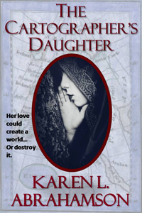
1. Reading: I read about what I want to write about. I read fiction that gives me a flavor of how other people write about a location. I read non-fiction accounts, memoirs, biographies and histories. These both allow me to pick up the nuggets these writers gleaned about the place or culture. I’ll pick up cheap coffee table books from remainder tables at book stores just so I can look at the photos. This often fuels my sense of place. I haunt the history and geography sections of used book stores like Powell’s to find relevant writing about the place or timeframe, like for 1400’s Portugal for my upcoming book, The Cartographer’s Daughter. I’ll read the coffee table book if something captures my imagination. For example, I was living in Thailand and saw a small coffee-table book about Burmese Puppets. I picked it up and what I read spurred me to want to write a story about the puppets – I know, it’s a ridiculously esoteric subject – but I read that book from cover to cover and used it as a jumping off place to identify other information I needed to know.
2. Maps: I’m a huge fan of maps. Maps give a me a sense of location and perspective. I recall traipsing around Venice, and it was the maps with the bird’s eye view that I first looked at when I arrived, that stopped me from ever getting totally lost in the maze of streets, canals and alleys. The same map put into perspective where Marco Polo’s house was and how that location within Venice might impact his view of the world. Maps let you identify potentialities in the location and they also show specific locations for events in your stories. Maps, I find, are an inspiration.
This is especially the case in writing historical stories, because maps not only show you the landscape back then, but they also tell you a lot about the culture, belief system and world view of the people. I’ll talk more about maps in a later blog.

Similar to historical fiction, when the story is a fantasy set in a fantasy landscape, I make maps up. Knowing where things are located and having place names in your head, allows you to build histories around those landscapes which are so important to making fantastical places real. It also forces you to think how long it would take to get from point A to B and about how the landscape would impact the characters who live or travel there.

3. Talking to people: Talking to people who are experts in their fields can help to get the details right. It can also be a source of inspiration with those odd facts that are so obvious to the experts, but no one else is aware of. These are jewels for writers, because they let readers in on the secret language of whatever this specialty is.

When I was writing about the Burmese puppets I had the good fortune to travel in Burma(Myanmar) and made a point of going to every puppet show in every town I travelled through. I made arrangements to interview the owner of one of the shows in Mandalay who spoke moderately good English and he referred me on to another man who made the puppets. It turned out this kind man was an ex-surgeon and spoke excellent English. He had been instrumental in providing information to anthropologists doing research on the puppets and kindly showed me how they were made, demonstrated some of them for me and even gave me a precious manuscript he had received from the anthropologists so that I could photocopy it for myself. You have to understand that at the time Burma was almost a closed country and that he was taking a risk even talking to me, a writer. Those items I treasure to this day and those unbound pages still have a place of honor on my bookshelves. They were also critical to a couple of fantasies and Karen L. McKee’s Paranormal Romance, Shades of Moonlight.

If you can’t talk to the people, you might be able to get in touch via e-mail. When I was writing my Afghan novel I was in touch with past foreign correspondents, and members of the military that friends helped me locate.

Writing about other cultures, it’s also important to talk to people of that culture. For my Afghanistan book I spent a number of coffee and lunches interviewing a lovely Afghani woman who was brave and interested enough to talk to me about woman in her culture, about her faith and about what was happening in her country, as well attitudes amongst her people towards the foreigners ‘liberating’ her country. These attitudes shaped my characters. She also provided me with small phrases and legends that are common in her country. These are also gold because they allow you to build in the real words and beliefs of the people.

4. Old Newspapers: If you are writing about a historical period where there were newspapers, or you are writing about another part of the world and can get newspapers in a language you can read from that time period, this can be an invaluable way to get a sense of the background events that were occurring in the location at the time you are writing about. Nowadays many major newspapers have their archives available on line. Reading the old papers can also spur inspiration regarding events that are reported and how your characters might have been involved or touched by the event, and can also give you a sense of fashion and language used ‘back in the day’. For example, a story about how bats had taken over the old Regina City library back in the 1920s led to an opening chapter of the first adult novel I ever wrote.

5. Library and Internet research: Having a local librarian as an ally can be a boon, because a librarian can suggest you try looking at books in areas you might not have even thought of. University libraries are also superb resources. When I was writing about Burma I wanted a specific book about the magic systems and the animistic spirit worship. There’s been very little written on the subject at the time, but there was one fairly comprehensive anthropological study. I found the book (a very old, falling apart version) and ended up photocopying the whole thing so I could have it available as a resource.

The internet can be helpful in finding old journals and photos of locations taken by other travelers. Blogs can be a wonderful source of information, both about the place and about the traveler’s reactions to it. I used old articles in The Economist and old travel journals about a very rough ride through northern Afghanistan to bring realism to my novel set in that country.

6. Travel: I try to travel every few years and I don’t go to resorts and I don’t do tours. I go to places I think I might want to write about and I spend my time poking around the back streets and absorbing the feel of the place. I spend time talking to people to get a sense of people’s attitudes. I’ll sit in a park and let people come to me. I talk to waiters and taxi drivers and vendors on the street – often with very limited communication skills because we speak different languages, but enough to get a sense of small bits of their realities—like the

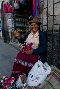
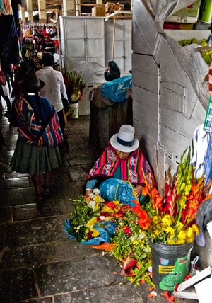
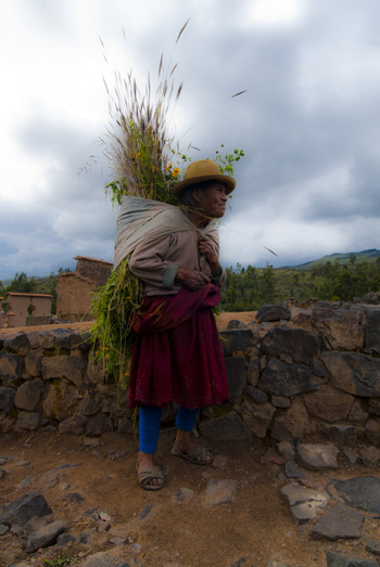
Carmelita of Puno, Arequipa (2011) Photo (c) Karen Abrahamson
Carmelita of Puno, on the Arequipa streets (2011) Photo (c) Karen Abrahamson

woman who worked in one city in Peru, but who had left her children behind in another city because there was better money to be earned where she was – a hard economic choice the country’s situation had forced on her.

Before I travel I think about where I want to go and what I want to see and a plan a general itinerary around that, but I also let fate take me where it will. There have been times when a chance meeting, or a wander off the beaten path, has allowed me to find something wonderful that takes the potential writing in a whole new direction.

So research for writing isn’t so much simply gathering facts and then writing about them, it’s about immersing yourself in a location or situation (even if you’ve never been there), so that when you sit down to write the place itself inspires what you are writing. I recall my Afghan book as one of the most difficult books I have ever written. Why? Because I had so many false starts on the book. I would start and get a chapter in and realize I wasn’t ready to write that story yet because I wasn’t filled with the sense of place and the culture. So I kept on researching and wrote other books and then one day I sat down and the book poured out wiht all the wonderful details in just the right places. And yes, there are probably errors in the book, because in a war-torn country there are places so remote that you just can’t get the information. So you know what? There are things in that book that arose purely from my imagination.

Because it’s fiction, folks. Remember that. Fiction.

Marketing: What I Learned From Peruvian Markets

Marketing: What I Learned From Peruvian Markets

Traveling in Peru, I visited many local markets, from the large mercados of Miraflores and Cusco, to tourist markets of Pisac, to the small village markets of Chivay and Ollantaytambo. I love the sights and smells and how they tell you a lot about the culture you are travelling in. But now that I’m home and starting to focus on the business of writing, I realized that there are marketing lessons for writers and indie publishers to be learned from the markets of Peru.

Before I list the five general lessons, I just want to comment on writers versus independent publishers. It used to be that independent publishers, were exactly that – small publishing houses as differentiated from the large houses of New York. Today, however, though the traditional independent publishers still exist (thank goodness), the self-publishing writer has a choice: they can either publish as authors, or they can create independent presses that publish their work. Either way, it’s the writer doing the work, but there are benefits to having a publishing house, that self-publishing as a writer doesn’t have – namely that an indie publishing house can get its books into bookstores more easily than a writer can.

The following five lessons apply to both independent publishing houses and writers publishing on their own.

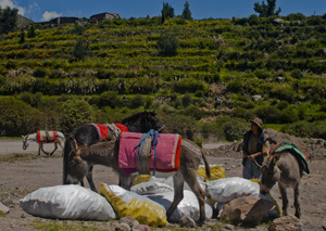
1) Product must get to market – In Peru’s cities trucks unload crates of fruit and vegetables. In Chivay, the produce comes to town wrapped in colorful mantas (blankets) on women’s backs. They brought in everything from tomatoes, apples, and animal fodder. Sheep were tied upside down to the back of a moto-taxi on the way to market. So however, they did it, the bottom line was that items for sale had to get to market.

Papas (potatoes) on their way to market (2011) photo (c) Karen Abrahamson

For the writer/indie publisher, this is perhaps the largest issue. Yes, writers have the traditional methods of getting manuscripts to traditional publishers, but now they have the choice of whether to publish into the electronic market or POD – both of which are now extremely acceptable ways of selling.

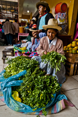
2) You must have a regular place to sell – In Peru I purchased my snack food – oranges, apples or bananas – at the local markets. When I can get them, died fruit and nuts are a staple. When I found a merchant that sold produce I liked, I always went back to them. Thankfully, mercado and street vendors have ‘their’ spots so you can always find the same apple vendor in the same spot.

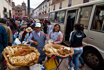
Women with their 'spot' picked out. Ollantaytambo (2011) Photo (c) Karen Abrahamson

For writers this means having a website – or two. At the very least you should have an author’s website (or possibly more than one if you are writing under more than one pseudonym) that includes in it a list of your books with links to where they can be purchased.

If you are serious about indie publishing, you should also have a website for your publishing house that includes all of your books (see examples, here and here and here), and presents all the books by all your writing personas. This allows people to find you and your books.

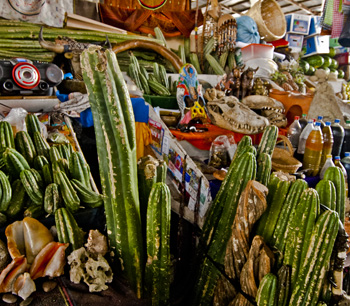
Shaman's stall, Cusco market (2011) Photo (c) Karen Abrahamson

3) You must have product – The markets of Peru are filled with produce. There are fruit and vegetables, meat, breads and cakes, fresh cheese, nuts, dried fruit, jugos (fresh mixed juice that is the most sublime treat – ever), shaman supplies, clothing, tourist weavings and so on. Most markets provide a wonderful place for browsing.

For the writer, this means that although self-publishing a single short story or novel is fine, to be serious about indie publishing you must have more product. Dean Wesley Smith talks about having a minimum ten novels. What this means for the writer, is that the focus HAS to be on writing more product, so that you aren’t dependent on just selling oranges in a world where oranges might fall out of favor.

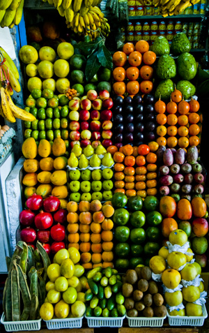
4) Product must look good – I couldn’t tell you how many vendors I walked past looking for the perfect orange or apple. Imagine how much time I spent in front of the kiosk where the vendor had avocados the size of green footballs. Good looking fruit is a lot more likely to sell than produce that looks like it’s had a hard ride on a bucking donkey.

Fruit display, Miraflores market (2011) Photo (c) Karen Abrahamson

For the writer this means that your produce needs to both look good and BE good – or at least as good as you can make it. As a writer you are responsible for the quality of your work both in terms of story and editing. Covers are the responsibility of the writer/indie publisher and are your calling card. Good covers, as Joe Konrath frequently talks abouton his blog (here), are critical to sales.

5) Product must be positioned – Peruvian vendors always took advantage of their location to show their wares. Some, near the doors, laid out attractive displays to catch the sunlight. Independent vendors crowded around the main doors to get attention. Others located themselves by side doors where they might not get as much traffic, but they might get more attention from those who DID pass through the doors.

Positioned for the light, Cusco maket (2011) Photo (c) Karen Abrahamson

As a self-publishing writer, or an indie publisher, you also need to make choices about how to get the attention of booksellers and readers. This can be either as simple or as complex as you want to make it. Examples of means to get attention for product include:

• Social marketing on twitter, facebook, etc.

• Social marketing on reader and writer groups

• Providing free fiction as loss leaders

• Advertising at conferences

• Advertising to booksellers

Choosing the methods that are right for you is the trick.

Given marketing is as foreign as a Peruvian market to me, I’ve planned a series of blogs that will explore marketing and provide information from authors who have gone farther down this road. So don’t consider me an expert, but look at this as a place to pull together ideas. Over the coming weeks I’ll explore each area in more depth and include interviews and examples. And please, if you have experiences in marketing as an author or indie publisher, share them here. After all, the last lesson I learned in Peruvian markets is that vendors help each other.

Working together to sell pork rinds outside Cusco mercado (2011) Photo (c) Karen Abrahamson
Machu Picchu Redux

Machu Picchu Redux

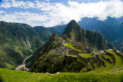
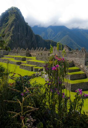
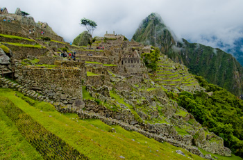
Machu Picchu caught in the coil of the coil of the Urubamba River (2011) Photo (c) Karen Abrahamson

Okay, I guess I have a type A personality. If it isn’t right the first time I’ve been known to do something again and again and again, until I get it – if not right, at least closer to right. I’ve been known to go back to the same place again and again and again to get THE photo I want, when previous attempts didn’t yield what I wanted. With writing, I’ve been known to trash manuscripts 2 or 3 or 4 times before getting what I originally envisioned.

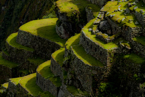
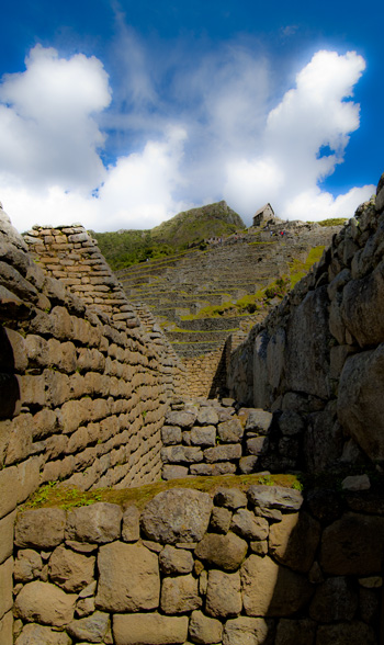
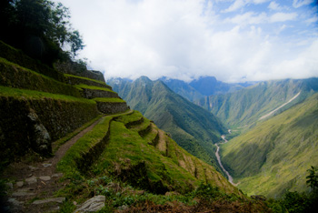
Terraces (2011) Photo (c) Karen Abrahamson

Given this, it shouldn’t surprise you that I decided to return to Machu Picchu after blowing out my legs on the Inca trail so that on my first visit to the site I was basically stationary. So up I got at 4:45 am on April 24, to catch the train to Aguas Caliente, an hour and a half train ride as the Andes unwound their scrub grass into jungle. Picture dawn light on magnificent glaciers, and then we slid into Aguas Caliente and I had to catch a bus up the mountain. And there I was. Again.

The Orchids of Machu Picchu (2011) Photo (c) Karen Abrahamson

Not that my ankles were 100% yet. Nope. I was still using a walking stick and my left ankle was still swollen and sore, but darn it, I’d come all this way and I darn well was going to enjoy the view. So I set off uphill, up innumerable steps to the guardhouse that perched along the path between the Sungate and what was once the main gate to the city. There I sat on the edge of a terrace and overlooked the city, trying to believe I was really here. It was still incredibly busy with tourists, but this time I could move away, an take cover in the shade of bamboo farther up the terraces.

The Guardhouse, many steps above the city (2011) Photo (c) Karen Abrahamson

I ambled (read limped) around the ruins and found the series of fountains the Inca had built. Now don’t think spraying water and dolphins or cherubs – these are a series of small pools fed by a single spring that still supplies the ruins with water from far up the mountain. The story goes that each small pool has its own voice. I think could almost make out the tonal differences out over the myriad loud tourists. So I focused on the liquid song and, on as hot a day as this was, and after seeing children crying because foolish parents forgot to bring drinks, I could believe that the Inca built this series of fountains as homage to the importance of water to life.

There were swallows soaring and song sparrows trilling and generally it was a glorious day – except for the tourists. The final straw for me was some children who were determined to separate a very young baby llama from its mother because they wanted to pet it. I mean where were those darn children’s parents? I was about to use my walking stick and not on the llamas! Thankfully another tourist intervened before I got myself arrested. But I did get some photos I’m happy with and so here you go.

Enjoy! Ciao, from Peru!

The last view of Machu Picchu (2011) Photo (c) Karen Abrahamson
Laid back in Ollantaytambo

Laid back in Ollantaytambo

Ollantaytambo sits in the Sacred Valley, northwest of Cuzco and is known for its ruins and its train station. You see this is the place most travelers to Machu Picchu go through, climbing on the train that will take them to Aguas Calientes and the bus to the famous ruins. It’s the place that the Camino Inca treks often stop for breakfast before hitting the trails into the mountains. I came here because it was (supposed to be) a quiet little town and because I am determined to go back to Machu Picchu and see the place as I didn’t see it before.

The town of Ollanta (as it is known to the locals) is apparently the best surviving example of Inca town planning available today.

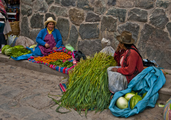
Women at Ollantaytambo market (2011) Photo (c) Karen Abrahamson

Leave the Plaza de Armas and turn towards the ruins on the mountain, and the streets are narrow, cobbled and have irrigation channels running down the sides. Stone walls are crowned with cactus in a traditional alternative to barbed wire and broken glass and each house sports twin bulls on their ridgepole – the result of the Spanish saying a bull was more appropriate than the Inca symbol of the ‘puma’.

You can tell this town wasn’t built in this century by the way the traffic congests every time more than two cars get on the road together. Now picture a town converged on by tour busses, taxis, moto-taxis and the occasional semi, all trying to squeeze across a single-lane bridge and I swear entertainment in Ollanta is sitting under the lone tree in the Plaza and watching the mess reconfigure itself again and again in a kaleidoscope of vehicles.

Unfortunately I didn’t get to see as much of the town as I would have liked, because both my ankles are still crippled from the Machu Picchu hike, but I did try to get out daily and finagled my way along (between naps – hey, recovering here) as the lone tourist with a local association devoted to preserving the weaving arts in small villages up in the mountains.

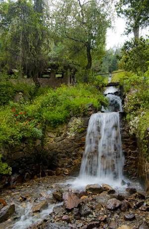
Irrigation waterfall along the mountain road, Ollantatambo, (2011) Photo (c) Karen Abrahamson

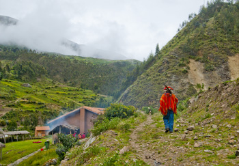
We drove out in the morning, heading up a dirt road that stretched back into the mountains. The road rose, switching back and forth across the mountain sides following a small rushing river, the Patacancha, that was joined by innumerable glacier-fed torrents that foamed down the mountainsides. Green Inca terraces, some the longest in Peru, an old stucco church with thatch roof that I was told is one of the oldest in South America. There were donkeys and pigs and sheep and trains of pack horses headed up the mountain and views of people harvesting their papa (potatoes) laboriously by hand.

Off to the fields, Pumamarka (2011) Photo (c) Karen Abrahamson

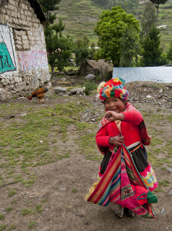
But best of all are the people. Not only are the people of Ollanta and environs friendly (they always have a smile, especially if you have one first), but this is a town where tradition has not yet been erased by globalization. Men and women both proudly wear their traditional clothing.

Nowhere was this more clear than in the small weaving town of Patacancha and the towns around it. As we drove in we could see the men in the school yard, bright orange and red clothing against the green.

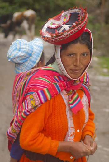
Woman near Pumamarka (2011) Photo (c) Karen Abrahamson

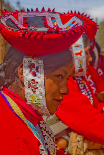
At the weaver’s cooperative, there were 36 women dressed proudly in their heavy skirts, hand-woven button-embellished jackets, and small hats held on by beaded chin straps. According to my informant, these villagers are not seeing their young men and women leave the village and that seemed the case looking at the ages of the women in the group.

So the coop bought the women’s weavings and I took photos while we sat on a hill side under thatched huts and blue skies with the sound of the wind in the eucalyptus and the river running. Taking it all in, I didn’t feel bad that I couldn’t walk much.

At the Weaving Coop (2011) Photo (c) Karen Abrahamson

Here in Ollanta, the culture and the past still lives and breathes and, if you sit quietly in the Plaza de Armas, both will pass you by – along with the traffic.

One of my new friends, waving goodbye (2011) Photo (c) Karen Abrahamson
Myth, Magic and the Transformation of Machu Picchu

Myth, Magic and the Transformation of Machu Picchu

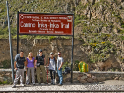
At the start of the trek (2011)

Hiking the Camino Inca to Machu Picchu should be a transformative experience. After all, I was treading the same stone steps that Inca kings and nobility had trod before the Spanish arrived. Think breath-taking heights (literally), panoramic views of the mountain tops, and struggling up steep grades through jungle and rain forest to get to the ‘Sun gate’ and finally peer down upon the fabled city of Machu Picchu. How can one not be transformed after an experience like that?

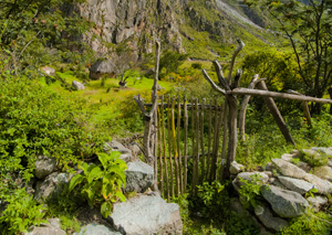
Farmstead gate, Sacred Valley, Peru (2011) Photo (c) Karen Abrahamson

There were five of us – a thirty-something New Zealand/Irish couple and a twenty-something British couple – and me at almost twice their age. We started our trip at 4:30 in the morning, joining the small bus that took us to the small town of Ollantaytambo northwest of Cuzco, and then beyond to kilometer 82 on the railroad tracks between Cuzco and Aguas Calientes, the modern town that lies just below Machu Picchu. From there we took to the trail and entered the backcountry of the Sacred Valley of the Urubamba River. We hiked up a gently sloping trail past people bringing horses and burros down to the river, and to fields to pack out the recent potato crop. We were passed on the path by our red-clad porters who literally ran up the path ahead of us like the ‘Flash’, to get to our lunch time stop ahead of us and prepare a massive meal of trout and vegetables and potatoes and pasta. With that break we kept hiking, stopping at lookouts to see terraced remains of ancient Inca communities and the small farmsteads that exist today.

The trail turns upwards (2011) Photo (c) Karen Abrahamson

The ground started up and we aimed at our first pass – 4,200 meters, but stopped to camp for the night at Ayapata, about half way up the mountain flank. So we had a quiet evening listening to the frogs that sang into the night and looking at the southern cross and Orion’s belt hanging over the glaciers, both of which were important to the Incas. The Southern Cross apparently helped predict the growing seasons, as well as major events such as the destruction of the Inca Empire. Orion’s belt represented the three layers of the world that the Incas believed in.

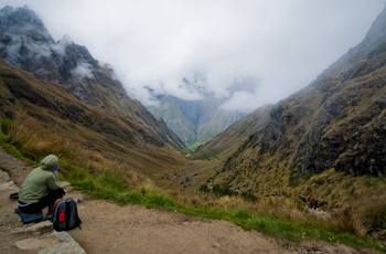
Day 2 began with a great breakfast of fruit and pancakes, but it couldn’t allay the torture to come. This was the day we had to cross the 4,200 meter, appropriately named, ‘Dead Woman’s Pass’. They say the pass earned its name because from a distance the rock formations look like a woman’s breast and nipple and face. Okay, I could see that, but as I began the climb I could also see other possibilities.

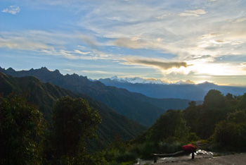
Early Morning Mountains, Inca Trail (2011) Photo (c) Karen Abrahamson

You see 4,200 meters makes it hard to breathe. You sweat and you climb uneven stairs and rocky paths and wind up through rough terrain, past old women driving llamas up the slope. Up and I was gasping and thanking god for the two walking sticks I had which, when I wasn’t climbing, I could lean on while I tried to find the oxygen to breath.

From the heights of Dead Woman's Pass (2011) Photo (c) Karen Abrahamson From the heights of Dead Woman's Pass (2011) Photo (c) Karen Abrahamson
From the heights of Dead Woman’s Pass (2011) Photo (c) Karen Abrahamson

Finally, I made it to the top and the freezing wind cut through me and made me pull on all my layers of clothing before starting the difficult journey down.

Think steps and more steps, presumably created by people with a twisted, carnival-funhouse sense of evil. Treacherous and steep and uneven, but we made our way down into a lovely valley with waterfalls and rivers cascading alongside the path through thickening vegetation that became cloud forest thick with the scent of moisture and growing. We had lunch there and it was a matter of throwing ourselves on the ground in exhaustion, having lunch, and then having thirty minutes to rest before the rest of the day’s trek.

You see, we still had another pass to climb.

Upward, and the forest grew up around us, moist and filled with exotic species like bromeliads and orchids, and the trees were covered with moss and old lichen and birds flashed yellow and blue through the branches. The air was heavy and gradually clouds rolled in as we stopped at an old, round ruin, where our guide drew the Cuzco cross for us and told us how the shape represented much of the Inca universe, and how the Urubamba river valley ruins match many of the sacred constellations that the Inca saw in the sky; over-world and this world in harmony.

The rain started then. It washed away the guide’s drawing as we started for the next pass of 4,000 meters. Wearing slickers against the rain, we struggled up – or I did – did I mention that I’ve had knee surgery twice? But I kept slogging as the rain became hail and the guide finally sent the others on towards the next camp while he and I – finally made the top and took shelter in a cave while the downpour continued. That was the first magical moment of the hike. Sitting in semi-darkness while the rain ran down the rock steps and dripped from moss on the rocks and the frogs sang in happiness at the moisture.

And then there was more down. More steps, water-slicked this time, but after what seemed like forever we made camp and I literally just sagged to the ground. It was over. The worst of it was. I had made it over Dead Woman’s Pass and only felt like I was dead.

Phuyupatamarka, the Town above the Clouds (2011) Photo (c) Karen Abrahamson

The next day involved crossing the third pass. It was much lower than the others and I could breathe as we started down the long string of stairs and rough paths through rain forest. As we went, we learned the names of the orchids, and saw how the elephant ear leaves are smaller near the peak and get larger as you go lower because the oxygen increases – which sort of explains why a coastal woman like me is sooo much taller than the people of the sacred valley.

At about 12:30 we had to choose: go to camp or go to nearby ruins. We chose the ruins of Huinay Huayna. Think a great arc of terraces built into a hillside so steep it would be hard to stand. Think jungle rainforest on all sides and we sat on the steps beside a trickling, ancient irrigation channel and looked out over the mountainside and the Urubamba far below. Butterflies, some black, some iridescent turquoise and yellow and translucent fragile, fluttered up around us dancing on the slight breeze. With the sun on our faces and the water music, that was the second magical moment of the trip.

Huinay Huayna, Forever Young, hung above the Urubumba River (2011) Photo (c) Karen Abrahamson

Frogs and cicadas welcomed our 3 am wakeup call the last morning. You see there is a race to get to the Intipunku – the Sun gate and we wanted to be the first out the checkpoint. We were, racing like ghosts by flashlight through pre-dawn darkness to the music of the frogs and cicadas, calling out treacherous footing to each other, struggling up fifty stairs that were almost perpendicular and then reaching the gate to be confronted by — cloud.

The myth is that on solstice days the sun comes through this gate and shines directly through one of the temple windows at Machu Picchu. The myth is that at Machu Picchu there are sacred stones that will fill you with energy if you touch them — but today these stones are cordoned off. The myth is that Machu Picchu exists as one of the few power places in the world, but standing there in the cloud it was easier to believe that Machu Picchu was like Xanadu and never really existed except in our hearts and our wishes. Magic.

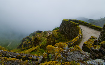
Going down to cloud-shrouded Machu Picchu was the anticlimax. No longer is the ancient city a place seen by the very few who dare the ridges and passes of the Canimo Inca. Now busses bring the tourists up from Anguas Calientes every five minutes. Hordes of them, laughing, blabbing, yelling, irreverent, fat, sweaty and swearing tourists of every accent and nationality. There is no place you can go and feel the quiet of the place. There’s barely a place you can hear the birds sing. So I sat in Machu Picchu nursing sore legs and watched the clouds and mists roll over the mountains. I almost wished I had never left the sungate, or had had the chance to keep running the mountain passes seeking a city that never existed.

Unfortunately, the other transformation was the realization that, though my heart may be willing, physically, I’ve outrun my days of running ridges.

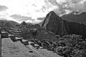
Machu Picchu in the mist (2011) Photo (c) Karen Abrahamson
Cuzco Conversion

Cuzco Conversion

I’ve now been in Cuzco for three days and I have to say I really like this city. People are friendly. The scenery is beautiful with red-tile roofs swirling across and up the sides of the valley like a terra cotta wine in a glass. There are 16th Century churches, camposinos on the corners, wild and wooly local markets and beautiful, quiet parks where I can sit in the shade and think. There are lovely old mansions surrounding the Plaza des Armas, that have their second floors converted to restaurants so you can sit in a screened alcove and peer out old carved windows at the colorful crowds in the plaza. I guess, that’s the theme for Cuzco – conversion.

Old Camposino Woman. She shows such strength. (2011) Photo (c) Karen Abrahamson

Today is Sunday and election day, but the city has been magnificently quiet all things considered. Stores were open (at least tourist ones were), and there were none of the rallies and rousing music I’ve come to associate with this election. I spent the morning climbing out of Cuzco proper to the ancient site of Sacsaywaman – one of the last strongholds of the Inca before the Spanish finally triumphed – and, in the ancient city plan (where streets formed a puma), Sacsaywaman was the part that formed the head.

It’s a long climb: first up steep, cobbled streets that are slippery enough cars must take a run to reach the top. Then follow the road until a cobbled path leads you into a pass between two of the hills surrounding the city. I kept telling myself that if I couldn’t do this then I had no business even contemplating Machu Picchu. The old heart was pumping and I was gulping in air, but I made it and, sweating, handed in my entry ticket.

A ruined wall at Sacsaywaman (2011) Photo (c) Karen Abrahamson

There was virtually no one there at 8:30 in the morning. A few alpaca grazed the green grass between the two sets of ruins. The great stone towers are gone, but the zigzag line of battlements that form the teeth of the Puma of ancient Cuzco, still jut into the ancient field. Instead of ritual sacrifice or battle cries, there were birds and butterflies and horses grazing in the next field over.

I climbed to the top of the exposed rocks and sat there in the sun. A friend had asked me to soak up the feel of the place and I have to say all I felt was silence, just as yesterday, when I travelled out to the Sacred Valley and Pisac fortress, there was just the wind through the fallen stone.

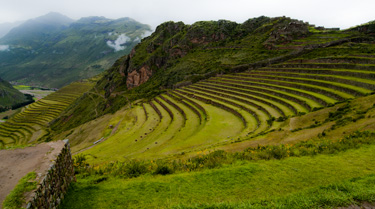
The terraces of Pisac with the ruins of the fortress on the bluff behind (2011) Photo (c) Karen Abrahamson

This was a great civilization, but it lasted only through a hundred years of expansion, before being blasted into oblivion by Pizzaro’s conquest. The Inca way was to take over a territory and subsume the local belief system into their own. Walking around Cuzco today I was more aware than ever of the thievery of conquest. Every cathedral, church and convent in this city is built on the remains of an ancient Incan palace or temple and they are built of stones robbed from said palaces and Sacsaywaman.

As I drove out to Pisac yesterday, my driver started talking about this. He is born of Spanish and Quechua (local Indian)-speaking parents, and I could hear the anger in his voice, which came back to me as I toured the great Cathedral of Cuzco. Every blasted surface of the place is gilded with gold or silver plate – probably robbed from the ancient temples. (Did you know that crazy old Puno was once called the City of Silver because during Incan times one street was actualy paved with it?) But most of all I was struck by the stark contrast to the ruins I’ve seen. Clean stone and narrow ways that give onto vistas. Perched on the heights, the ruins were automatically closer to Incan Apus and the sun.

The churches, however are encrusted with treasure and filled to the brim with figures of Christ and Mary of the mountains (an attempt to convert people from their worship of Pachamama- the earth mother), and I swear every other saint or maybe-saint known to man, as if said cathedral was looking for safety in numbers from what lurked beyond its doors. There is figure after figure in niche after niche, and altar after altar in chapel after cloister until I felt almost sick with the panoply and actually longed for the clean lines of the ruins.

I realized then that what the Spanish did in Peru, wasn’t really a matter of civilizing the people, but, like the Incas before them, was instead a matter of trading one form of Idolatry for another.

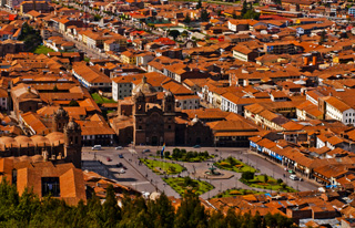
Cuzco's Plaza des Armas and the red roofs of the city from Sacsaywaman (2011) Photo (c) Karen Abrahamson
Puno: Leaving Things Unfinished

Puno: Leaving Things Unfinished

I wasn’t sure what I was going to write this blog about because I saw so little of the Lake Titicaca area, but perhaps that’s the point. Sometimes things get in the way of best intentions and we either can’t or just don’t get the job finished for whatever reason. This certainly happens in writing, when health or other life issues get in the way. So I guess this is my turn. Just in case anyone was worried, I seem to be fine. The high blood pressure meds seem to have done the trick and I am going to get checked out before the Machu Picchu climb. But that’s all fodder for a next post.

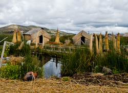
A village of the Isla Uros, Puno, Peru (2011) Photo (c) Karen Abrahamson

Let me tell you about Puno.

Puno sits on the shore of Lake Titicaca, running up the sides of a number of hills that roll down to the great northwestern bay of the lake. My bus arrived in the night, so we crammed three of us (from the bus) into a shared taxi to get to our various hotels. All well and good, until we left the bus terminal and headed into the streets. Think narrow enough two cars can’t pass. Think congested with cars, trucks, motorcycle-taxis that they call ‘chilos’, as well as bicycle rickshaws. And pedestrians. Don’t forget the pedestrians. Masses of them, blithely passing between the vehicles. In the night everything smelled like car exhaust , and the air was glossy with mist off the lake. And pollution. OK, I thought: this seems rather Dante-esque, but it was night and I was tired and so I let it pass, because I’d seen worse in other countries.

The next day, the day I finally saw the doctor, I went out for a walk. Grotty was about the best I could describe it. Now maybe it was me – I was unstable enough on my feet I actually got lost twice – and I rarely get lost, but the city seemed in a perpetual state of being unfinished. Everywhere you looked there were brick buildings with iron poles sticking out of the roof awaiting the next story. Even my guest house, which was up-scale on the scale of guest houses I’ve been staying in, had its courtyard dug up and the front entrance perpetually stuck in a heap of dirt-cum-mud.

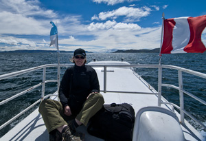
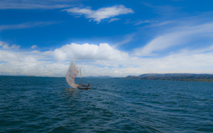
FishingSailboat on Lake Titicaca, (2011) Photo (c) Karen Abrahamson

Not impressive, to say the least. Not a place you’d want to spend any more time than you had to, even though the streets were filled with delightful ladies in traditional bowler hats and absolutely everyone I had contact with was wonderful. My plans for Puno had been to use it as a base to do research farther afield. I had planned to go out to one of the islands in the lake and live there a few days, but given how I was feeling it seemed like a particularly stupid idea to put myself that far from a doctor.

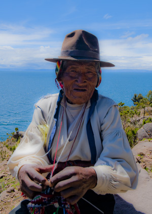
One of the knitting old men of Isla Tranquile, Lake Titicaca, Peru (2011) Photo (c) Karen Abrahamson

So instead I did what I never do: I booked into a – dare I say it – a tour. A one day tour out to Isla Tranquile. I figured there was no way they were going to stress me out, and I could at least see something of the lake.

Of course I was wrong.

A wonderful day – brisk wind, blue skies and the scent of wet mud you get from a marsh as we first visited the floating islands of Lake Titicaca. These are islands built of a layer of matted root and then heaped on top with reeds. Whole towns exist on these islands. And if you don’t like your neighbor, you just pull up your ten anchors and float away to Bolivia. Think about how easy ending a marriage would be!

From there we headed to Tranquile. I’m picturing a landing, a light walk and lunch. The real picture relates to the fact that Tranquile is basically a mountain. So we land, and I’m looking at an uphill climb. Way uphill. We have to reach the top for our lunch. And of course I’m carrying about 35 pounds of camera equipment that I will not leave unchaperoned on the boat.

Looking back own the flank of Isla Tanquile (2011) Photo (c) Karen Abrahamson

At 14,000 feet this was not an easy hike, but the panting was worth it. Isla Tranquile sits in glacier-blue waters, its steep sides terraced with green, and laced with gold flowers. The sounds of birds and the call of children fill the air. The old men sit knitting (Tranquile is a UNESCO site for its fine fabric weaving and knitting) and its women constantly spin a weaving bobbin. You see them everywhere and they produce absolutely beautiful knit wear. The island is also famous for its gender roles. Men gain their worth by having a wife gift them with many handmade purses. The women cut their hair and weave it into a belt for their future husband. They also cut their hair to produce long falls that the men wear in ancient, Andean ceremonies. When you look at these faces, they have the same high cheek bones and hawk nose of the Incans and some say that Lake Titicaca is where The Inca – the first Inca – came from.

Which brings me back to Puno. I felt bad to leave the city without exploring it better. I climbed on the bus this morning feeling something of a failure, because I don’t like to leave things unfinished. Which is perhaps why Puno’s appearance that the whole place was under construction or reconstruction left me so unsettled.

But I learned from the guide on the bus that my perception was correct. Apparently the government of this department (state) only requires citizens to pay taxes on a finished house….

So I’m holding to that: Like the homeowners of Puno, sometimes in writing and travel it pays to leave things undone.

On the rooftop on the way to Isla Tanquile (2011)
Altitude

Altitude

In Peru everyone calls me the ‘Alto Mujer’, the tall woman. I sort of stand out in crowd around here, which is probably why I was picked to be robbed. But Alto, as in ‘Altiplano’, or the high flat plains between the mountains, are one of the reasons why I wanted to come here and so I headed from Arequipa to the Canon del Colca, the second deepest canyon the world by a bare 150 meters (and twice as deep as the Grand Canyon).

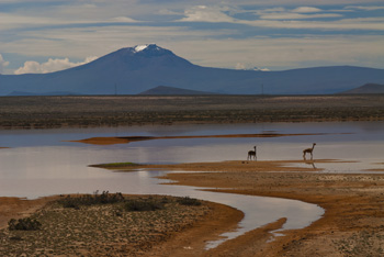
Vicunas in lake with El Misti in the background. As I looked closer I realized the anmal on the right is dying. (2011) Photo (c) Karen Abrahamson

To get there you must go to the high places where the windswept mountainsides are constantly repainted by clouds and as far as the eye can see are rocks and more rocks and stunted clumps of ichu grass that are the primary fodder for camalids like domesticated llama, and alpaca, and the dainty vicuna that lives wild in a huge natural reserve created for them. Picture windswept plains and tiny flowers and the mighty volcanic peaks of El Misti (5822 m), Picchu Picchu (5571 m) and Chachani (6075 m) looming above everything. The air is clear and smells only of dust and grass and sometimes animal manure, and aside from the wind, there is only silence until a truck or tour bus passes.

I was fortunate. I paid for a car and driver for two days and Edgard was the perfect person. He spoke no English and I speak very little Spanish, but we got along sharing my Spanish/English Dictionary and he told me things about the places we went. The road went up and up through this staggering landscape until we reached the viewpoint of the volcanoes which stands at 4,900 Meters. Yes, meters.

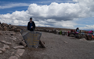
Karen, trying hard to breathe at 4,900 meters. (2011)

 On all sides are these huge peaks and in the foreground small traveler’s cairns too numerous to be counted that give praise for having made it that far and to pray for good luck with the rest of their voyage. This was so similar to practices in India and Tibetan, China, that it made me realize how right the Inca were when they thought the huge mountains were inhabited by Apus, or gods.

From there we headed down towards the canyon and the small town of Chivay that sits at its head. Unfortunately I was struggling a bit with the altitude as we were still at 3,630 meters. It is a small town, but the capital of its District, and everywhere you went there were signs about the upcoming elections that occur April 10. The main square (Plaza des Armas) has a lovely fountain and tree-shaded benches and I spent a few hours relaxing in this slower paced life and watching he women in their traditional clothing.

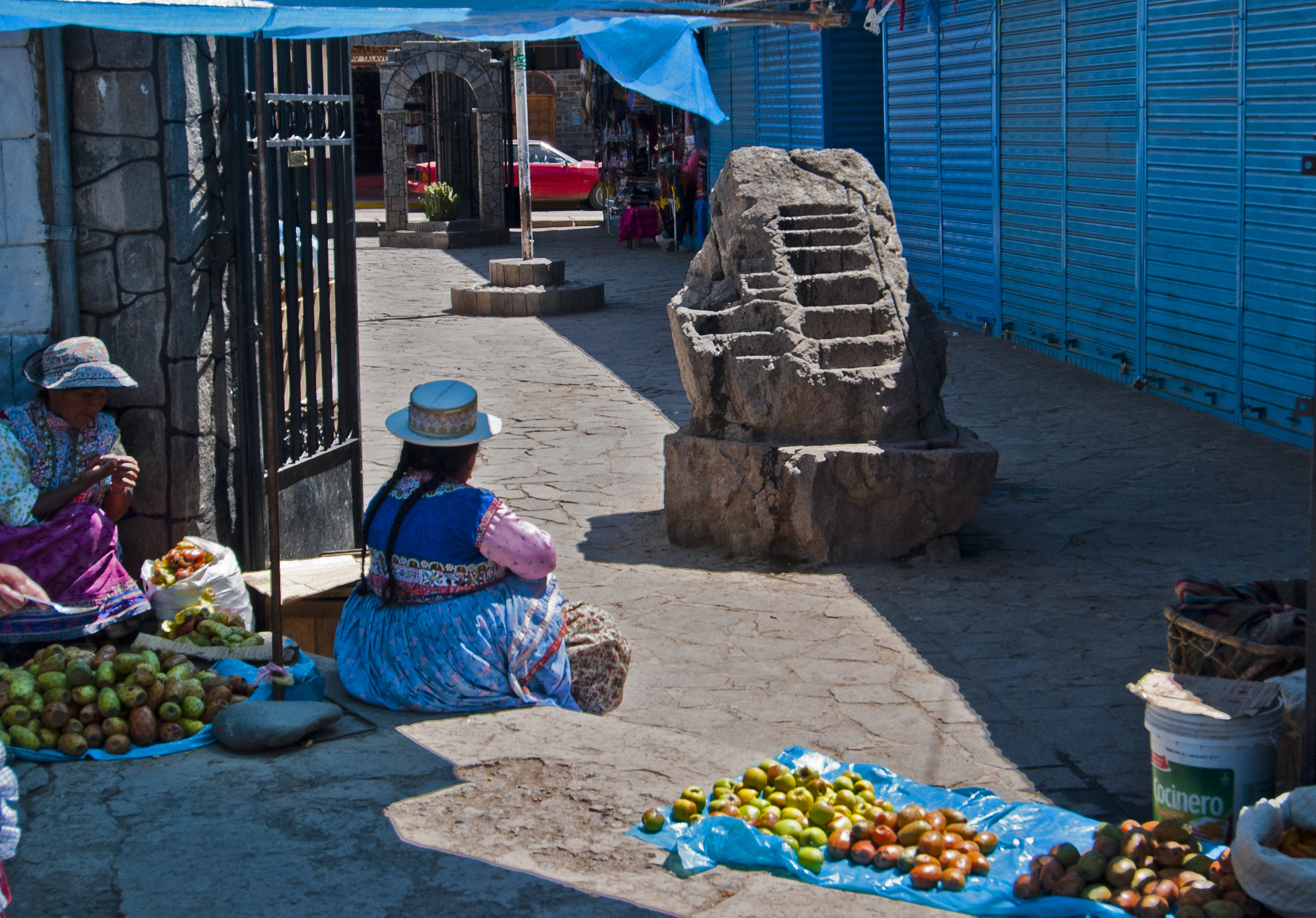
Market Scene, Chivay. Note the Inca rock that shows terracing and irrigation techniques. (2011) Photo (c) Karen Abrahamson

Edgard and I drove out the next day to see the valley. Actually, I almost called the whole thing off because I was feeling so ill, whether from Altitude sickness or the flu, I wasn’t sure. But at the last minute I thought I’ve come so far to see these birds and this valley, so I had to go.

So we went, through a valley that was filled with incredible Inca terracing up the mountainsides, each with their own microclimate so while one might be perfect for potatoes, others are perfect for Maize, or Quinua. We saw ancient tombs from pre-Inca times, and Inca-age rocks carved to keep track of the terracing. And then there was Cruz Del Condor.

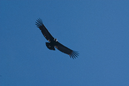
Like entering a passport hall at a major airport, there was every language being spoken around you from the crowd that had made it this far to see. We were all perched in this high point of the cliff wall, waiting for the word the Condor had taken off and was rising up the cliff wall. I was there for one hour and saw one bird, but breathtaking isn’t the word. The swoop and soar on the wind. Everyone drew a breath so all you could hear was the swoop of huge wings and the frantic clicking of camera power-winds. And then he was gone. Magnificent and ephemeral as he swept away upwards and over the cliffs behind.

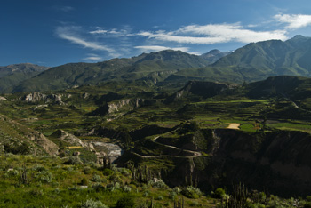
Colca Canyon, (2011) Photo (c) Karen Abrahamson

So Edgard left me with best wishes for my journey and went back to his lovely family in Arequipa. Apparently, his wife is an obstetrician and his children are studying medicine and engineering. Yesterday I climbed aboard a bus to Puno and drove 6 hours through the high altiplano again, but this time southeastward toward Lake Titicaca, that sits at 3,830 meters above sea level.

The countryside seemed filled with curves of hillsides that cloud shadows made seem to fold in on each other. A few lakes filled deep valleys, but mostly they are shallow affairs that overwinter flamingos. We arrived in Puno at 7:30 pm, coming down out of hills to see great arcs of darkness surrounded by lights. The darkness? Lake Titicaca.

So today I am in Puno, but unfortunately I’ve not seen much other than what I saw last night. You see, there is a price to be paid for being Alto in the altiplano world. The people here are built short and barrel-chested for a reason. Me, I’m about the antithesis of that physiognomy, and given I’d been sick from the moment I left Arequipa, I finally called a doctor. It seems the altitude has given me high blood pressure.

Which has made this Alto Mujer, a little more Plano at this moment.

 But it was so worth it.

Condor, Condor del Cruz (2011) Photo (c) Karen Abrahamson

Recent Fantasy

Available HERE,

$1.99

Available HERE,
$3.99

Available HERE $1.99


Recent Mystery


Available HERE
$4.99


Available HERE,

$4.99


Available HERE,

$4.99


Available HERE,
$4.99


Recent Romance

Available HERE, $2.99