Tag: risk taking

Rhumb Lines, Novel Writing and How to get from point A to Point B
Rhumb Lines, Novel Writing and How to get from point A to Point B

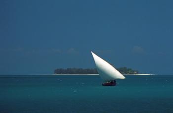
Dhow in coastal waters off Zanzibar Island (1994) Photo (c) Karen Abrahamson

As I mentioned in a previous post, I’m in the midst of a year of writing sequels. Actually it may take two or three years to get through all the sequels needed for my current novels. As I have already mentioned on this blog I’ve found writing my first sequel a bit of a challenge even though I knew where I was going. It seemed that I kept straying off course.

This puts me in mind of the challenges mariners had back before Gerard Mercator created his famous projection in 1569. A projection is a way of taking three dimensional landforms off of a globe and placing them onto a flat surface (a map) while retaining relative conformity of shape and relation between the landforms. What Mercator did was take meridians of latitude and longitude and make them all aim straight north-south or east-west creating 90 degree angles at each intersection. Sure it expanded the landforms closer to the poles, but it also gave mariners a means of plotting courses over long distances.
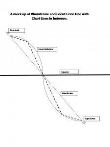
Picture this overlaid on top of a typical world map with latitude and longitude laid out.

You see, prior to Mercator, mariners shared two fears – bad weather and getting lost. (Actually I share their fears, the latter most particularly when I’m writing.) In the years before Mercator’s projection, mariners had generally confined their sailing to the Mediterranean and coastal waters. The transatlantic voyages to America were done by the stars, but there were no helpful portolano (mariners maps using compass roses to show sailing routes) of the great oceans. Mercator’s grid made sailing the open ocean as easy as sailing the coasts because it gave sailors a means to chart a straight line (a rhumb line) from Point A to Point B across the ocean. From this they could plan their headings and make their voyages.

Of course sailing the distance from Cape Town to New York is about as huge an endeavor as writing a novel (or a sequel) from page one to the end and neither route actually takes a straight line. Sailors travelling that distance recognized that they didn’t travel a flat earth, they travelled a globe and so they added to their calculations, the curve of a great circle that was the largest circle they could draw through a sphere and this route showed the actual shortest distance between two points. Sailors then chose their routes by drawing straight chart lines between the great circle and rhumb line that allowed them to approximate the great circle along the route.
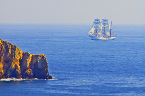
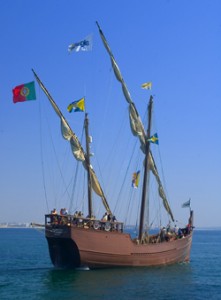
Tall ship off Portuguese coast (2006) Photo (c) Karen Abrahamson

This seems a lot like the process I use when I’m writing. I know where I start and I know where I want to finish (most of the time). The writing process then becomes one of deciding how far to travel from the rhumb line (the plot or the backbone) of the story, for it seems to me that novels have great circles, too. These are the themes you are writing about and you don’t want to allow your plots to take over, so that your story is nothing but plot, but neither do you want your subplots to take you so far out of your way that the story no longer fits within its themes. And that’s where sailing and writing diverge in their process. Sailors use the great circles and rhumb lines to plot their course and they follow it from Point A to Point B. A writer, on the other hand, will use them to plan their novel or their series of novels, but also to look behind and check whether they have wandered too far off course to get to their final destination. This is the challenge in sequels: viewing the second or third book as just one of the charted lines between the rhumb and the great circle, building its way to the ultimate end of the voyage.


Westward Ho!

Westward Ho!

I’m sitting here watching the snow fall on the western edge of North America and contemplating how with the spread of people over all of the continents leaves no mysterious ‘promised land’ to cling to. As I’ve written in previous posts, in earlier centuries people sought Prestor John or mysterious islands. They sought an easy route to India and the Northwest Passage. All of these were, over time, debunked, but in our restless human need to seek, we replaced those distant vistas with something else. At least in the past we did.

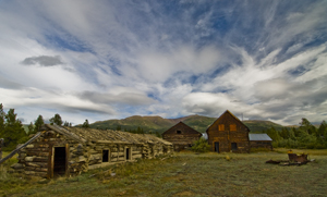
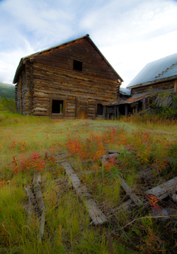
Old Ranch, Yukon (2009) Photo (c) Karen Abrahamson

The exploration of North America helped with that. As the surveyors moved west they opened up awareness of a great mysterious place called the American West. The acquisition of the Louisiana Purchase brought Lewis and Clark’s expedition and knowledge that the western mountains were more than one range and a new awareness of how broad the continent was. While they set to rest the final hopes that the Columbia and Missouri Rivers might connect and form a Passage to India, tales of what they had seen brought a new hope that, if not a promised land, there might at least be a Garden of the World in the rich lands westward.

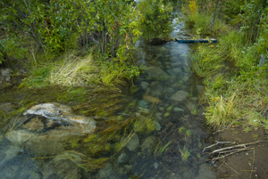
Channel at edge of Yukon River (2009) Photo (c) Karen Abrahamson

Lewis and Clark were followed by the Topographical Engineers – a small elite branch of the army, whose most famous member was John Charles Fremont. Fremont took with him a red-faced German topographer named Charles Preuss. With Kit Carson, these three set out to map the trail west, determine where to establish outposts, and scout passes over the mountains. While the results of their first venture were of only limited value for its maps, Fremont’s dramatic escapades of planting a US flag on a high peak to demonstrate the national resolve of ‘America strong and triumphant from sea to sea’, and his colorful journal, apparently launched many settlers westward. Subsequent Fremont/Preuss ventures resulted in some of the best maps of the day, extending knowledge down into California and erasing as much fanciful cartographic information, as it established. Preuss’s expertise in creating maps led not only to cartographic information, but also to the first ‘road map’ to the west.

Other explorers like John Wesley Powell, extended our knowledge of areas around the Grand Canyon as they travelled down the Green River and into the cataracts of the Colorado River within the Canyon. His further expeditions surveyed much of southern Utah from the Colorado to the Nevada line. Powell’s work also resulted in warnings about the old methods of agricultural farming. The warnings weren’t heeded and it took the dust bowl dirty thirties to prove him right. But Powell gave America an even greater legacy. He lobbied for, and finally achieved, the creation of the United States Geological Survey, which continues to this day to provide detailed maps of the country.

Old Ranch, Yukon River (2009) Photo (c) Karen Abrahamson

The only problem with this is that detailed maps removed the mystery and it seems to me it impacted the human psyche. From America, explorers joined the Europeans in the further exploration of our planet. We delve into the depths of the ocean, the frigid wastes of the Arctic, and into the humid breadth of the Amazon Rain Forest. But even those areas are being explored and the race for space seems to have died. It makes me wonder if part of the anger and anxiety we see in our culture isn’t partially due to the fact we have no new vista to call us and no new ‘promised land’ to bring out our best.


Boundaries and Goals: The straight edge of the map

Boundaries and Goals: The straight edge of the map

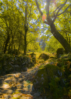
Old Roman Road, Portugal (2005) Photo (c) Karen Abrahamson

I just read a great post by my friend and fellow writer, Matthew Buchman. Matt wrote about goal setting and why he always sets hugely high goals, and how he (usually) berates himself for not reaching those goals instead of celebrating the numerous accomplishments his goals have helped him achieve. He also wrote about how he intends to continue set superhuman goals, because it keeps him going, pursuing the dreams he has for his writing. This got me thinking about goals and maps, because what is a goal, anyway, but a map of where you are trying to go? You set your goals farther and you’ll probably go farther. You set easy to accomplish goals and you might not reach the brass ring you really wanted to achieve.

This made me think about the boundaries we place around our lives and how the mapmakers of North America have perhaps influenced how we think. I’m talking about the surveyors who first set boundaries across the landscape. At first, North American surveyors took a metes and bounds approach to surveying, much the same as is used in England. A metes and bounds description might be something like, Beginning at the cherry tree growing where Hazy Creek joins the Swift River, north along Swift River 200 rods to the stone wall next to Cascade bridge bordering the road, then West along the road to a lightning-struck maple at the corner of Christopher Hopper’s place, thence, south toward Hazy Creek where a cairn has been set next to the ford, and thence eastward along Hazy Creek to the beginning place.

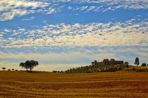
HIlltop Fortress, Alentejo, Portugal (2005) Photo Karen Abrahamson

This approach to placing boundaries relative to the landscape, shifted with the survey of the Mason-Dixon line, to an approach dependent upon accurate readings of latitude, and on a process of taking horizontal measure with a chain and surveyors level and frequent (every 10 degrees or 17.5 kilometers) astronomical observations. They even made careful adjustments for the earth’s curvature.

Surveyors subsequent to Mason and Dixon used similar methods as they moved forward to comply with the Land Ordinance Act of 1785, which modified a proposal originally made by Thomas Jefferson, to use the principle of rectangular surveys, instead of the irregular metes and bounds, to partition the landscape. Congress envisioned a series of townships along the Ohio River and up to the great lakes and so on westward. As a result, teams of surveyors headed west with axemen chopping a line through the forest. Of course the Indians had other thoughts about the measuring of the land which they thought of theirs. But the surveyors kept coming and the trees fell as the surveys were made and the lands of America became something new: a checkerboard landscape of straight lines and right angles as exemplified by the four corner meeting if Utah, Colorado, New Mexico and Arizona and as seen on any map of America.

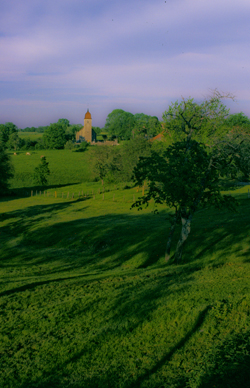
French village spire (2004) Photo Karen Abrahamson

How does this relate to goals? Well all these straight lines got me wondering if setting too-clear boundaries might also set boundaries in our minds. It got me wondering if Matt’s ideas of setting goals that almost surely surpass our abilities (read boundaries) might actually make us reach farther.

With that in mind, I’ve modified my annual writing goals as follows:


Original:

  • Write 30 pages a week
  • Write four novels (or three if one is a fat fantasy)
  • Post one blog a week
  • Publish at least one new short story and three novels
  • Work on craft of openings and voice

Revised writing goals:

  • Write 30 pages a week
  • Write four novels (or three if one is a fat fantasy)
  • Post one blog a week
  • Publish 25 items (Novels and short stories) in 2012
  • Work on craft of openings and voice.
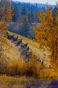
Snake fence along the Kane Lake Road, British Columbia, (2006) Photo(c) Karen Abrahamson

The thought of publishing 25 items fills me with fear because it means I have to write those stories or novels. I knew I could accomplish the 3-4 novels, but I don’t know if I can accomplish this. So I’ve stretched beyond those neat little borders I set for myself. I’m back into the wild spaces marked by metes and bounds. And you know what? If you fly over all those neatly surveyed spaces, you’ll find that fence lines and roads and buildings generally follow more natural paths anyway. So here’s to breaking boundaries and going to those new places nature takes us.


Maps and Spies

Maps and Spies

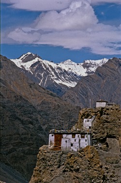
Himalaya Monastery outpost (2000) Photo (c) Karen Abrahamson

In one of my last posts (here) I wrote about how Sir Francis Drake may have been the real first discoverer of the Pacific Northwest coast, and how this fact was likely kept under wraps by the British government because of the potential for Spanish spies. Maps and spies have gone hand-in-hand for years and are still important in modern battles. I recently picked up the book Swan Song and the opening scene is the President looking at spy satellite images (maps) of Russian Territory. Spies and maps. That’s what this post is about.

Of course spy satellites weren’t always around, but spies were, and they have played an important role in the Great Game of Asia (the name given to the period between 1813 and 1907 when the Brits and Russians duked it out over influence and ownership over Central Asia). Being able to map an area and to gain control over important vantage points, rivers, towns and countries was all part of ‘the game’. The Survey of India I mentioned here, was all part of the British Raj’s need to know about and control their holdings.

But they ran up against a barrier – the physical boundary of the Himalayan Mountains and the geopolitical border with Tibet that had been closed by order of the Chinese Emperor. Although Europeans had sighted the heights of K2 and had scaled peaks only slightly less tall than Mount Everest, they hadn’t been able to map Tibet because of the Chinese border that specifically excluded Europeans. As a result, a captain of the Indian Survey, Thomas G. Montgomerie, decided to train and send disguised native agents into the mountains. Only two men passed the rigorous training: cousins Nain and Mani Singh.

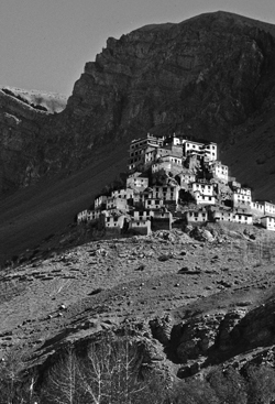
Himalayan Monastery along the Spiti Valley India (2000) Photo (c) Karen Abrahamson

In 1865 they went on their first mission through Nepal and into Tibet to try to reach Lhasa. The two became separated on their journey. Mani made it into western Tibet and returned with some mapping information, but it was Nain who managed to make it to Lhasa. Along the way he was robbed, but managed to retain his survey instruments. Trained to take even paces as his means of measuring distance and using a 100-bead rosary to keep track of his pace-count, he eventually entered the fabled city disguised as devout pilgrim. There he chanced public beheading by taking night-time measurements of altitude and latitude using mercury he poured into his begging bowl.

When he thought people were becoming suspicious of him, he left the city with a Ladakh caravan and headed west along the great Tibetan river, the Tsangpo. Along the way he mapped the river’s course and kept up his careful measures before finally escaping one night to make his way back across the Nepali border. He’d travelled 2,000 miles and mapped it all and returned with descriptions of Lhasa and the first reasonable placement of it on the map.

Nain’s accomplishment was followed by similar mapping parties, not all of which ended well. One agent travelled into northern Afghanistan and was murdered in his sleep. Another returned to Lhasa and back to India with data on almost 48,000 square kilometers of previously unmapped territory. A nephew of Nain’s continued the work and travelled for nearly six years in the mountains. He’d mapped a caravan route to China as well as the headwaters of the Mekon, the Salween and Irrawaddy rivers.

More impressive still, is the adventure of Kinthup, another native trained to survey the mountains. In 1880, he and another man were sent into the mountains to answer the question of whether the Tsangpo River became the Brahamputra. He braved the mountains and escaped after being sold as a slave by his ‘partner’ on the venture, but still managed to complete his mission in a feat that became legendary to Survey of India.

But it was only in 1911, after the Great Game was over, that the mapping of the Himalayas was completed, when the British joined their surveys with those of the Russians they had so long fought against. But it was brave native spies like Nain Singh and Kinthup who did the work for us and brought Lhasa and the Himalayas into the known world.

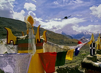
Himalayas and Crow (2000) Photo (c) Karen Abrahamson
Spy Lands –Who really discovered the coasts of America

Spy Lands –Who really discovered the coasts of America

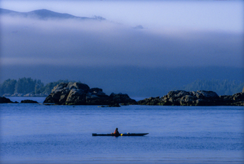
Kayaking the west coast of Vancouver Island, Photo (c) Karen Abrahamson

I mentioned last week about spies and maps and government subterfuge as aspects of maps that we rarely think about. Municipal governments still fool residents with streets on maps that are planned, but haven’t been built. Map makers take liberties with place names and add imaginary towns and streets that reflect their biases for and against university football teams. But in the past spies were frequently involved in cartographic subterfuge.

For instance, most of us were schooled that Captain Cook was the first European to lay eyes on the north western coast of North America. However there is mounting evidence that the English privateer (government sanctioned pirate) Sir Francis Drake, not Cook, first saw the coast of Oregon, Washington and British Columbia between 1577 and 1580 – 160 years before Cook’s journey.

Why isn’t this known?

First of all because some historians are hard pressed to let go of old ideas, but second of all because Drake’s journey was likely suppressed and evidence of it hidden, because of disputes with the Spanish that were, later, going to erupt into war. Drake is confirmed to have travelled as far north as Mendocino, California, the farthest north the Spanish had been, but a 412 year old map commemorating Drakes circumnavigation of the globe shows details of the coast of British Columbia that no one could have known unless they had been there. Additionally, archeological evidence – 1571 British coins and equipment – have been found in Oregon and Victoria, B.C. gardens, so that Drake is believed to have travelled as far north as Prince of Wales Island in Alaska. Finally, Drake’s cousin confessed under torture to the Spanish, that a fabled North Pacific island, Nova Albion, had been discovered by Drake and claimed for England 29 years before Samuel Champlain founded Quebec and before there was a Virginia on any map. This is believed to have been Vancouver Island, kept secret.

A further example of cartographic spies, deals with those icons, Christopher Columbus and John Cabot. Columbus, we’re taught, discovered the Americas while looking for China. Cabot’s fame is due to his first North American landfall by a European. Or at least that’s what we’re taught. But in a 1498 letter that was penned just months after Cabot’s historic return from Newfoundland, a spy in England wrote to Columbus and talked about earlier voyages by men from Bristol to the same place Cabot had been and that these earlier voyages had been to an “Island of Brasil” and that Cabot’s landfall “is believed to be the mainland that the men from Bristol found”. The spy’s letter also mentions that these voyages from Bristol were well known to Columbus – something that is further supported because Columbus had spent time in Bristol and Iceland in the 1470s – almost 20 years before he managed to convince the Spanish monarchy to fund his explorations. Did Columbus use this knowledge to convince Isabella? Did he use it to calm his crew on his long crossing?

We may never know, and even if we do, will it matter? For Columbus IS an icon that history won’t forget, but what this shows is how secrets and spies permeate the European history of maps, so that who really ‘discovered’ the coasts of America may never be known. Of course, just talk to a First Nations/Native American person and they’ll tell you we’ve got it all wrong anyway. North America had been ‘discovered’ long before any European left home.

A Question of Balance

A Question of Balance

We have a lot to thank the ancient Greeks for. They gave us Greek culture, mythology, the Odyssey and the Iliad. They developed drama and many of the arts and sciences and gave us some of the best early approaches to understanding the world – including its cartography. But the Greeks got some things downright wrong, too, like the circumference of the world. Unfortunately the rest of the European world held onto these errors as gospel simply because it WAS the Greeks who initiated the theories.

Case in point was the Greek philosophers’ belief in symmetry which, in cartography, surmised that because there was a large landmass in the northern hemisphere (Europe and Asia and North Africa), there must be a similar large land mass in the south. This led to world maps carrying the weight of a large continent south of the equator. In earlier maps this continent encircled the Indian Ocean, but when Vasco da Gama sailed the Cape ofGood Hope to circumnavigate Africa, the great continent receded a little, and simply reached out from the limits of Antarctica. It became known as Terra Australis.

The myth of the Antipodean continent caused cartographers to override the information brave explorers brought back from their ventures. When Magellan made the dangerous crossing from Atlantic to Pacific off the tip of South America, they spotted Tierra del Fuego and surmised it was an island. Cartographers, however, chose to override those who had been there, and drew Tierra del Fuego as an outcropping of the great continent. More mapmakers embellished their maps with prominent features like the land of Parrots, the Cape of Good Signal and the River of Islands, all lending credence to the existence on the continent. But exploration in the Pacific continued to chip away at the continent’s size, but it was only in the 1770s, when Captain James Cook was instructed to search for the southern continent, that he sailed farther south than 71 degrees to a land of fog and snow mists, that cartographer’s gave up on their belief in the super-sized southern continent.

So they turned their notion of symmetry northward.

If South America and Africa both had southern straights that gave passage from one ocean to another, then surely there must be something similar in the north. This led to the search for the Northwest Passage that scattered the names of many an explorer across Canada’s north. Think Frobisher Bay. Think Baffin Island and Hudson Bay, just to name a few.

Explorers from Spain, France and England sent explorers up and down the coast of North America and deep inland through the great lakes, seeking that passage. The English sent exploration teams one after another into Canada’s north, many never to be heard from again.

Driftwood at Longbeach, B.C. (2005) Photo (c) Karen Abrahamson

When the search from east to west brought no results, they sent famed Captain Cook, and then Captain Vancouver, exploring and mapping the Pacific coast of North America still seeking that elusive fjord that would spread out and become a fulsome channel all the way to England.

It was not to be, but such legends died hard. And today perhaps the ancient Greeks are laughing, as global warming opens up the northern passage they prophesized. Symmetry exists at last.


Free Fiction

Free Fiction

This week will be the start of something new : For the rest of the year I’ll be publishing my urban fantasy novel Mutable Things as a serial novel with 1-2 chapters a week. I hope you enjoy this novel of an empath who must conduct a murder investigation while her face and form change to meet the desires of the men around her.

To read the first two chapters, click HERE.

Recent Fantasy

Available HERE,

$1.99

Available HERE,
$3.99

Available HERE $1.99


Recent Mystery


Available HERE
$4.99


Available HERE,

$4.99


Available HERE,

$4.99


Available HERE,
$4.99


Recent Romance

Available HERE, $2.99