Tag: Spies

Maps and Spies

Maps and Spies

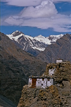
Himalaya Monastery outpost (2000) Photo (c) Karen Abrahamson

In one of my last posts (here) I wrote about how Sir Francis Drake may have been the real first discoverer of the Pacific Northwest coast, and how this fact was likely kept under wraps by the British government because of the potential for Spanish spies. Maps and spies have gone hand-in-hand for years and are still important in modern battles. I recently picked up the book Swan Song and the opening scene is the President looking at spy satellite images (maps) of Russian Territory. Spies and maps. That’s what this post is about.

Of course spy satellites weren’t always around, but spies were, and they have played an important role in the Great Game of Asia (the name given to the period between 1813 and 1907 when the Brits and Russians duked it out over influence and ownership over Central Asia). Being able to map an area and to gain control over important vantage points, rivers, towns and countries was all part of ‘the game’. The Survey of India I mentioned here, was all part of the British Raj’s need to know about and control their holdings.

But they ran up against a barrier – the physical boundary of the Himalayan Mountains and the geopolitical border with Tibet that had been closed by order of the Chinese Emperor. Although Europeans had sighted the heights of K2 and had scaled peaks only slightly less tall than Mount Everest, they hadn’t been able to map Tibet because of the Chinese border that specifically excluded Europeans. As a result, a captain of the Indian Survey, Thomas G. Montgomerie, decided to train and send disguised native agents into the mountains. Only two men passed the rigorous training: cousins Nain and Mani Singh.
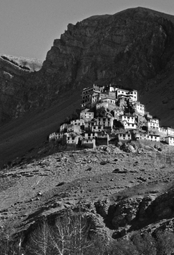
Himalayan Monastery along the Spiti Valley India (2000) Photo (c) Karen Abrahamson

In 1865 they went on their first mission through Nepal and into Tibet to try to reach Lhasa. The two became separated on their journey. Mani made it into western Tibet and returned with some mapping information, but it was Nain who managed to make it to Lhasa. Along the way he was robbed, but managed to retain his survey instruments. Trained to take even paces as his means of measuring distance and using a 100-bead rosary to keep track of his pace-count, he eventually entered the fabled city disguised as devout pilgrim. There he chanced public beheading by taking night-time measurements of altitude and latitude using mercury he poured into his begging bowl.

When he thought people were becoming suspicious of him, he left the city with a Ladakh caravan and headed west along the great Tibetan river, the Tsangpo. Along the way he mapped the river’s course and kept up his careful measures before finally escaping one night to make his way back across the Nepali border. He’d travelled 2,000 miles and mapped it all and returned with descriptions of Lhasa and the first reasonable placement of it on the map.

Nain’s accomplishment was followed by similar mapping parties, not all of which ended well. One agent travelled into northern Afghanistan and was murdered in his sleep. Another returned to Lhasa and back to India with data on almost 48,000 square kilometers of previously unmapped territory. A nephew of Nain’s continued the work and travelled for nearly six years in the mountains. He’d mapped a caravan route to China as well as the headwaters of the Mekon, the Salween and Irrawaddy rivers.

More impressive still, is the adventure of Kinthup, another native trained to survey the mountains. In 1880, he and another man were sent into the mountains to answer the question of whether the Tsangpo River became the Brahamputra. He braved the mountains and escaped after being sold as a slave by his ‘partner’ on the venture, but still managed to complete his mission in a feat that became legendary to Survey of India.

But it was only in 1911, after the Great Game was over, that the mapping of the Himalayas was completed, when the British joined their surveys with those of the Russians they had so long fought against. But it was brave native spies like Nain Singh and Kinthup who did the work for us and brought Lhasa and the Himalayas into the known world.
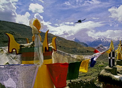
Himalayas and Crow (2000) Photo (c) Karen Abrahamson
Spy Lands –Who really discovered the coasts of America

Spy Lands –Who really discovered the coasts of America

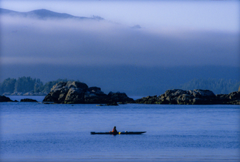
Kayaking the west coast of Vancouver Island, Photo (c) Karen Abrahamson

I mentioned last week about spies and maps and government subterfuge as aspects of maps that we rarely think about. Municipal governments still fool residents with streets on maps that are planned, but haven’t been built. Map makers take liberties with place names and add imaginary towns and streets that reflect their biases for and against university football teams. But in the past spies were frequently involved in cartographic subterfuge.

For instance, most of us were schooled that Captain Cook was the first European to lay eyes on the north western coast of North America. However there is mounting evidence that the English privateer (government sanctioned pirate) Sir Francis Drake, not Cook, first saw the coast of Oregon, Washington and British Columbia between 1577 and 1580 – 160 years before Cook’s journey.

Why isn’t this known?

First of all because some historians are hard pressed to let go of old ideas, but second of all because Drake’s journey was likely suppressed and evidence of it hidden, because of disputes with the Spanish that were, later, going to erupt into war. Drake is confirmed to have travelled as far north as Mendocino, California, the farthest north the Spanish had been, but a 412 year old map commemorating Drakes circumnavigation of the globe shows details of the coast of British Columbia that no one could have known unless they had been there. Additionally, archeological evidence – 1571 British coins and equipment – have been found in Oregon and Victoria, B.C. gardens, so that Drake is believed to have travelled as far north as Prince of Wales Island in Alaska. Finally, Drake’s cousin confessed under torture to the Spanish, that a fabled North Pacific island, Nova Albion, had been discovered by Drake and claimed for England 29 years before Samuel Champlain founded Quebec and before there was a Virginia on any map. This is believed to have been Vancouver Island, kept secret.

A further example of cartographic spies, deals with those icons, Christopher Columbus and John Cabot. Columbus, we’re taught, discovered the Americas while looking for China. Cabot’s fame is due to his first North American landfall by a European. Or at least that’s what we’re taught. But in a 1498 letter that was penned just months after Cabot’s historic return from Newfoundland, a spy in England wrote to Columbus and talked about earlier voyages by men from Bristol to the same place Cabot had been and that these earlier voyages had been to an “Island of Brasil” and that Cabot’s landfall “is believed to be the mainland that the men from Bristol found”. The spy’s letter also mentions that these voyages from Bristol were well known to Columbus – something that is further supported because Columbus had spent time in Bristol and Iceland in the 1470s – almost 20 years before he managed to convince the Spanish monarchy to fund his explorations. Did Columbus use this knowledge to convince Isabella? Did he use it to calm his crew on his long crossing?

We may never know, and even if we do, will it matter? For Columbus IS an icon that history won’t forget, but what this shows is how secrets and spies permeate the European history of maps, so that who really ‘discovered’ the coasts of America may never be known. Of course, just talk to a First Nations/Native American person and they’ll tell you we’ve got it all wrong anyway. North America had been ‘discovered’ long before any European left home.

Recent Fantasy

Available HERE,

$1.99

Available HERE,
$3.99

Available HERE $1.99


Recent Mystery


Available HERE
$4.99


Available HERE,

$4.99


Available HERE,

$4.99


Available HERE,
$4.99


Recent Romance

Available HERE, $2.99