Tag: Travel

Winter is Coming

Winter is Coming

Okay, I know that line has been taken, but it seems that winter is a theme running through my writing these days. I recently finished a new alternative history mystery novel, (as yet unpublished—still at first reader stage) that arose out of a writing workshop I attended on the Oregon Coast. It is set in what is Kyrgyzstan in our world. Okay, okay. I can hear you now. KYRGYZSTAN? Where the heck is Kyrgyzstan?

Think north of Afghanistan in and around the Tian Shan and Allay mountains.

It’s a small, ex-Soviet Union country—one of the ‘stans’.

My story grew out of an exercise at a Historical, Time Travel, and Alternate History workshop presided over by Kristine Kathryn Rusch, author of such wonderful time travel novels as 
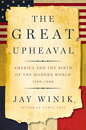
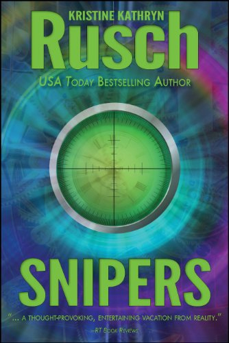
Snipers. She asked us to take an event out of the wonderful non-fiction book The Great Upheaval, and use that as a jumping off point for an alternate history story. The short story that arose presumes that history diverged way back in the late-1700s at the time of Catherine the Great, or Yekaterina as I call her. It was around the same time as the American and French revolutions when Catherine was the great Tsarina of the Russian people. She was an interesting lady who wasn’t even Russian by birth, but she married the Tsar and then usurped his throne. Like I said, interesting lady.

In her younger years Catherine was tempted by the influence of the great statesmen and philosophers of her day to consider democracy for her people, but eventually decided that it wouldn’t work—for Russian peasants. Instead she went to war against the Ottoman Empire. In our world she won her battles because the Ottoman Empire was waning.

But what if Catherine’s depredations (and they were vicious) woke the Ottomans up? What if the Ottomans found their strength again and took the battle to Catherine and the Russians? The Russians were stretched by conflicts on their northern and southern borders and with Poland.

Because the Ottomans won (in my version of history), it led to a world very unlike this one. It led much sooner to the end of the French Revolution so that Napoleon never became emperor and never ruled. As a result, the French government never supported the fledgling United States in their great democratic experiment, and that led to Great Britain taking over most of North America.

At least in my made-up world.

In the novel that grew out of the short story, a rag-tag group of Russian refugees escaped the Ottoman juggernaut and now live in a small country called Fergana. Fergana lies caught like the gristle in a joint between the two behemoths of the Chinese and Ottoman Empires. In the late fall of a modern day New Moscow a young girl is found dead in a city park. Thus begins my new novel, After Yekaterina. It’s late October and the first snow is threatening as Detektiv Alexander Kazakov stands over her body.

That is how I came up with my latest mystery series. And now, as I start the second novel in the series, the autumn ocean storms are settling in over my home, but in Fergana it is deepest January and the long winter has arrived.

My goodness I like this writing thing.

Back to Burma (Myanmar)

Back to Burma (Myanmar)

I traveled to Myanmar (Burma) in 1997 while I was living and working in Thailand. At the time, the country was still mostly closed to foreigners. Only select parts of the country were open. During my month ‘in-country’ (the maximum the visa allowed) I conducted research on the Burmese puppet troupes and stayed at small guesthouses for a better chance of meeting local people. Unfailingly, everyone I met was giving of their time, knowledge and their kindness.

That began my love affair with Burma. (You can read more about my travels here.)

Since then I’ve written a number of novels set in Burma, including the modern, paranormal romance Shades of Moonlight.

In April 2017 Guardbridge Books published Death By Effigy, the first in my historical Aung and Yamin Fantasy Mystery series, in which an aging puppet singer and a mischievous puppet, must solve the murder of the king of the puppets or risk the destruction of the entire troupe.

I’m pleased to announce that the second in the series, A Death In Passing, has just been released, continuing the trials and tribulations of Aung, the puppet singer, with his troublesome assistant, Yamin, as they try to solve the murder of Burma’s most powerful spirit dancer.

In all of these books I’ve attempted to be true to the country’s culture and to accurately present the wonderful nature-magic systems (with a few embellishments). Burma seems to be in my blood and I envision more novels set in this wonderful and varied country. Whether historical or modern novels, I hope to capture the country’s magic for readers.

If you’ve traveled in Burma, I’d love to hear how I did.

“A Good Traveler (or writer) has no Fixed Plans…”

“A Good Traveler (or writer) has no Fixed Plans…”

Porter on the Camino Inca. (2011) Photo (c) Karen Abrahamson

I purchased a lovely journal the other day. Though it’s not specifically a travel journal it certainly could be, because all of the quotes in the book relate to travelling, but when I read the complete quote by Lao-Tzu, all I could think of was its applicability to writing. The quote goes thus:

‘A good traveler has no fixed plans and is not intent on arriving.’

As someone who loves to travel, this quote provides a cautionary tale, because it warns that if you focus always on the destination you miss a lot along the way. Personally, I prefer to meander from place to place because you never know when you are going to find some better place to go than the place you intended. If you are always focused on heading somewhere, you have a much greater chance of missing where you are. As the Buddhists suggest, mindfulness of where we are, rather than worrying about the future  (or where we are going) brings much more happiness than the rush, rush, rush of hurried travel. It’s for that reason that I don’t take bus tours. The tours point out what they think you want to know, not what you can really learn just by being there.

Yukon path, (2008) Photo (c) Karen Abrahamson

But Lao-Tzu’s quote applies equally to writing. The writer who spends all his/her time solely focused on completing a project isn’t really giving themselves the opportunity to enjoy the project. I’m not saying that you should fool around and never finish, I’m suggesting that you should enjoy the process, no matter how difficult it is, and—just like the traveler who takes the time to meander you don’t need to be so end-driven that you can’t enjoy the little sidepaths that your muse sends you down.

I guess what I’m talking about is allowing the story to carry you along, just like the road can. You don’t have to know where you are going exactly, though you may have a vague idea that you would like things to end in a certain way. Some of my best days of writing are when I have allowed the story to carry me away from the story I had intended—those are the mornings I get up and rush to get writing again because I want to know what happens next. The funny thing is that if you allow the little digressions and flashes of insight to lead you, often the ending will turn out to be some place better than what you envisioned. Believe me, if the ending surprises you, it’s going to surprise and charm your reader, too.

So as a recovering ‘plotter’ of novels I think all novelist should allow themselves the freedom to step off the path they are following to explore the new world they’ve created. They might just find it’s bigger and better than they ever imagined.

Angkor Wat reflections. (2009) Photo (c) Karen Abrahamson
Maps, Shakespeare and Melville- One Year Later

Maps, Shakespeare and Melville- One Year Later

Rajasthani girls with Mendhi on their hands. (2000) Photo (c) Karen Abrahamson

Exactly one year ago I wrote my first blog about maps and decided that I would write a series on that topic– maps, their history, the people who made them, and how maps have been used by people. I did this because maps are integral to the series of books I write in the Cartographer Universe and I wanted to understand more deeply what maps have meant to humankind.

What I’ve come to understand is that maps can be a truth, a lie and a metaphor. They can present the ‘reality’ of the physical world—the mountains and rivers and roads and cities and can inspire men to superhuman acts just to complete a map. Just as often, though they represent lies or half-truths—the imaginary island of Brasilia, the shifting landscape of Prestor John’s Kingdom or, more overtly, contorted landscapes intended to lure the unwary into towns, gold fields and department stores. And that’s a problem, because we tend to think of maps as representing the truth and we don’t  approach maps with a ‘use at your own risk’ mentality or with the realization that any map may only represent the reality that the map’s maker wishes to represent. They’ve been used this way for centuries, so that the modern-day Chinese maps which change the location of major city thoroughfares to stymie the advance of any potential invasion are only an extension of the same tradition that caused British mapmakers to make erroneous maps of the West Coast of Canada (presumably to stymie the work of Spanish spies), and the Portuguese and Dutch Kings who kept secret their routes to the spice islands.

Ship off the Portuguese Algarve, (2005) Photo (c) Karen Abrahamson

But maps are much more than simply tools to convey or obscure information. Maps are a part of our psyche so deeply engrained that the map metaphor has seeped deep into our culture. Cervantes wrote ‘Journey all over the universe in a map, without the expense and fatigue of travelling, without suffering the inconveniences of heat, cold, hunger, and thirst.’ Shakespeare wrote “In thy face I see the map of honor, truth and loyalty.”

The Camino Inca Trail to the sacred city of Machu Picchu. (2011) Photo (c) Karen Abrahamson

But maps themselves are not truth, but metaphors. Once, in Fra Mauro’s time, they represented the mythical extent of man’s imagination and potential. Once, they represented the adventure, the spirit of mankind in the terra incognita of the empty sections of the map. Nowadays they represent the world as governments want it to be when they represent contested borders (think the current battle over islands between Japan and China, or the oil-rich islands in the South China Sea that three countries claim). Maps are used to represent presidential aspirations, shifts in battlefields, oil pipeline routes, and enemy and friendly countries—not that these presentations are the truth, but they are one truth—the truth that the mapmaker wants us to believe.

In this day and age when maps are no longer produced by a person hunched over vellum and ink, we must remember that many things influence the mapmaker’s pen. Everything from politics, funding sources and the publishing company’s allegiances represent what is filtered onto the page. Which brings me to my final conclusion about maps and the truth. They have always been creatures of the imagination and not of the truth, no matter that they grew out of scientific endeavors, but now that purpose of inciting the imagination is being used with more strategic purpose than ever before. Can we trust maps? No.

As Herman Melville stated so well:

It is not down on any map; true places never are.

Porto boats at dawn , Porto, Portugal. (2005) Photo (c) Karen L. Abrahamson
Road Maps and Avarice

Road Maps and Avarice

Uigher apothecary shop, Kashgar, Western China. I doubt this shop still stands as the Chinese have torn most of the old city down for new ‘Chinese’ development. (1997) Photo (c) Karen Abrahamson.

Yes, it is all about the money.

Two weeks ago I wrote about the Klondike gold rush and how that led to cartographic oddities that misled gold seekers into taking ill-advised routes to the gold rush. But other maps are also intended to ‘sell’ to their users—including the ubiquitous road map.

Americans often claim that they invented the road map, and indeed Americans certainly created the most extensive collection of roadmaps just as they advanced their road systems. But there are earlier versions of roadmaps. In the third century the Romans produced a six meter-long map of roads and distances between certain points called the Peutinger Table (now stored in a Viennese museum) and during the time of the crusades crude journal/maps of routes to the Holy Land were produced. But the modern road map is largely an American invention.

These maps didn’t originate with cars in mind, but as a result of bicycle clubs in the late 1800s when cyclists were searching for maps of paved roads to enjoy their activity. Cars soon took over and road maps developed as promotional tools to encourage people to travel to, and live in, new places. Of course, as new locations opened up, land sales increased, and as the car culture grew and people travelled more, road maps did wonders for the bottom line of the oil companies.

A Peruvian cowboy in the Sacred Valley. These roads still resist development. (2011) Photo (c) Karen Abrahamson

But maps were used for promotion by other companies, too. In Canada, department stores developed road maps that showed that ‘all roads started or ended’ on Yonge Street, Toronto, the location of their store. Maps produced by oil companies specifically marked the location of oil refineries and invited people to visit these new ultramodern facilities. Maps produced by exhibitions/fairs included images of vehicles speeding to that location. Road maps were not just a means to open up a person’s eyes to the many places in the landscape, they were a means to direct that person’s attention to a specific location in an overt attempt to separate that person from their money.

City maps were more of the same only concentrated in a microcosm of what was going on all over the United States. John Jacob Ast0r became the veritable poster child for land speculation through his exploits in Manhattan. Astor bought his first lot on the Lower East Side in 1800 and gobbled up numerous lots afterwards to make a fortune in property values. What was bought for$50 an acre in 1800, was worth $1,500 in 1920 and as the City’s grid system was planned well before the city finally took shape, Astor was able to parlay his wealth into $25 million—the wealthiest man in America when he died in 1848. How did he do that? By looking at the street map of the city. Then he could sell properties—always at a profit—to take the cash and purchase more property in as-yet undeveloped areas that would be worth even more in the future. For example, a sale at $12,000 allowed him to purchase lots that would be worth $80,000 in a few short years. All because the road maps, like the maps to the Klondike, told him where to go.

Which brings me to the latest development debacle in Greater Vancouver: a developer not only leveled all the trees on the property that was soon to hold four mega houses, he also leveled the trees in a local park, on private property and along a salmon spawning stream. I’m not holding my breath given the history of cutting down trees in these parts, but here’s hoping a large part of his profits go into reparation.

Mist over the Fraser River. These peaceful scenes are ending as hihg-density development occurs. (2010) Photo (c) Karen Abrahamson


Maps, Dreams and a Road Trip to Port Townsend

Maps, Dreams and a Road Trip to Port Townsend

One of the lovely old buildings along Water Street, Port Townsend. (2012) Photo (c) Karen Abrahamson

This past week a good friend and I embarked on one of those memorable institutions of Americana (or Canadiana—we are both Canucks)—the road trip. Not that it was one of those great ventures across the continent like so many novelists have captured. No this was a small road trip—actually more of a mini or micro-mini road trip all the way from Vancouver, Canada, to Port Townsend, Washington. Why did we go? Just like any other road trip, we went because it was there and because it was a point on a map that we hadn’t visited before.

Road trips seem like an important part of our North American culture. Maybe it’s our love of the automobile or maybe it’s the distances, but I know people who think nothing of hopping in their car and driving for days on end just to visit a friend, or to be able to stand on a point of land and look out at the Pacific Ocean. Yes, they might have been able to fly to the location quicker and more conveniently, but the road trip makes the process of getting there just as important as the arrival.

Boat pulled onto dock at Coupeville, Whidbey Island. (2012) Photo (c) Karen Abrahamson

My first road trips were in the back of my parents’ black Ford sedan, travelling across the continent not once, not twice, but at least five or six times because my dad was posted at a military base on one side of the continent and ‘home’ was always on the other side. Dad would drive and mom would ride shot gun and play navigator with the road map. For summer holidays we took road trips from the Pacific Northwest to Utah and California or Montana. Those were memorable trips and brought home at a young age, just how huge the continent was and the diversity of all the places there were to visit and all the different people you could meet along the way. We’d play games of spotting license plates from other places, and I’d count the horses I saw in the fields.

My first independent road trip was right out of high school when, with two friends, we drove to Mexico and back in a Ford van affectionately known as the Dorf. At eighteen it was adventure and an announcement of independence to the world. It took all three of us to places we’d never been before, following the map down the coast and back up I5. We got lost travelling at night playing leapfrog with the long haul truckers and then turning off when exhaustion made us look for a place to sleep in the Van. We got chased off by locals and scared by someone prowling around us and ended up taking turns and travelling right straight through from central California to home in one sitting following the long straight road laid out on the map for us.

Lovely old Heritage house, cum B and B, Port Townsend. (2012) Photo (c) Karen Abrahamson

What is it about the road trip that draws most of us to such a trip at some point in our lives? Is it simply the love for the automobile and the feel of power that wheels us away from the moorings of our life, or is the call to adventure that dreamers dream of and writers write about? Or is it the vestigial need to explore that remains like a tailbone in our psyche?

Wooden boat hull reflections. Port Townsend has a long history of wooden boat building. (2012) Photo (c) Karen Abrahamson

Either way, my friend and I explored the heritage byways and backwaters of Whidbey Island before climbing on a ferry and crossing to Port Townsend. We followed the city map of heritage houses and explored the town before heading on our way again looking for opportunities to fall of the map before climbing back on again to eventually find our way home. At one point our trusty map failed us and it took a kind trucker and his GPS to put us straight again, but that’s the nice thing about road trips: you meet nice people most of the time. When we got home my friend and I were both ready for another, longer trip. We’re already scanning the maps for new places we haven’t seen. Any recommendations?

A Port Townsend cat makes us welcome by licking the window. (2012) Photo (C0 Karen Abrahamson
Maps, Mergers, Detours and the Other Direction

Maps, Mergers, Detours and the Other Direction

I just got back from Seattle (my OTHER favorite city), from a whirlwind trip to a Clarion party to see my old writing instructor Connie Willis (she teaches a mean reversal and wonderful lessons on plot). I travelled with another of my Clarion classmates (Class of 2001) and we were struck by a few things that got me thinking about maps and directions and foreign countries.

You see, there we were following the directions provided by Google maps (I prefer maps over GPS any day)and we were trying to get from I5 to the Queen Anne area when we discovered that there apparently is different English used for American directions than for Canadian. The American directions told us to merge when to Canadians it was clearly a left hand turn. ( A merge being something you do from an onramp onto a freeway.) In other spots we were told to turn left or right, when clearly to our Canadian eyes it was a merge. Needless to say, while we didn’t get lost, there were times I was seriously glad I wasn’t a driver behind us. I mean what were these crazy foreigners doing?

Of course our trip home wasn’t any easier. Not only did we have to navigate the many one way streets, that area of Seattle seems perennially under construction so we had to deal with detours. The main Lake Washington Bridge was closed which meant we couldn’t easily take a side visit to Redmond, and the downtown was also chewed up by construction so that we had to follow detour signs to get to I5 again. The interesting thing was, if we hadn’t been going to visit friends in Redmond we would have been seriously in trouble, because the detour signs just got us to the highway – headed south instead of back to Vancouver. Later, as we attempted to find our turn off, we had to deal with signs that said X Exit merge left and then, a quarter mile later, X Exit merge right.  Again I was glad of my foreigner license plates that at least gives me some license to be a little confused as I madly slalomed across the highway.

Christmas Street, Besconson, France (2005) Photo (c) Karen Abrahamson

All of this put me in mind of my travels in other countries where charming street signs have tickled my fancy. My favorite continues to be crossroad signs in France:  Paris with an arrow pointing in a certain direction, to Pontarlier, with an arrow pointing in a second direction, and a third sign with an arrow saying Les Autre Direction (the other directions). Maybe it’s just that North Americans have more need for specificity, but these signs always made me snort with laughter. I mean, of course the sign pointed in another direction, the question (for me) was what direction was it? Although I drove many places with my friends I don’t recall ever driving in that direction. So today as I wended my way home through the deceiving streets of greater Seattle I think I may have found myself unknowingly travelling Les Autre Directions. The surprising thing is I got to where I wanted, whether the signs led me there or not.


Andean Civilizations: A Map of a Different Color

Andean Civilizations: A Map of a Different Color

Off to the fields, Pumamarka (2011) Photo (c) Karen Abrahamson

When I think of maps I imagine back to when the first human made their first finger marks in mud to share a game trail, or a watering hole or an especially good berry bush. Surely that must have been the earliest form of map. Of course none of those primeval drawings exist, and so I’ve found myself writing a about the western development of maps over the ages and have tried to give a sense of the European tradition and the contributions of Arab and Chinese explorers and cartographers. This is the easy stuff to research and write about because the maps these cultures used were set down in a manner we are trained to see. Maps, to most of us, are a visual representation, usually on a flat medium like paper, that presents the relationship of one place to another. But other cultures have had other ways of presenting their landscapes, case in point are the great civilizations of the South American Andes.

What most of us think of as the Inca are actually a series of overlapping civilizations that rose and fell in the various livable areas of Peru, Bolivia, Ecuador, Columbia and Chile. After the very effective conquest of South American by the Spanish, not much remains of any Inca records and to date no maps (as we define them) have ever been found. But did these cultures simply not have maps or did they represent their landscapes in a different way?

Anthropologists and Cartographers say that formal mapmaking tends to occur within highly organized, bureaucratic societies as a form of discourse. The conditions necessary for mapmaking include: demands for agriculture, private property, long distance trade, militarism, and tribute relationships, amongst others, all of which are attributes of the various Andean societies.

Women at Ollantaytambo market (2011) Photo (c) Karen Abrahamson

Anthropologists studying the various ancient cultures have begun to realize that westerners probably won’t recognize Andean maps until we start to see them through Andean eyes. The structure of maps aren’t only determined by geography, but also by social organization, cultural conventions and human perception. In the Inca worldview, the cosmos was built on a quartered circle, based on the way they viewed the Milky Way divide the heavens. They viewed their world that way as well, with the lands they ruled broken into four distinct quarters.

The Inca also had to map unusual terrain, from the coastal deserts and river oasis, up through the highlands to the alte-plano and Andes mountains and down again into the Amazon basin. Trade and tribute came those long distances, and north and south from Ecuador to Chile. Over those distict terrains there were distinctions of crop and animals at each of the different elevations. So, for an ancient Andean, among the things they needed to represent, were the different elevations, the different foods, and the waters that made life possible across these sometimes inhospitable terrains, as well as capturing the four quarters of the world and social relations.

Market Scene, Chivay. Note the Inca rock that shows terracing and irrigation techniques. (2011) Photo (c) Karen Abrahamson

The resulting landscape representations convey things like ownership and elevation. Ancient weavings show the long narrow fields of produce separated by clan-assigned canals. Pottery shows spatial designs that encode critical social structures, and still other sculptures, such as Chieftain Vessels correspond to Andean landscapes with the head of the figure as the summit, the shoulders as central mountain slopes, the lower hips as the coastal plains where mountain rivers diverge on fields. Still other sculptures show realistic representations of the terraced fields and irrigation systems that make up areas of central highland valleys.

So while we might say the Inca made no maps, it doesn’t mean that they didn’t represent their landscape. The difference is that the Inca ‘maps’ were often three dimensional and layered with meaning, both in terms of the landscape, ownership and familial relationships, and the relationship of the landscape to their ancestors, the spirits and the cosmos.


The Star Raft: They came from the rising sun (part 2)

The Star Raft: They came from the rising sun (part 2)

Two weeks ago I wrote about the evidence showing contact between China and Africa long before the Portuguese sailed around the tip of Africa and into the Indian Ocean. More evidence of this appears from maps found in Korea and dating back to 1402 that show the WEST coast of Africa as far north as the Orange River, one of the longest rivers in Africa, which forms the international boundary between modern day South Africa and Namibia. This same map places Africa immediately opposite Indonesia with a string of small islands in between, suggesting that whoever drew the map, didn’t get there via India and the Gulf and down the African coast, but instead by sailing across the Indian Ocean. Records suggest some of these Chinese travelers came by way of a Star Raft. So who were these sailors and what is a Star Raft an how does this have relevance today?

Unlike later generations of Chinese dynasties, the Tang dynasty (A.D. 618-907) was outward looking and venturesome. This continued with the Southern Song Dynasty (A.D. 960-1279)who had lost half their territory to the Tartar hordes of the north. To make up for their property losses, they looked to oversees trade to fill their coffers and China became, for the first time, a maritime nation.

The ships they built had five or six decks, and carried a year’s supply of grain, herds of pigs and jars of fermenting wine. They carried the world’s most advanced seafaring technology in magnetic compasses, water-tight bulkheads, advanced rudder systems, sounding lines, and a sail designed for steering into the wind that could have allowed them to travel into the trade winds that had deterred the Arab seamen. By the end of the twelfth century they were on the edge of the western Indian Ocean and had appeared in the Gulf and off Yemen.

Old woman and Brazier and Xi'an Temple (1998) Photo (c) Karen Abrahamson

While many of these huge boats went no farther than India to trade, accounts from those few who went further also made their way back to China and described the port towns and the people they met. They describe the sources of ivory and rhinoceros horn, of frankincense, ambergris and a red gum resin called ‘dragon’s blood’ as a series of villages down the East African coast. News also came of the landscape and the African wildlife, including the marvelous creature called a camel-ox with a hide like a leopard’s, the hooves of a cow, no hump but a neck nine feet long perched above a body ten feet tall.

The contact between Africa and China continued, including embassies of African traders to the Chinese court. Proof of this comes both from Chinese records and from the diaries of Ibn Battuta, the many travelled Arab who wrote of meeting a man from Mogadishu who had been in China.

With the fall of the Song Dynasty and the coming of the Mongol hordes, the naval trade reduced, but the rise of the Ming Dynasty (A.D. 1368-1644) saw the creation of a huge maritime fleet that in 1414 sailed into the western Indian Ocean led by General Zheng He, Grand Eunuch of the Three Treasures. (See my short story here.) Zheng He was the Chinese Columbus, but the Chinese ships topped Columbus’s ships in every way. While Columbus sailed with three ships with single decks, Zheng He sailed with sixty-two galleons that each outweighed Columbus’s ships three to one. While Columbus had about 100 men, Zheng He had 868 civil officers, 93 commanders and 26,800 soldiers plus numerous others.

But unlike Columbus, who was a man of exploration, Zheng He led a Star Raft – an expedition planned to bring the ‘star-like radiance of the imperial ambassador’ and to win allegiance of distant people for the Chinese emperor. Yes, goods were traded during these voyages, but the symbolism of the exchange was unique to the Chinese. They believed that their trading partners were paying homage to the Chinese sovereign of the world. So unlike Columbus. the Chinese venture was based in looking inward – bringing the homage of other places to the center of the world.

Inside a modern Xi'an Temple (1998) Photo (c) Karen Abrahamson

Which makes me wonder about the state of the world’s economy today as China’s economic engine begins to overtake that of the United States. Are we watching a modern-day version of the Star Raft as western companies and governments seek their trade accords with the new China?


Recent Fantasy

Available HERE,

$1.99

Available HERE,
$3.99

Available HERE $1.99


Recent Mystery


Available HERE
$4.99


Available HERE,

$4.99


Available HERE,

$4.99


Available HERE,
$4.99


Recent Romance

Available HERE, $2.99