Tag: Fra Mauro

Maps, Shakespeare and Melville- One Year Later

Maps, Shakespeare and Melville- One Year Later

Rajasthani girls with Mendhi on their hands. (2000) Photo (c) Karen Abrahamson

Exactly one year ago I wrote my first blog about maps and decided that I would write a series on that topic– maps, their history, the people who made them, and how maps have been used by people. I did this because maps are integral to the series of books I write in the Cartographer Universe and I wanted to understand more deeply what maps have meant to humankind.

What I’ve come to understand is that maps can be a truth, a lie and a metaphor. They can present the ‘reality’ of the physical world—the mountains and rivers and roads and cities and can inspire men to superhuman acts just to complete a map. Just as often, though they represent lies or half-truths—the imaginary island of Brasilia, the shifting landscape of Prestor John’s Kingdom or, more overtly, contorted landscapes intended to lure the unwary into towns, gold fields and department stores. And that’s a problem, because we tend to think of maps as representing the truth and we don’t  approach maps with a ‘use at your own risk’ mentality or with the realization that any map may only represent the reality that the map’s maker wishes to represent. They’ve been used this way for centuries, so that the modern-day Chinese maps which change the location of major city thoroughfares to stymie the advance of any potential invasion are only an extension of the same tradition that caused British mapmakers to make erroneous maps of the West Coast of Canada (presumably to stymie the work of Spanish spies), and the Portuguese and Dutch Kings who kept secret their routes to the spice islands.
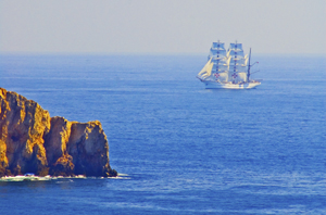
Ship off the Portuguese Algarve, (2005) Photo (c) Karen Abrahamson

But maps are much more than simply tools to convey or obscure information. Maps are a part of our psyche so deeply engrained that the map metaphor has seeped deep into our culture. Cervantes wrote ‘Journey all over the universe in a map, without the expense and fatigue of travelling, without suffering the inconveniences of heat, cold, hunger, and thirst.’ Shakespeare wrote “In thy face I see the map of honor, truth and loyalty.”
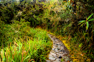
The Camino Inca Trail to the sacred city of Machu Picchu. (2011) Photo (c) Karen Abrahamson

But maps themselves are not truth, but metaphors. Once, in Fra Mauro’s time, they represented the mythical extent of man’s imagination and potential. Once, they represented the adventure, the spirit of mankind in the terra incognita of the empty sections of the map. Nowadays they represent the world as governments want it to be when they represent contested borders (think the current battle over islands between Japan and China, or the oil-rich islands in the South China Sea that three countries claim). Maps are used to represent presidential aspirations, shifts in battlefields, oil pipeline routes, and enemy and friendly countries—not that these presentations are the truth, but they are one truth—the truth that the mapmaker wants us to believe.

In this day and age when maps are no longer produced by a person hunched over vellum and ink, we must remember that many things influence the mapmaker’s pen. Everything from politics, funding sources and the publishing company’s allegiances represent what is filtered onto the page. Which brings me to my final conclusion about maps and the truth. They have always been creatures of the imagination and not of the truth, no matter that they grew out of scientific endeavors, but now that purpose of inciting the imagination is being used with more strategic purpose than ever before. Can we trust maps? No.

As Herman Melville stated so well:

It is not down on any map; true places never are.

Porto boats at dawn , Porto, Portugal. (2005) Photo (c) Karen L. Abrahamson
The Roots of the World

The Roots of the World

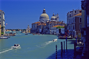
The Grand Canal, Venice (2005) Photo (c) Karen Abrahamson

For men like Fra Mauro (see last post), the exploration of the external world led to an understanding of the inner landscape of men. So too, from the triangulation of the world (see post here) came a greater understanding of the internal shape of the earth.

I mentioned previously that in order to determine the shape of the world, a French survey team went to Ecuador and Peru at the same time as a team went to Lapland. Unfortunately for the Peruvian team, the Lapland team discovered the answer to the scientific question long before the Peruvian team ever finished their survey. While in South America, however, the Peruvian team struggled over mountains and through jungles and noted different gravity readings as they took their survey measurements along their route. They surmised that the differences in the readings might reflect the varying landscape and theorized that mountains might be made of less dense material than the lowlands. A good theory, but it took over a hundred years for the matter to be more fully explored and the discovery was made far from South America. It took the British Raj’s need to survey India to bring understanding to what the mass of mountains might mean.

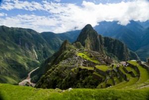
Machu Picchu caught in the coil of the coil of the Urubamba River (2011) Photo (c) Karen Abrahamson

In the mid nineteenth century, the horrendous task of surveying India through triangulation was almost undone by the discovery of an error of some 150 meters between the distance the triangulation measurements computed, and an actual direct surface measurement. To determine what had led to the error, the cartographers involved had to reexamine their assumptions – in this case they had assumed that the mass of the Himalayan Mountains would greatly influence the gravity measurements of their survey instruments. What they found was that they had overestimated the lower mass of the mountains.

This led to a theory of the earth’s crust that still exists today, namely that every (theoretical) column of the earth (from core to outer surface following a theoretical plum line) should have approximately the same mass. Given that tall mountains have a lower mass, they must have an equally large (but low mass) protuberance at the bottom of the earth’s crust to achieve the same mass as denser areas of the earth’s crust. Conversely, under the oceans where the ocean basins are very dense, the earth’s crust would be relatively thin. The theoretical result would be that inside the earth there would be a mirroring of the plains, mountains and ocean valleys we see on the surface, much like a tall iceberg has a large underwater presence to balance it out. Modern science has supported this, by obtaining crust measurements off the coast of South America that show the Andes have roots as deep as 75 kilometers.

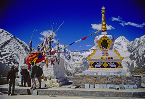
Stupa and Prayer flags at the Manali Summit (2000) Photo (c) Karen Abrahamson

Think of this the next time you are crossing the mountains, staring up at those tall, snow-covered peaks, for they are the frosting, the outer conceit of an iceberg of stone that conceals the deeper reality of the roots of the mountains.

Much like Fra Mauro saw the illusions of men obscure the truth of his map of the world.

Powell’s Books: A glimpse inside the cartographer’s mind

Powell’s Books: A glimpse inside the cartographer’s mind

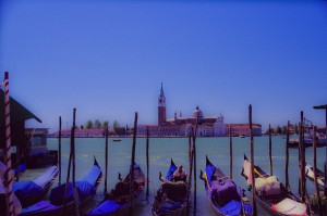
Gondolas, Venice (2004) Photo (c) Karen Abrahamson

The other day at Powell’s Books (Portland), I came across a wonderful little book called “The Mapmaker’s Dream” by James Cowan. The book is the translation of the diary of Fra Mauro, a sixteenth century Venetian monk and cartographer who set out to make a perfect mappamundi (map of the world) though he had never stepped outside the confines of his cloisters. Instead he gathered travelers’ tales through exchanges of letters or interviews of missionaries, merchants and soldiers travelling through Venice. His task became well known and he received envoys from as far afield as the court of the Chinese Emperor. Not only was this book astounding for the fact that word of his venture travelled so far in the 16th century, but the information he collected and the workings of his mind fascinated me.

Yes, his travelers brought stories of the Cyclopedes, beings in the southern hemisphere with only one huge foot that they used for hopping and also for shade when the sun in the antipodes became too fierce, but envoys also brought other tales that caused good Fra Mauro much reflection. This was what captured my attention for they showed a keenness of mind and a shifting view of the world much like new age philosophers. This seemed strange for his time; given Fra Mauro was a devout Catholic.

His encounters left him pondering whether the soul could possibly transmigrate into another person upon the death of the body and whether we are ‘all drifting towards a more complete life in someone else’. The visit of an old Jewish merchant from Rhodes left him contemplating how the loss of place (in the holy land) ‘condemned the man to inhabit his loss forever’ and how the rootless person came to inhabit a region of his own mind instead.

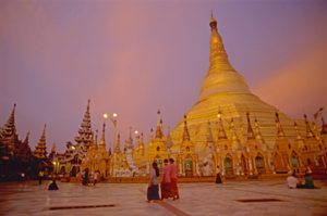
Schwedigon pagoda
Holy Schwedigon pagoda at sunset, Yangon, Myanmar (Photo (C) Karen Abrahamson)

Visits from others left him considering how venerated holy relics become something more because of that veneration, and how those objects take on their own life because they unite an idea that men aspire to. They left him wondering at cultures that worshiped Satan and yet were not evil, and others that determined their actions and their future through the calls of seven forest birds.

But most of all he wrote of the minds of travelers. He was struck by the notion that travelers not only travelled with their bodies, but also that they travelled in their minds and were transformed by that travel or, alternatively, transformed the place they had been. He wrote of the journeys of envoys sent to find the mythic kingdom of Prestor John and looked at the evidence of such a kingdom – the long letter still held in the Vatican archives that describes a kingdom so perfect it could not possibly exist. Fra Mauro concluded that the reason the search for Prestor John’s kingdom became all consuming, was not just the desire for aid against the Moslem hordes, but the desire to know that it was possible for paradise to exist on earth. Travelers longed to become ‘slaves’ to Prestor John’s perfection and bounty. But the country of Prestor John would never be found because it was only built on dreams.

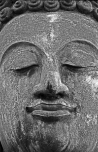
Buddha face, Sukhothai
Buddha face, ruins of the ancient capital of Sukhothai (1997) Photo (c) Karen Abrahamson

Ultimately, Fra Mauro realized the challenge of creating a perfect map arose because each man’s perceptions of place were different and any ‘perfect’ map must capture not only the land forms, but also the forms of the world created by men’s minds.

The lowly monk of Venice completed his life’s work, but today no trace of his perfect mappamundi exists, except in references in the pages of his journal. Perhaps, like the worlds he described, it faded away to become the world as we know it today, but more importantly what his journal shows is a man of deep thought who’s Sixteenth Century perspectives still resonate with readers today.

Thank you, Powell’s, for this gift.

Recent Fantasy

Available HERE,

$1.99

Available HERE,
$3.99

Available HERE $1.99


Recent Mystery


Available HERE
$4.99


Available HERE,

$4.99


Available HERE,

$4.99


Available HERE,
$4.99


Recent Romance

Available HERE, $2.99