Tag: Environment

Bhutan: How Gross National Happiness Made Me Cry

Bhutan: How Gross National Happiness Made Me Cry

Prayer flags at Gangtey. Photo copyright Karen Abrahamson.

Sometimes… sometimes this world can be so darned hard to be in—like reading about the death of the last male northern white rhino, or that 18 of the Tigers ‘rescued’ from a Thai temple ended up dying. And then there’s the whole darn political situation where nobody seems to speak the whole truth.

But other times the world can be such a giving place that it overwhelms. That was my experience in Bhutan.

As I mentioned in a prior post, Bhutan is a Buddhist country. It isn’t a big country. It isn’t particularly modern in the way places like London, New York, or even Bangkok might be, but it’s a country that seems to understand the concept of ‘enough’. It might not be a wealthy country (up until this year it’s biggest source of revenue was tourism), but the government has decided not to rate the well-being of the country not on gross domestic product (in other words, how much does the country produce or earn each year), but instead they assess the country on Gross Domestic Happiness.

A local suspension bridge adorned with flags and a couple of photographers in the Tang Valley. Photo copyright Karen Abrahamson.

I’m not quite sure how they measure this apparently quite ‘ephemeral’ concept, but I have to say that the country seems to be doing quite well. Some of it seems to be the personal realizations of the citizens that they can have ‘enough’—maybe not from driving for the ‘high life’, but from something else. For instance, the country has put a lot of energy into education and has a well-educated middle class. This has lead to many young people leaving their traditional country villages for the city leading to pressure on Thimpu and Paro (the two main cities) and some concern for the farming tradition of the country. What did the country do? It offered sizeable subsidies for the well-educated young people to return to farming—and its working!

Prayer flags above one of the many mountain towns. Photo copyright Karen Abrahamson.

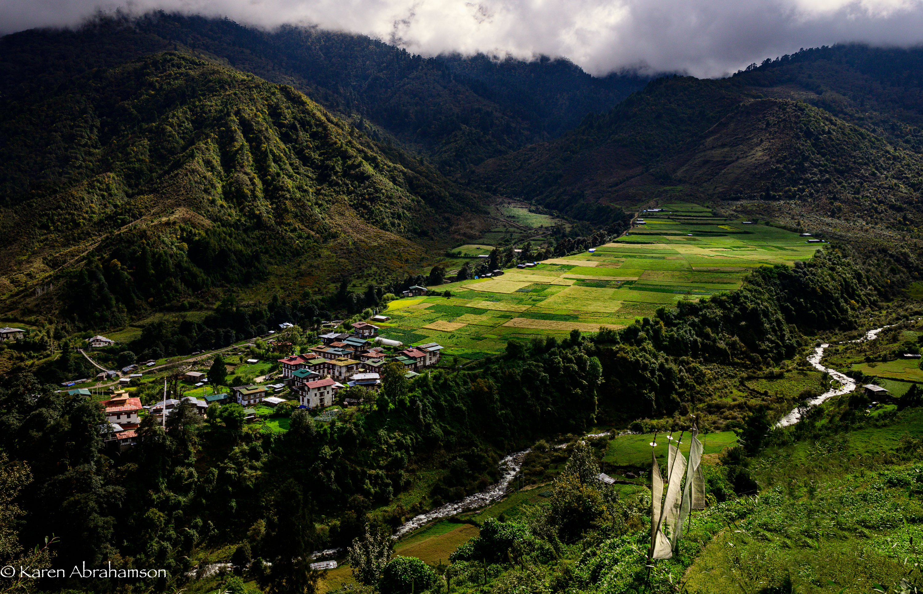
Bhutan is also a country that is trying hard to balance growth with protection of the environment. Compared to most countries around the world, Bhutan has actually seen an increase in the its national forest cover and it does things like set aside an entire fertile valley floor in order to preserve the habitat of the rare black-necked crane. Pretty progressive.

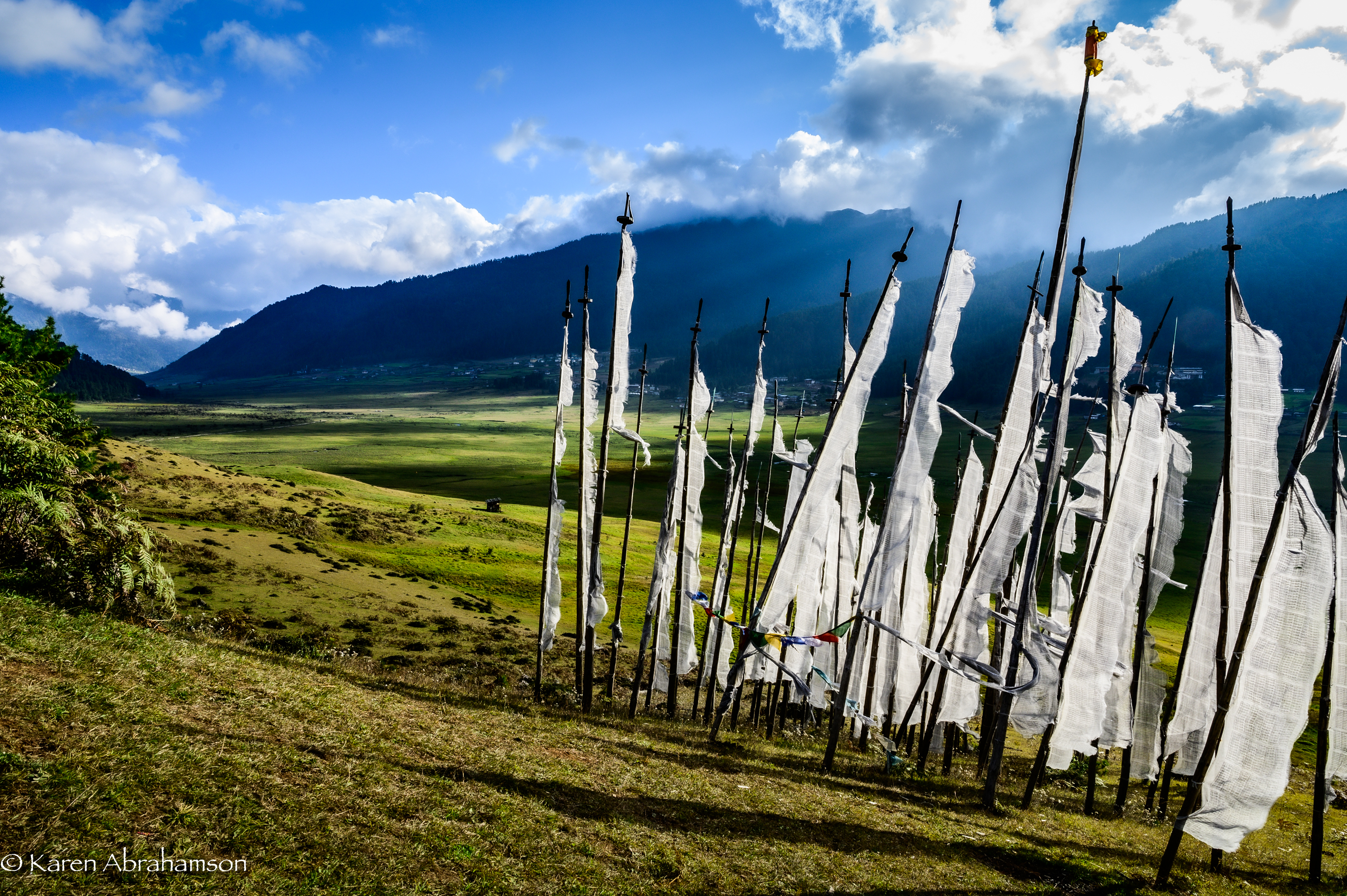
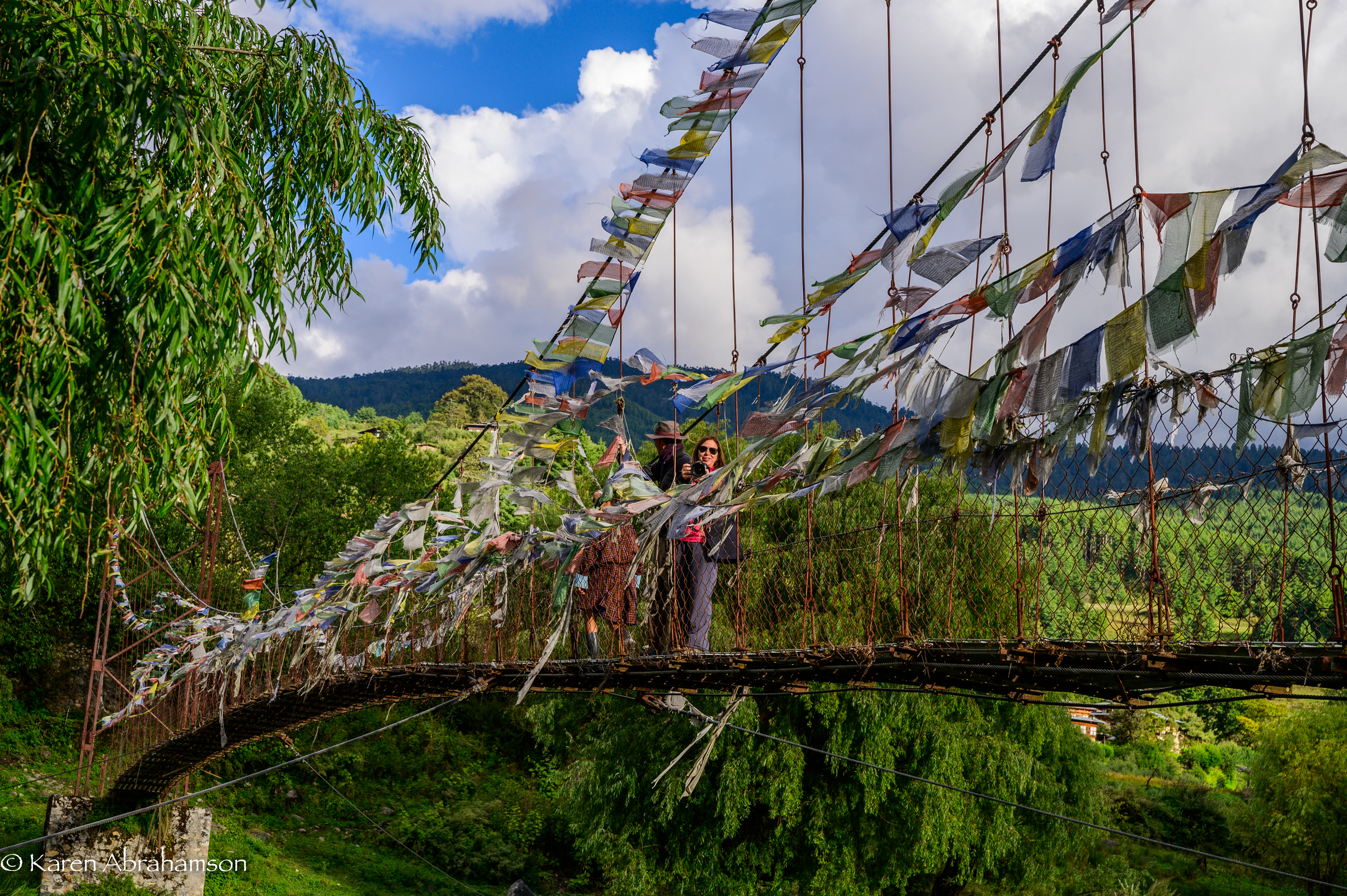
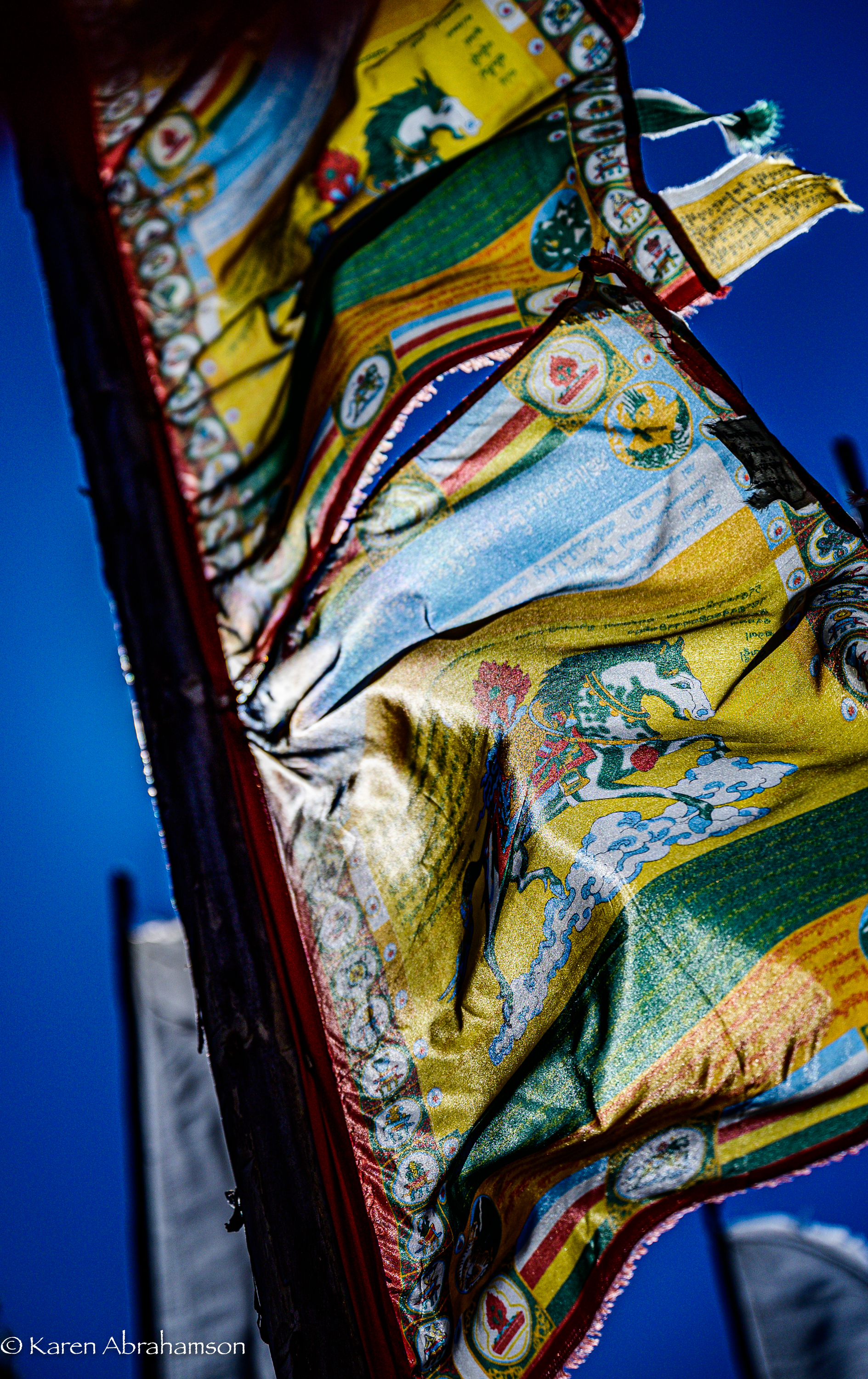
At the same time, tradition is everywhere. Come to a bridge, a river confluence, or mountain pass, and you find yourself amongst the fluttering host of red, yellow, green, blue or white prayer flags. Tradition says that with every gust of wind, the prayers connected to the flags are sent skyward to the benefit of the prayer flag’s patron. You become a patron by deciding to put up the flags but you’ll also see clusters of white prayer flags on poles that are raised in remembrance of the newly dead.

While I was in Thimpu, the capital, I had the chance to visit a Bhutanese astrologer who informed me that:

  1. I was a Fire Monkey (they use the Chinese astrological calendar)
  2. That I was going through a couple of bad years, and
  3. That there were flags that I could hang to help me get through this tough patch.

Given the astrologer was exactly right about the couple of bad years, I took the prayer flags he recommended and thought that I would hang some in Bhutan and some when I returned home. My kind and oh-so-knowledgeable guide, Kuenzang Norbu, researched dates that were bad to hang flags, and our wonderful driver, Tenzin Norbu (no relation) actually asked his father to research my best and worst days of the week.

Prayer flags against the sun. Photo copyright Karen Abrahamson.

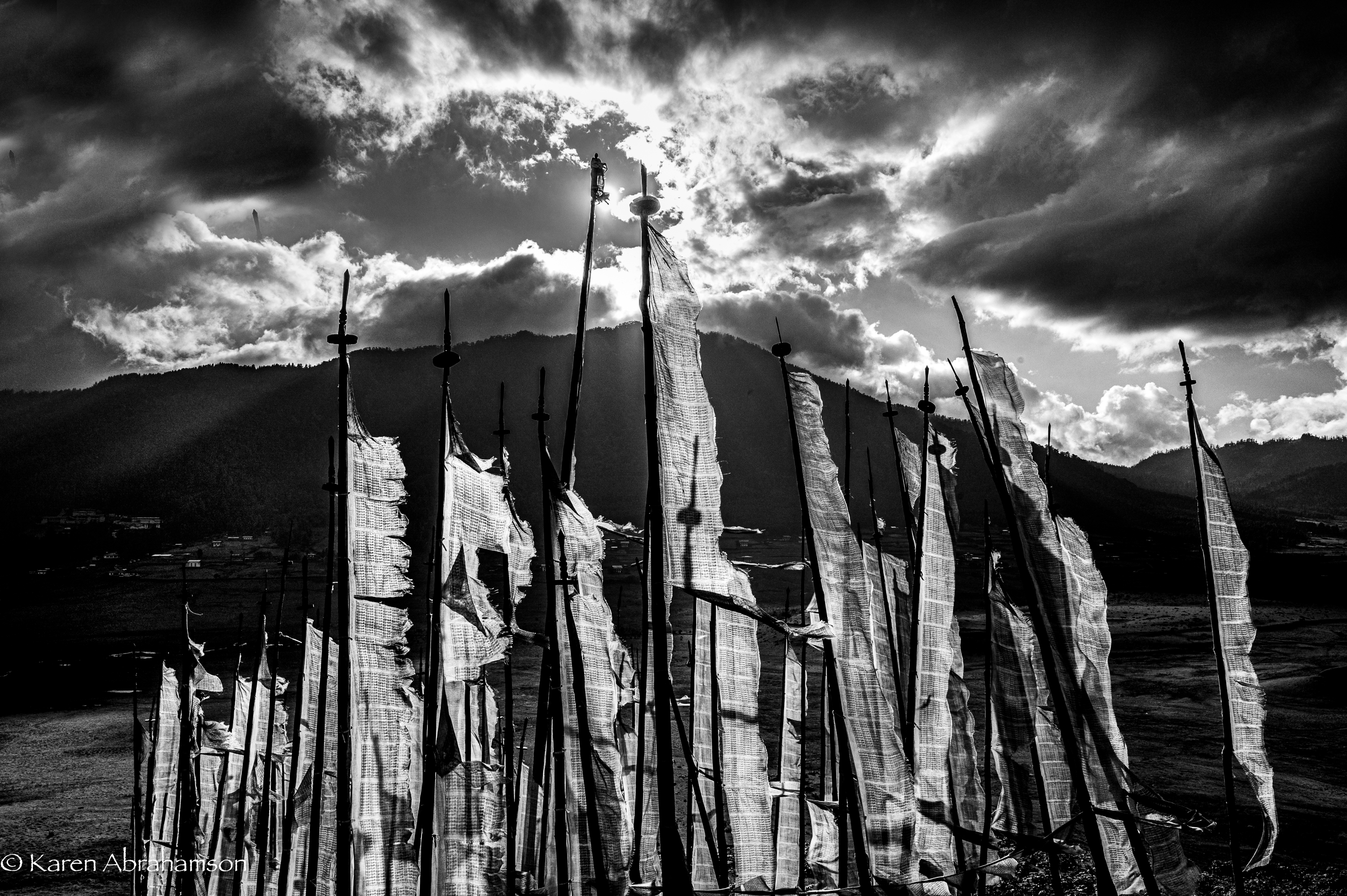
Not long afterward, we were traveling over one of Bhutan’s many high passes where the wind rarely ceases. The peaks of the pass were a mass of poles bearing crowds of fluttering flags and I knew immediately that this was where I had to hang my flags. Wonderful Tenzin helped me sort through them and then our entire group climbed the hill with me and helped hang my flags.

Whether it was for my benefit or whether it was because we all received the benefit of hanging those flags in the wind, the giving nature of everyone involved (foreign photographers and Bhutanese hosts alike) left me quite astounded.

So, I stood in amongst all those windswept prayers and cried.

Colourful flags on a mountain pass. Photo copyright Karen Abrahamson.
The Care and Feeding of Birds… and Novels

The Care and Feeding of Birds… and Novels

I put up a new birdfeeder the other day. It’s not the feeder oriented toward small birds like rosy and gold finches or chickadees. This one is solid wood, with a solid tray and a wooden roof that I inherited from my parents’ house. I decided to throw it up on my back deck as a way to get rid of some bird feed that I had had left at my house.

The first day a few little birds fluttered over from my other feeder to try it out. This carried on for a few days, but they clearly preferred my tube feeder with the chopped sunflower seed. I waited anxiously to see whether anyone would like the plain bird seed, peanuts and sunflower seeds in their shells. About three days in suddenly I had a vivid blue visitor—a cocky Stellar Jay. Not long afterwards there was a second—a youngster who kept bugging his mother to feed him even though he was perfectly capable of feeding himself. These two kept the feeder busy, taking turns feeding and teasing my Bengal cats in the process.

Two weeks later the population of Stellar Jays has doubled with four of the forward little fellows coming in to feed. They also take great pleasure in teasing the cats by hopping right up to my sliding screen doors. There are also two or three flickers that come in to feed as well as the usual mix of smaller birds. It’s kitty T.V.

The process of building a population of bird neighbors got me thinking about the care and feeding of novels—mainly because this spring and summer life has kept me from being able to write as much as I would like to. It got me thinking about how the kernel of an idea for a novel is a lot like putting out a birdfeeder.

Writing a novel requires the same faith as putting up that bird feeder, but instead of waiting for the birds, as a writer I’m waiting for the visitations of ideas. When I first put fingers to keyboards to start a new novel, it’s like hanging out the birdfeeder. There are tempting ideas there, there may even be ideas about the characters you intend to include, but the reality is something else. The core of the idea is there, but finding the other ideas that make a novel a novel is another matter altogether. After all, a bird feeder without birds isn’t much of anything at all and a novel without layers of ideas is at most a short story.

In the best of cases, new ideas come as you write. They really do seem to flutter down of their own accord, attracted by your initial idea—some even strut onstage cockily much like a Stellar Jay. The best of them you never see coming, leading to a veritable Eureka moment. The ideas that surprise the writer are my favorite kind and are usually the situations or reversals of fortunes that please readers the most, too. They are the ideas I strive to find in my stories, but in truth I think the ideas find me.

This year my creative process seems to have been dampened by dealing with too many family issues. It feels like my bird feeder is empty. And yet…

I wrote a short story the other day (good or bad, who knows) and I saw a pileated woodpecker for the first time since I moved into this home 18 months ago. My plan for this challenging time is to gradually get back into writing and to blog about the process.

And I will remember my bird feeder metaphor. If I start the novel, the big ideas will come.

Wish me luck.

Road Maps and Avarice

Road Maps and Avarice

Uigher apothecary shop, Kashgar, Western China. I doubt this shop still stands as the Chinese have torn most of the old city down for new ‘Chinese’ development. (1997) Photo (c) Karen Abrahamson.

Yes, it is all about the money.

Two weeks ago I wrote about the Klondike gold rush and how that led to cartographic oddities that misled gold seekers into taking ill-advised routes to the gold rush. But other maps are also intended to ‘sell’ to their users—including the ubiquitous road map.

Americans often claim that they invented the road map, and indeed Americans certainly created the most extensive collection of roadmaps just as they advanced their road systems. But there are earlier versions of roadmaps. In the third century the Romans produced a six meter-long map of roads and distances between certain points called the Peutinger Table (now stored in a Viennese museum) and during the time of the crusades crude journal/maps of routes to the Holy Land were produced. But the modern road map is largely an American invention.

These maps didn’t originate with cars in mind, but as a result of bicycle clubs in the late 1800s when cyclists were searching for maps of paved roads to enjoy their activity. Cars soon took over and road maps developed as promotional tools to encourage people to travel to, and live in, new places. Of course, as new locations opened up, land sales increased, and as the car culture grew and people travelled more, road maps did wonders for the bottom line of the oil companies.

A Peruvian cowboy in the Sacred Valley. These roads still resist development. (2011) Photo (c) Karen Abrahamson

But maps were used for promotion by other companies, too. In Canada, department stores developed road maps that showed that ‘all roads started or ended’ on Yonge Street, Toronto, the location of their store. Maps produced by oil companies specifically marked the location of oil refineries and invited people to visit these new ultramodern facilities. Maps produced by exhibitions/fairs included images of vehicles speeding to that location. Road maps were not just a means to open up a person’s eyes to the many places in the landscape, they were a means to direct that person’s attention to a specific location in an overt attempt to separate that person from their money.

City maps were more of the same only concentrated in a microcosm of what was going on all over the United States. John Jacob Ast0r became the veritable poster child for land speculation through his exploits in Manhattan. Astor bought his first lot on the Lower East Side in 1800 and gobbled up numerous lots afterwards to make a fortune in property values. What was bought for$50 an acre in 1800, was worth $1,500 in 1920 and as the City’s grid system was planned well before the city finally took shape, Astor was able to parlay his wealth into $25 million—the wealthiest man in America when he died in 1848. How did he do that? By looking at the street map of the city. Then he could sell properties—always at a profit—to take the cash and purchase more property in as-yet undeveloped areas that would be worth even more in the future. For example, a sale at $12,000 allowed him to purchase lots that would be worth $80,000 in a few short years. All because the road maps, like the maps to the Klondike, told him where to go.

Which brings me to the latest development debacle in Greater Vancouver: a developer not only leveled all the trees on the property that was soon to hold four mega houses, he also leveled the trees in a local park, on private property and along a salmon spawning stream. I’m not holding my breath given the history of cutting down trees in these parts, but here’s hoping a large part of his profits go into reparation.

Mist over the Fraser River. These peaceful scenes are ending as hihg-density development occurs. (2010) Photo (c) Karen Abrahamson


Danger-Maps, Belief and New Madrid

Danger-Maps, Belief and New Madrid

Schwedigon pagoda, Yangon, Myanmar
Schwedigon pagoda, Yangon, Myanmar (2000) Photo (c) Karen Abrahamson

Most of the maps I’ve written about over the past year have been maps setting out the geographic formations of the world—regardless of how skewed the map-maker might have made the map in order to influence the beliefs of others. But some maps are made to represent truth and to save populations from dangers, so today we’re going to look at a specific type of map—those used to convey earthquake danger. I’ve been researching this because it relates specifically to the current novel I am writing called Aftershock.

Most of us are familiar with California’s San Andreas fault, the 800 mile long fault that stretches northwest-southeast in California and that brings Los Angeles (west of the fault) two inches closer to San Francisco (east of the fault) each year. This much-talked about fault line has been the subject of disaster movies and books, and also of reams of geological research. The damage caused by the fault’s quakes led the State of California to have the San Andreas and other surface faults mapped and to require disclosure of proximity to fault lines in any residential real estate dealings in the state. The trouble is, that even though these maps are available, most people – even those who have lived in proximity to a faults line seem uninformed about the dangers and new buyers of homes are positively unaware of their proximity to faults even though they sign disclosures in their ‘offer to purchase’ agreements. Why? Because maps and the language around them can either be used to convey danger or to minimize it. In the case of the California real estate disclosures they say that the house is in the San Andreas zone, but they don’t specifically use the language ‘earthquake fault zone’.

Cypress knees and trees, Orlando (2012) Photo (c) Karean Abrahamson

Another example or earthquake danger maps, and one dear to my heart (given I live on the south coast of British Columbia, Canada), are the ones that show the Ring of Fire around the Pacific Ocean basin. Nothing brings home the dangerousness of the place I live as seeing the numerous dots presenting quakes over 4.0 magnitude in recent history around the Pacific. You see, there are so many dots that a thick black line extends around virtually all of the Pacific except for the stretch bordering the Antarctic and a small section of North America – the part of the coast where I live. Okay, so there hasn’t been a moderately sized quake here in the past 20-30 years (yes, Seattle has had one, but not here, so far). In fact there hasn’t been a really big one here in a heck of a lot longer than that. But historical evidence and that ring of dots around the ocean says that there’s a very good chance one will happen one of these days. Around here we grow up being told to be earthquake prepared. Are we? Given the number of schools that haven’t been seismically upgraded, I’d say ‘no’, even though the maps are there to show us the danger.

So why do we refuse to listen to the maps? A likely answer lays in another part of America. Right in the heartland of the U.S., where Missouri, Tennessee, Arkansas and Kentucky meet, in 1811/12 near the small community of New Madrid, a series of massive earthquakes (magnitude 7.5 and 8) wiped out entire fledgling towns, sent sand and water geysering into the air and lifted huge chunks of the landscape. The only thing that stopped huge loss of life was the fact that few people lived there.

Research into the quake says this type of quake will happen again. The trouble is the quake zone isn’t at the edge of a tectonic plate and there isn’t something like really a visible fault line to show where the quake will occur because these quakes occur far underground—that’s also why they are so devastating—and so life in the Midwest has mostly been focused on the danger of tornadoes, rather than the lurking danger right underfoot.

Sunrise over Porto, Portugal. (2005) Photo (c) Karen Abrahamson.

The trouble with this type of deep earthquake is that shockwaves travel farther and wreak more damage. In fact, geologists predict that such a quake today would be felt from Colorado to Washington D.C. and could wipe out most of the country’s central infrastructure.

As a result when, in 1990 a prominent inventor named Iben Browning predicted a major quake would occur in the New Madrid fault zone between December 1 and 5th of that year, the media promulgation of maps showing concentric areas of damage seriously impacting cities like St. Louis, Nashville, Birmingham, Little Rock, Jackson and Chicago started to get people taking the danger seriously. Children were kept home from school during the danger days. T.V. crews descended on the area like flies on road kill and everyone held their breath.

When nothing happened, of course finally people began to listen to the scientists who had previously laid out why the big one wasn’t likely to happen at that exact place and time. But the maps had done their damage. They’d laid out a ‘cartography of danger’ that hadn’t arisen. As a result, even though the states of Kentucky, Missouri, Arkansas and Tennessee try to prepare people for earthquakes because the risk of the big one still exists, they have an even more uphill battle than they do in California or here in the Pacific Northwest. You see, seeing a fault line on a map may not bring home the importance of believing, but when what you believe the danger presented on the map and then nothing happens, you’re less likely to believe in future danger.

So when the big one does hit, it will be Aftershock, indeed.

A pile of bricks is all that remains in earthquake-prone Peru. The ruins of Huaca Pucllana, Miraflores, Peru. (2011) Photo (c) Karen Abrahamson.


Maps, Klondike Gold and Northern Pipelines

Maps, Klondike Gold and Northern Pipelines

One of the Kane Lakes, Central British Columbia (2012) Photo (c) Karen Abrahamson

I’ve mentioned previously how maps are actually an argument on paper to convey, or propagate, a specific belief system. A good example of this was seen in the late 1800s during the famed Klondike Gold Rush that lured many a man (and woman) north to what was then viewed as the last frontier on the continent.

In the early 1880s little was known of the geography and geological wealth of the north but, extrapolating from gold strikes in places like Cassiar, British Columbia, there were rumors abounding of what might be found. As a result of the lack of real information, the Geological Survey of Canada sent surveyors north and by 1887 a report, with maps, had been completed that outlined the territory’s geological features and mining prospects as well as its geographical features. The report went so far as to predict gold finds in the Yukon and in 1896 that came true, with the discovery of placer gold on Rabbit Creek.

The resulting gold rush led to a demand for maps of the area. When the Geological Survey ran out of official maps, private companies and cities and towns took over. All of them wanted their piece of the Klondike pie, so many cities and private operators developed maps of the Klondike that presented their city, or their route as the best-easiest-most direct (you choose which) way to get to the north. They couldn’t all be right, so of course, they lied or at least doctored the truth to be in their favor.

Old farmstead, Yukon (2009) Photo (c) Karen Abrahamson

Case in point were maps that gave the impression it was only two or three days from Edmonton to the Klondike, because the prospector just had to navigate two waterways and they would arrive at their destination. Other maps skewed the projection of the earth (a projection is used to take the landforms of a round earth and place them on a flat map. Every projection skews the land formations to some degree, but different projections can be used to make different part of the land look larger or smaller). These new maps emphasized the huge distances of some routes and made others look shorter. Of course they also failed to mention things like mountain barriers or the high costs associated with steamer passage across lakes that blocked the short way to the promised land.

Which brings me back once more to the Northern Gateway Pipeline. While Enbridge and the Canadian Government show maps of the pipeline route and claim that it will be built to withstand the rigors of northern British Columbia and will pose limited risk to the landscape, the fact is that they haven’t even allowed a full environmental assessment of the area the pipeline proposes to cross. The trouble is, we’re unlikely to ever have such an assessment, because the Canadian Government has failed to provide its scientists with the resources (time, staff, funding) to complete such an assessment within the time the Government’s process now allots.

As a result the rhetoric on safety and responsibility we’re hearing from the Canadian Government sounds an awful lot like the maps to the Klondike from Edmonton. A road trip of two to three days of easy travel.

Right. And we’re supposed to believe it.

The government seems to be hoping that, just like gold on the Klondike did to prospectors, black gold to be sold to China will inflame our imaginations and distort our knowledge of geography – and make us believe anything.

Not going to happen, Mr. Prime Minister.

Old homestead, Yukon (2009) Photo (c) Karen Abrahamson


Mystical Dunvegan and the Northern Gateway Pipeline

Mystical Dunvegan and the Northern Gateway Pipeline

Along Kane Lake Road, British Columbia (2012) Photo (c) Karen Abrahamson

The furor in British Columbia about the proposed Northern Gateway Pipeline got a little bit more interesting this past week. First of all we had Enbridge providing the public with maps of the coastal route to be used by oil tankers. Those maps conveniently left out all the islands and difficult narrow ocean channels those same tankers would have to navigate. Then we had the announcement by a B.C. newspaper mogul that he was exploring the potential for building an oil refinery on the Northwest coast of BC. His rationale was that with so many people concerned about oil tankers travelling the treacherous and pristine British Columbia waterways, why not process the oil in BC, create new jobs, and only ship processed gas and diesel. This would alleviate some of the concerns over a potential oil spill as both gasoline and diesel are easier to clean up and don’t pollute like oil does. Of course the reaction has been mixed. Even the oil companies aren’t sure they like his alternative, but Enbridge’s maps and the newspaper mogul’s vision put me in mind of the ‘town’ of Dunvegan.

Abandoned Yukon Homestead (2009) Photo (c) Karen Abrahamson

I say ‘town’ with parentheses because Dunvegan was never actually built, but in the saga of Canadian maps it has a place of ignominy. You see, as the Dominion of Canada was busily surveying and dividing the country to encourage development it led to a boom in land speculation. These high stakes games were trying to anticipate where the next great land boom was going to take place. Dunvegan seemed like a likely place.

Located six hundred and fifty kilometers north of Edmonton, Alberta, Dunvegan was a convergence point for a number of native trails and a regular route for explorers and map makers. Indians camped there. Two creeks met there. A fort was built at the location and provided a jumping off point and point of safety for missionaries, explorers and homesteaders. Dunvegan became one of those mystical places on the map like Finisterre was to the pilgrims on the Camino de Santiago in Spain and France.

So much did Dunvegan enter the public consciousness of the day that it was included in the name of the first railroad to the Peace River in British Columbia, the Edmonton-Dunvegan and British Columbia Railroad. The trouble was, the railway never actually ran to Dunvegan. This was never mentioned in all the real estate material selling land to Englishmen and Easterners. Nope, the material and the maps showed the rail running to the town. Along with the railway the maps showed wharves along the waterways and development. But that wasn’t the only problem with Dunvegan. The many maps of the town being used to sell the land to the unwary, showed quarter sections of land without bothering to mention the topography. Think vertical cliffs and steep drops. Though the land was sold to many, not one lot was built upon because of the many difficulties.

Kayaking Clayoquot Sound, British Columbia (1996) Photo Karen Abrahamson

Which brings me back to the proposal for a pipeline and a world class oil refinery on the north coast of British Columbia. Sure, you could build the refinery, or you can talk about it, but such a refinery is dependent upon a pipeline across the same type of terrain that turned back the land investors in Dunvegan. I like to think that unlike the unsuspecting purchasers of land in Dunvegan, the British Columbia public won’t be taken in by maps and rhetoric that enhance non-existent amenities and that minimize the dangers that do.


The Past, the Future and Map Wars

The Past, the Future and Map Wars

Dhow off Zanzibar Island (1994) Photo (c) Karen Abrahamson

I’ve written about how maps created belief systems in the people of old. In ancient days, stories and maps of Prestor John led people to Asia and Africa in search of his kingdom. Mariners believed that the Indian Ocean was a huge inland sea surrounded by Africa that swept down and around to join with Asia. When North America was discovered, maps of the mythical Northwest Passage, led explorers to seek the real passage. But maps do more than that. Maps are sources of propaganda and maps are sources of conflict. You see maps, their systems, omissions and scale (as examples) are often used to take forward propaganda or a dominant world view. They have been used this way close to home in Canada.

For example, for many years maps of Lake Superior were left largely blank, because people believed the lake was very deep. But the truth was that fishermen didn’t want their secret ‘fishing shoals’ mapped for others to find. It was only after military vessels went missing (not to mention the Edmund Fitzgerald) that in 1930 that the Canadian Hydrological survey confirmed that there is a mountain rising in the middle of Lake Superior creating a large shoal. This shoal had been known to American fishermen, but no one had ‘told’ because the area was a magnet for fish.

Recent visitors. (2012) Photo (c) Karen Abrahamson

Maps as propaganda were used extensively in the settling of Canada. The Dominion of Canada turned surveyors maps of soil and rivers into grid maps that were then artistically enhanced with pastoral images of farms and young golden-haired women clad in white dresses. Atlases of Canada were created and sent to Europe and America in hopes of encouraging immigration. The art was focused on meeting the pastoral desires of the Europeans and in particular the British. Slightly different art work was used for maps sent to America. It didn’t matter that the images didn’t reflect the prairie landscape (The images were more of Ontario). It was the dream of the pastoral lifestyle that drew the immigrants that Canada needed.

These same maps with their grid lines were sources of conflict because they established expectations about how people would inhabit the landscape. The grids were set out in sections six miles by six miles, based on latitude and longitude, regardless of the lakes or waterways they crossed. As I mentioned in a previous blog (here) the Metis found the grid pattern foreign because they settled land based on long strips of land that swept back from water courses and that allowed everyone access to water. But immigrant groups from Eastern Europe also had challenges with the grid pattern. They were familiar with more communal, village styles of land allotment, where the land was marked off from the village in a manner more appropriate to communal living. As a result these groups (the Mennonite, Doukhobors, and Hutterites) subverted the grid style by purchasing the land, but then subdividing it according to what worked for them.

Kayaking the coast of British Columbia (1996) Photo (c) Karen Abrahamson

Maps were also used as propaganda by commercial entities such as the railroads. Canada’s two railways, Canadian Northern (CN) and Canadian Pacific Railway (CPR) battled for ridership through their maps. Maps were developed that left out or diminished the competitor’s railway. For example, CN created a triangle route map between Edmonton, Jasper National Park and Vancouver that played with scale. In this map CN’s journey through scenic Jasper was presented in large scale so that the route through Jasper leaves little room for any other details, while the rest of British Columbia was presented in small scale that didn’t allow CPR’s rail lines to even exist—according to the map. The interesting thing about this map is that no one then, or even today, notices the scale issues with the map—we accept what the map presents as reality.

So while maps are supposed to be presentations of reality, the big question the map reader has to ask themselves is whose reality (or wishful thinking) are they reading. Sometimes it is helpful to step back from the map and ask what does this map tell up about the people who developed (or paid for) it? Or what was going on at the time it was made? Or Why was this map even made? I think of my local community developers who, like the Dominion of Canada with their maps, are presenting the paved-over reality they would like to have made. The question is whether this is the map of the future we want, or whether, like the Mennonites, Hutterites and Doukhobors, we can  subvert it to a better reality.

Maps, Childhood, Disease and Living Bridges

Maps, Childhood, Disease and Living Bridges

One of the Kane Lakes, Central British Columbia (2012) Photo (c) Karen Abrahamson

Two weeks ago I wrote about the rampant development planned in one of the cities here in the Lower Mainland in British Columbia. They plan to ‘develop’ most of the large wooded acreages remaining in the city into high density housing developments, that, if they are anything like the other development in the city, will strip all trees from the landscape. When I questioned that decision I was told that the land was just too expensive to keep in forest. This week I’m questioning that decision.

You see there is increasing evidence that contact with nature has profound effects on both adults and children, with the impact even greater for children. For example, research indicates that children with attention deficit are better able to concentrate after contact with nature. Children who regularly play in a natural environment have better motor skills and are sick less often. The diverse play opportunities of the natural environment leads to increased collaboration and improved language skills. Outdoor environments are important to children’s development of independence and autonomy. And these are just a few of the developmental benefits of nature for our children.

Doing what kids do. The nieces at Buntzen Lake. (2011) Photo (c) Karen Abrahamson

At the same time, we are seeing the development of what some researchers are calling a ‘childhood of imprisonment’ as opportunities for play in natural surroundings are being paved over and built upon and parents become so concerned about their children’s safety outdoors that play outside has virtually disappeared. Locally we see this with the proliferation of townhouses intended for young families being built with no yards, so that children are forced to play inside, unless a parent is willing to take children whatever distance it takes to get to a park.

If you don’t care about child development, other research (and maps) speaks to the impact of the destruction of natural habitat on the incidence of disease. A recent article in the New York Times pointed out that hot spots of emerging diseases and potential pandemics are where deforestation is occurring. As an example, researchers point out that a 4% increase in deforestation led to a 50% increase in malaria in some parts of the Amazon basin. Closer to home, North American deforestation has led to the increased spread of diseases like West Nile Virus and Lyme Disease, that are spread by robins and mice respectively. In both these cases, the replacement of forest with habitation of agricultural fields, tipped an ecological balance that favored animals and birds without their usual predators. This link takes you to an interesting map that shows that hot spots don’t just abound in other parts of the world. In North American areas of greatest risk exist around most of our largest urban centers—including here in British Columbia.

Jo at Okanagan Lake (2011) Photo (c) Karen Abrahamson.

Today’s children live lives far different from what my generation enjoyed when we could go play down the block, in the park, and even in the woods. It used to be that during the summer children escaped outside to play in the fields or the local creek or the woods. Sometimes it was a vigorous game of tag. Other times we sought treasure with our homemade maps. Now children’s indoor lives have them living in a world that is dominated by media. Not only is this a loss for the children, but it is a loss for nature, because children raised without contact with nature and animals will have less reason to care about the natural world. Children’s experience of nature is being limited to T.V. programs like National Geographic and they are growing up thinking that nature is exotic and not learning that nature is right outside their door and that they must care for it.

This should concern all of us, for raising our children away from nature, means that we are separating them from a large part of who and what they are and stealing their access to an important natural legacy. Humans might think they are above, and can control, the environment, but as we see the impact of climate change wreaking havoc across America and the world, perhaps we need to rethink our strong-arm approach dealing with the coming disaster, and instead turn our minds to a more conciliatory approach to nature. It has been done before. As this lovely video about the living bridges of Northeastern India show, sometimes nature provides its own answer to a problem, if we can just value nature enough to listen and hear.

The Living Bridge


Mapping the Mind: Birds, the Inuit and Urban Development

Mapping the Mind: Birds, the Inuit and Urban Development

Canada geese goslings. (2012) Photo (c) Karen Abrahamson

Last week I wrote about some of the maps that helped create a country. This week I want to write about maps and development here in my little bit of Canada. You see, recently I attended a City planning meeting about the planned development of said city over the next thirty years. The city planner was there to gain input to the plan, so like I am wont to do, I opened my mouth. I asked whether there were plans included for city parks that were more than playing fields. In particular I asked about retention of trees.

You see the city plan targeted three areas of the city for development. This meant that the areas that currently hold some of the last large acreages with the last stands of mature trees would be logged off and cut up into micro-lots of high-density houses and townhouses. If the development practices I see in other areas of this city are any indication, the landscape will be reduced to a wasteland of ticky-tacky houses and spindly trees planted so they don’t block resident’s views. The aim is to build the highest number of houses on the smallest lot, which doesn’t leave a lot of room for trees. Land costs too much.

Jo at Buntzen. Children need the opportunity to be close to nature. (2011) Photo (c) Karen Abrahamson

I know, I know. People have to live somewhere, but the prospect of this loss left me so angry I felt poisoned inside. I’ve been trying to figure out how my perspectives have wandered so far into ‘radical’ territory from what now seems to be mainstream. You see, I worry about the other creatures we share this earth with. I worry about the air-cleaning capacity of the trees we’re cutting down. I worry about the birds and the squirrels and the other creatures we’ve displaced with our houses.

The worst part of the episode was that few people in the meeting seemed to share my concern.

A recent survey of birds in Canada, showed a decline of 40% plus across most species. Here in B.C. the decline is 35%, but with every development permit, you can bet the bird population is a little bit less. Over the last ten years that I’ve lived here, the flocks of swallows have decreased so I see less than ten on a morning walk. In my own townhouse complex, the council is continually cutting down lovely mature trees that provide homes to song birds and safety from predatory crows and starlings, in order to improve the view of some homeowner.

So what does this have to do with maps, you’re wondering. Well I recalled reading about Inuit maps and how they are ephemeral things. Each member of an Inuit tribe builds cognitive maps that remember and recognize different things. Shamans remember where malevolent spirits dwell. Hunters carry knowledge on moving over the landscape and the sea, while the women recognized the safest campsites and the sources of berries and seaweed. When asked to draw maps of particular areas, Inuit elders drew proportions skewed with places of greater importance presented larger, and those of lesser importance, drawn smaller. Place names, unlike our western tendency to name places after historical people, are based on a location’s physical, biological or ecological significance. Their names evoke images like ‘the place where the rocks are warm from the bodies of walrus’, or convey not only that a place is flat, but also that in winter the land and sea look continuous. For the Inuit, a map is not just a representation of the world. It becomes a lens that layers meaning on a place and that meaning is carried in place names.

Right now, with the inroads of western culture on the north, the place names that made up these northern cognitive maps are being lost, and placing at risk the understanding of the relationship of the Inuit to the land they inhabit. This seems to be what has happened in this city. People have forgotten the importance of having nature around them, and thus it is being eroded away. The loss of a word, the felling of a woodlot. It happens so gradually and then the knowledge is lost and the trees and birds are gone.

Cabin on the Kane Lake Road, B.C. (2011) Photo (c) Karen Abrahamson

I’ve come to view myself as one of the old ones that carries an old fashioned cognitive map of what my city should look like. Unfortunately no city planner understands what I’m talking about and hat no one but maybe an anthropologist or someone of my generation might understand my anger.

I wonder if the Inuit language contains a name for a silent landscape where no bird sings and all the houses look the same.


Ray Bradbury and Rewriting the Map of Canada

Ray Bradbury and Rewriting the Map of Canada

Woodland trail, Yukon, Canada (2009) Photo (c) Karen Abrahamson

Ray Bradbury died this week and as a science fiction and fantasy writer, his was some of the writing that most inspired me. I will forever be haunted by his horrific short story “All Summer in a Day,” but some of Bradbury’s best work were his cautionary tales like Fahrenheit 451, a terrifying look at the death of freedom and the burning of books in a fictional future. You might wonder what this has to do with the map of Canada, but bear with me.

This post will probably be as close to getting political as I will ever get, but events here in Canada have pushed me to the place where I finally have been forced out of the silent majority. You see the map of Canada is about to change. Not the physical map, perhaps, but the environmental map and the map of our hearts and our place in the world, and our children’s future is under attack so badly that I have to speak out. It feels very strange for a business person and writer who has always focused on fiction. For those of you who don’t live in Canada, here’s what’s at issue.

Small fishing lake in the B.C. Interior. (2011) Photo (c) Karen Abrahamson.

1. Our federal government is currently introducing legislation, Bill C 38, that will abolish most of our environmental protection legislation. They claim that they are trying to clean up the legislation in order to make it ‘make sense’ for municipalities and farmers, but in reality, while they might cut some red tape, they are getting rid of any legislation that might block the immediate implementation of major corporate initiatives, like the Enbridge Pipeline that will cross some of the most rugged and pristine landscape in Canada, from Alberta to the Pacific Ocean. This pipeline will cross hundreds of miles of wilderness and thousands of salmon-spawning streams to bring the dirtiest type of oil to the Pacific Ocean. Once there, this same legislation erases much of the laws in place to protect the pristine waters of British Columbia. It will allow oil tankers to ply the delicate environmental areas of the inland passage to take this dirty oil to China—one of the worst polluting countries in the world. Think Exxon Valdez. The legislation also removes the safeguards in place for many endangered species, because, the new legislation says, these species aren’t really important.

Kayaking the coast of British Columbia (1996) Photo (c) Karen Abrahamson

2. At the same time this government is systematically silencing any opposition. Along with this salvo against the environment which shortens any environmental assessments and limits who can even participate in the discussions, the government has also launched an attack against non-profit societies and charities, by imposing restrictions that stop these charities from any sort of advocacy against government actions. This attack has specifically been leveled at environmental organizations because they receive donations from other countries and this government is threatened by the groundswell of reaction from around the world about what they plan to do. They are changing the rules to hamstring any opposition against the huge oil corporations.

At the same time, they either stop funding scientific research, or they place gag orders on all remaining government scientists who might provide a voice of reason or evidence that government actions are wrong. But then I shouldn’t be surprised. This government doesn’t believe in science.

Even Members of Parliament who try to express what their constituents want are silenced. And when members of the United Nations commented recently on the impoverished state of our First Nations population, this government told them to go away and focus on third world countries. It seems Canada, in this government’s eyes, is beyond criticism.

All of this paints a picture that should terrify anyone concerned for our future. For someone who has always been a proud Canadian these actions are only the tip of a blood-chilling iceberg. It leaves me to think that, instead of the great white north that has stood proudly for freedom, integrity and honour both here and abroad for 145 years, we are being transformed into a country I only read about as in Ray Bradbury’s writing.

Welcome to totalitarian Canada – next comes the book burning.


Recent Fantasy

Available HERE,

$1.99

Available HERE,
$3.99

Available HERE $1.99


Recent Mystery


Available HERE
$4.99


Available HERE,

$4.99


Available HERE,

$4.99


Available HERE,
$4.99


Recent Romance

Available HERE, $2.99