Peru Photos, Finally!
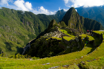
I finally put up some of my favorite photos from my month in Peru last year. Click here, to go to the index.

I finally put up some of my favorite photos from my month in Peru last year. Click here, to go to the index.
When I think of maps I imagine back to when the first human made their first finger marks in mud to share a game trail, or a watering hole or an especially good berry bush. Surely that must have been the earliest form of map. Of course none of those primeval drawings exist, and so I’ve found myself writing a about the western development of maps over the ages and have tried to give a sense of the European tradition and the contributions of Arab and Chinese explorers and cartographers. This is the easy stuff to research and write about because the maps these cultures used were set down in a manner we are trained to see. Maps, to most of us, are a visual representation, usually on a flat medium like paper, that presents the relationship of one place to another. But other cultures have had other ways of presenting their landscapes, case in point are the great civilizations of the South American Andes.
What most of us think of as the Inca are actually a series of overlapping civilizations that rose and fell in the various livable areas of Peru, Bolivia, Ecuador, Columbia and Chile. After the very effective conquest of South American by the Spanish, not much remains of any Inca records and to date no maps (as we define them) have ever been found. But did these cultures simply not have maps or did they represent their landscapes in a different way?
Anthropologists and Cartographers say that formal mapmaking tends to occur within highly organized, bureaucratic societies as a form of discourse. The conditions necessary for mapmaking include: demands for agriculture, private property, long distance trade, militarism, and tribute relationships, amongst others, all of which are attributes of the various Andean societies.
Anthropologists studying the various ancient cultures have begun to realize that westerners probably won’t recognize Andean maps until we start to see them through Andean eyes. The structure of maps aren’t only determined by geography, but also by social organization, cultural conventions and human perception. In the Inca worldview, the cosmos was built on a quartered circle, based on the way they viewed the Milky Way divide the heavens. They viewed their world that way as well, with the lands they ruled broken into four distinct quarters.
The Inca also had to map unusual terrain, from the coastal deserts and river oasis, up through the highlands to the alte-plano and Andes mountains and down again into the Amazon basin. Trade and tribute came those long distances, and north and south from Ecuador to Chile. Over those distict terrains there were distinctions of crop and animals at each of the different elevations. So, for an ancient Andean, among the things they needed to represent, were the different elevations, the different foods, and the waters that made life possible across these sometimes inhospitable terrains, as well as capturing the four quarters of the world and social relations.
The resulting landscape representations convey things like ownership and elevation. Ancient weavings show the long narrow fields of produce separated by clan-assigned canals. Pottery shows spatial designs that encode critical social structures, and still other sculptures, such as Chieftain Vessels correspond to Andean landscapes with the head of the figure as the summit, the shoulders as central mountain slopes, the lower hips as the coastal plains where mountain rivers diverge on fields. Still other sculptures show realistic representations of the terraced fields and irrigation systems that make up areas of central highland valleys.
So while we might say the Inca made no maps, it doesn’t mean that they didn’t represent their landscape. The difference is that the Inca ‘maps’ were often three dimensional and layered with meaning, both in terms of the landscape, ownership and familial relationships, and the relationship of the landscape to their ancestors, the spirits and the cosmos.
The ancient T.O. maps didn’t represent reality, but they did map the reality of the Christian spirit at the time. Portolan Charts gave a realistic representation of coastlines and the work of the Indian spy/cartographers, placed rivers on the maps well before aerial mapping existed.
One of the last bastions of ‘unmapped’ territory was the Amazon basin of Brazil. In 1799 Alexander von Humboldt, the son of a Prussian baron, spent five years travelling from Venezuela’s Orinoco river through the Amazon, collecting specimens and surveying. Afterwards he produced 33 volumes of maps and illustrations. That was the last mapping for over a hundred and fifty years except for the occasional scientific or rubber company exploration.
Until 1970.
That’s when the Brazilian government got the idea to construct a highway from the Atlantic Coast, across 5,000 kilometers (about 3,400 miles) of rainforest to the Peruvian border. The construction was a nightmare due to a dearth of maps. The rainforest had too many clouds and—gee, rain in a rainforest?—for aerial mapping to work. The result was construction following ground-based surveyors who were barely ahead of the bulldozers and this led to the construction having to cross the same river multiple times leading to enormous unforeseen costs.
Enter the cartographers. In this case it was cartographers and the invention of side-looking radar (SLAR). SLAR is an improvement on the radar that helped safe Great Britain during the Battle of Britain. It’s the invention that allows radar to be shot out the side of an aircraft to take long horizontal pictures of the landscape. This technology can ‘see’ through clouds and trees to the landforms. With the help of computers, SLAR can provide accurate pictures of the rise and fall of the landscape.
The survey team with their aircraft arrived in Brazil on the summer of 1971. In just under a year SLAR mapped the Amazon in 32-kilometer-wide swaths which lead to the first detailed maps of the Amazon and an understanding that this huge territory wasn’t the previously-thought Amazon “basin”. Instead they found that only about 20% of the area was lowlands, with most of the landscape being hilly and mountainous.
This ‘sped up’ the construction of the highway which was completed in 2011 except for a single bridge in the Peruvian part of the road. But what has this meant for the area? For some, it replaces weeks of travel on dirt roads to a relatively short drive. For others it promises income from a potential huge influx of tourists. But what it also means is environmental degradation.
Brazil has a long history of environmental issues springing directly from road-building into this relatively delicate biosphere. Previous road building shows that almost 90% of deforestation lies within 50 kilometers of a road (about 23miles). Timber and mineral extraction are followed by hydroelectric dam development and the destruction this causes.
What’s disturbing is that the Amazon is truly the lungs of the world and cartography has provided the data needed to seriously damage those lungs. It places a different perspective on maps; one that undermines the beauty of what I’ve always thought and suggests the need for ethical standards that stand up to the push of corporate greed.
There are means to ameliorate the potential destructiveness of developments like the Transoceanic Highway or the construction of pipelines like the proposed Northern Gateway pipeline through British Columbia, but it requires people like cartographers, citizens, and government officials to demand agreements that protect the environment BEFORE, planning starts. Otherwise ‘progress’ can just as easily lead to widespread destruction like what is happening in the Amazon.
The new maps of the Amazon not only map progress, but also the destruction of a reality. Unlike the T.O. maps of the Christians that cemented the Christian spirit firmly in Jerusalem, these maps not only mark destruction of biodiversity, but they record the destruction of the spirit of the indigenous people.
 Okay, I’m anachronism. It’s Easter Sunday and so I’m writing about faith—well, a little bit of faith—faith and maps.
As I’ve said, I like maps and will continue to use them. Though many people are turning more and more to GPS systems in their vehicles, I still have my trusty book of street maps of the metropolitan area where I live. When I pull out my yellowing, dog-eared map book I’m reminded of the volumes of Portolan charts of old, that were the predecessors of the Mercator projection I spoke of HERE.
Portolan charts were mariner charts, used by sailors to navigate the Mediterranean and then the coasts of Africa and Asia. The earliest existing portolan chart dates from 1290, but records as early as 1270 talk of a captain pulling out charts to convince a frightened king that their ship really could reach land during a terrible storm. Portolan charts have distinctive features, most noticeably the rhumb lines and compass roses that gave sailors bearings to set their sailing headings. These rhumb lines set out the four cardinal directions and the principle wind directions (North, Northeast, East, Southeast, South, Southwest, West and Northwest) as well as the eight half-winds (NNE, ENE, etc.) Portolan maps also had detailed, careful place names along the coast, color coding of places to show importance, and standard ways of showing rocks and shoals, while overemphasizing bays and headlands—all important information for sailors trying to reach safe harbor. This is very different from the predecessor of the Portolan, the medieval mappamundi , which generally had East at the top, and Jerusalem at the centre without any detail. The mappamundi were there to represent a way of thinking for the faithful; all they really needed to know was the location of Jerusalem in relation to where they lived. By contrast, the portolan set out in detail the way to make your way in the world.
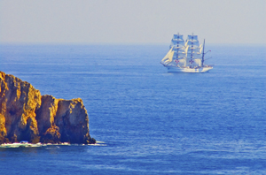 Yes, there were issues with the portolan charts. They used a rough scale, but had none of the accuracy the Mercator Projection provided. Still, they served their purpose.
No one knows who made the first portolan chart, but researchers have shown that those we know about were copied, some by tracing (they can tell by small pinpricks left in the vellum, and some by simple eyeballing). Portolan charts were also generally written on vellum—sheep or calf skin prepared in such a way that the narrow end of the beast (toward the neck) could fit the narrowing of the Mediterranean. The vellum could handle the rigors of sailing better than paper could and vellum could role up for easy storage or could be made into volumes of portolan charts. Of course, because they had different makers, different parts of the world were drawn using different scales which made it a challenge to draw up larger maps of the world.
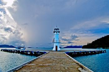 But portolan fell out of use with the advent of the Mercator Projection because, while the portolan charts were good for the Mediterranean and coastal shorelines, they were not as good for great sea voyages where the Mercator Projection provided relatively easy ways to chart a route from places like South Africa to New York.
So the beautiful, utilitarian portolan chart fell out of use, just like my map book has fallen out of favor in comparison to those tiny black box GPS units and smart phones that help gadget users to get from point A to point B. To me, it feels like civilization has taken a great leap forward by stepping back. No longer are we worried about great sea voyages (Mercator maps), or even the details of where such and such a place sits along the coast in relation to where we are (Portolan charts). Now we simply input our destination and trust the GPS to tell us which headings to take, much like medieval civilization trusted their priests to tell them how to live in relation to Jerusalem. Which makes me wonder whether we might have stepped right back to the days of the mappamundi, where our sense of direction is directly related to our faith—but today it’s our faith in technology.
As I said way back when I started blogging about maps, some of my favorite early memories are of looking at maps with my family as we started out on some adventure, or as I fantasized about places around the world that I wanted to see. I guess that experience made me a map fan. In reaction to my blog about whether maps should be in books, a few blog readers reminded me that they also like to read maps and in particular find satisfaction in maps contained in books because those maps offer the opportunity to better understand the relationship and distances between places written about in the book. The readers enjoyed following along with the characters as they moved across the landscape.
This enjoyment with following voyages isn’t limited to readers. I recently lost an afternoon playing with the Facebook Cities I’ve Visited app. I think Facebook and Tripadvisor are on to something there – the need to record and understand just where we’ve been in relation to where we are right now.
I mentioned previously that I always carry a map when I travel and mark my journey down for my future enjoyment. As a writer, taken in conjunction with my journals, these maps always help me remember the places I’ve been or travelled through and provide a cartographic representation of terrain that my aging brain cells might have forgotten. But maps aren’t just used by me during my journeys. My family always hauls out the atlas and follows along as I wander. On my last trip, to Peru, a network of writer friends around North America followed along as I did sent in my blogs like an itinerant reporter. I suppose the satisfaction for them, was not only that they could follow along, but that they could also get a sense of the relationship of where I was to their location.
Because although maps represent a greater world, they are also are very egocentric creations. By this I mean that maps are drawn by the creator not necessarily to draw reality, but to draw their reality. Case in point is a lovely 1886 Imperial Federation Map if the World Showing the Extent of the British Empire which shows Britain at the centre of the map (much as the medieval T/O maps showed Jerusalem at the centre of the known world). The wonderful map uses the Meracator projection which nicely enlarges landmasses in the northern hemisphere (including Britain) and also includes mythic Atlas holding aloft the world which is straddled by lithesome Britannia who is surrounded and adored by the lesser ‘races’ (read colonies), all peering up at Britannia’s greatness. Not simply a map it seems, but also a satisfying cartographic representation of the way Brits at that time wanted to view the world and themselves.
To some degree I think the Cities I’ve Visited acts something like the 1886 map: although we aren’t placing ourselves above the world, it gives us comfort with our place in the world. We create our representation of the places we’ve touched and maybe that gives them more reality for us. Perhaps that satisfaction also includes a little reassurance of our place in the world?
So when I was done with Cities I’ve Visited, I was very satisfied that I’d trod so many places in the world, but also fairly embarrassed. I felt almost like I was competing with some cyber-other to show that my vision of the world was broader because I’d been more places. Was it really a competition? The App said the average person has visited 17 cities. I was at 247 and I stopped when I started to feel really stupid (not to mention that I’d wasted a good chunk of the afternoon).
The whole experience reminded me of too many tourists I’ve laughed over who arrive at a place, leap out of the tour bus, take a photo and then leave to drive like mad to the next place and the next photo. That phenomena always put me in mind of a mission to collect places like notches on a belt – or like a dog leaving photographic spoor like doggie–do reminders of where they’ve been.
It makes me wonder if our egocentric need for maps is something like our need to collect, buy and own – as a means to quell our unquenchable need for satisfaction.
Last night I received an article from my local Romance Writers of America chapter about world building for writers and how making a map of a location can help to create your story and your plot. I got thinking about this and how it relates to human history. In particular I got to thinking about how some anthropologists and historians have drawn a line in the sand (the 15th Century) about when true maps came into existence. (See my last post here.) But it got me wondering whether they were short-sighted in their definition.
The authors of this theory have said that prior to the 15th century while people might have made maps, they largely weren’t made for the same purpose of orienting the landscape like maps are used for today. They talked about how maps of older civilizations presented a cosmology, not a spatial map, or were used to show relationships, which could as easily be represented in text or the spoken word. This, they posited, means that earlier map-like creations are not true maps. Whether they are wrong or right is a matter of some debate.

A case in point is Native American cartography. The literature about Native American maps is challenged by the fact that not only is it hard to find maps from pre-European contact (birch bark and leather just don’t stand up to five hundred years of colonization), but most of the records of native maps are colored by the perspectives of those who collected the map. The few maps that do exist require the reader to think of maps in more than one way. For example, records of a Virginian Algonquin map collected by John Smith in 1624 (while he was a prisoner), show a cosmological view of the world, but also a spatial linking of places. The map shows three concentric circles around a fire, with the first circle being a circle of meal representing the Algonquin Territory, the second being an inner circle of corn representing North America, and the third circle of corn representing the edge of the supposedly circular world. To try to understand John Smith’s origins from beyond North America, the Algonquin created a thatched stick island between circle two and three. Clearly this shows a sense of spatial distribution, even if it is not based on any scale a western European would use.
Another interesting ‘map’ was a gesture used by a Native American Elder to describe the location of his town. The elder held his forefinger and thumb like a not-quite-closed-looped ‘okay’ symbol. The location of his town was between the unclosed tips of the finger and thumb, with Quebec, Montreal, New York, Boston and Halifax all located along the knuckles and joints of the rest of that looped finger set. This again clearly places the Native American town in relation to the major cities. So the question may not be whether Native American’s had maps, but whether they recorded their map information in a different way. Native American communities and living accommodations like the Navajo Hogan, the Pawnee earth lodge and even some longhouses could be said to be map-like in their structural symbolism of the concept of the sky dome or celestial vault providing shelter for a two dimensional geography with the four directions spreading out from a pivotal centre of the house. It might not be written on a piece of paper, but clearly there is a sense of direction and relationship to place within their sacred geography.
Finally, Petroglyphs, a primary source of pre-contact information about Native American culture, have also yielded examples of what could be maps, though there continues to be some debate. Some appear to show river routes and tributaries along with trails. Still other stone paintings appear to represent drive fences (fences used to drive prey animals into capture areas) complete with pictures of the animals that resided in the area.
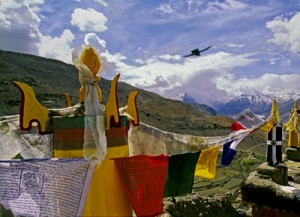
Which brings me back to the RWA article. It spoke about how, for a writer, a map can help you to give a greater sense of place to your writing. The writer will know where the towns and roads and lakes and mountains are in relationship to where the character is. But drawing a map can help the writer to also learn something beyond thethe lay of the land. A writer’s map can help you to understand what monsters live in what areas, what territory belongs to the enemy and what resources there are to harvest, along with your character’s place in the world. This leaves me to think the Native Americans understood modern (writerly) mapping better than the anthropologists and historians think they did, and that the modern writer’s map is based in something much deeper and perhaps more linked to the notion of a sacred human landscape. Both look for something more than just scaled lines on a page to find our way through either our imagination or the world.
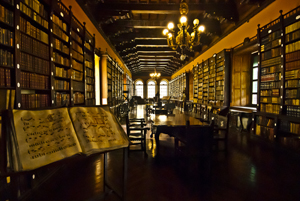
Writing this series of posts about maps and map makers has brought home that people have been making maps or pictures of places for a very long time, but it has also brought home that what people were making and the reasons they were making them has changed dramatically over the centuries. This change in purpose has led academics to wonder whether maps really were as ubiquitous across human history and they suggest that maps as we know them today really only came into existence in the 15th or 16th century.
What do they base this upon?
First of all it’s the paucity of maps that have remained in existence from earlier times. Sure, time would have destroyed many maps, but surely more than the few we have would have survived, just as art and sculpture and manuscripts survived. Secondly, those ‘maps’ that have survived from earliest times, had purposes that were different than maps today. Some represented a way of seeing the world , for example, the T-O maps I wrote about here, were intended to show Jerusalem as the holy centre of the world. Another example are Mesoamerican maps that didn’t focus on spatial mapping, but instead presented ‘community maps’ that represented history and territory, something like a pictorial genealogy. Native American maps present something similar. Other early maps were diagrams of a monasteries and manors, and still others served as religious icons, mandalas, construction drawings, itineraries and so on. Different maps, different purposes, and definitely not the purpose we put maps to, today.
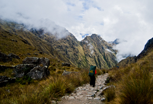
The proponents of the idea that maps as we know them began in the latter half of the second millennium, also point to how the current purpose of maps – namely representing space or relationships, or showing ownership, or pointing out how to get from point A to point B were purposes that had previously been accomplished using means other than maps for as long as there has been history. If people wanted to represent a place, there were paintings and art work. For relationships, there was genealogy. If they wanted to convey ownership, there was text to use, or numbers. And if they wanted to show how to get from point A to point B, well there was word of mouth or text. These had sufficed for centuries. Why did people need these things called maps?
The answer apparently came with the rise of the nation state in the 15th and 16th Century (and possibly as early as the 12th Century in China). As nations expanded, as military ventures demanded, the need for maps became more evident. Rulers such as Henry IV of France were advised that maps could convey an idea of his holdings better than words could. Other rulers such as the Hapsburg emperor Charles V lost vital battles for wont of a map of a strategic area. And this wasn’t just a European experience. In places like Japan there is little evidence of widespread use of national maps until 1591 when suddenly maps were commanded for all geopolitical areas, leading to a national map in the 1630s. And Japan isn’t alone: at the same time that Japanese and European mapmaking blossomed, similar mapmaking flourished in China, Thailand, Russia, Malaysia, Vietnam and the North American Colonies.
Yes, some of this flourishing may have been due to importation of mapmaking from one culture to another as international trade broadened, but academics suggest that the ease of the adoption of these skills speaks to the existence of similar map-making traditions that had sprung up independently across cultures at the same time. Why?
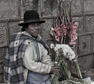
Map making appears to have proliferated in the new nation-states where it would otherwise be difficult for a central government to ‘know’ the length and breadth of their nation, suggesting maps brought local knowledge from the hinterlands into the center of government, where that knowledge could be used to the service of the central state. So modern maps themselves, just like the lines we draw on them, were an act of control – not just setting boundaries on the landscape, but also establishing boundaries around the people who dwelt there.
 A recent Facebook posting referred me to an article about dark matter and how astronomers are mapping dark matter through space by identifying how light distorts as it travels through the invisible web of the dark. Scientists hope that, by mapping dark matter’s distribution through the sky, they can gain a better understanding of this substance and the underlying physics of the universe.
Reading this article reminded me of my recent trip to Peru and the unique Incan astronomy. Most of us are taught that the Incan’s worshiped the sun, and indeed the sun was a deity to the nobles. But beyond that worship, the Inca used their astronomical studies to not only follow the sun, moon and stars, but also to map the dark parts of the sky. They even had a special word for those places: ‘Yana Phuyu’, or dark clouds – the vacant places in the sky.
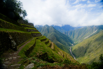
The Inca believed the Milky Way was a great river and the Yana Phuyu were animals called Pachatira that came from mother earth to drink at its side. These dark clouds were known and tracked across the sky and watched with interest. There was the fox, the black llama with her child, the serpent, the toad, the partridge. Each had their place in the sky and each was watched for signs of what would happen on earth. As the black llama descended from the sky she would lower her head and drink from the oceans to stop flooding. The toad, Hanaptu, rose in the sky, when the toads came out of hibernation, and Azoq, the fox rose during the summer solstice when foxes gave birth. For that was the strength of Inca astronomy, they truly believed ‘as above so below’. They watched the heavens and foretold the seasons and the rains by when certain animals appeared over the horizon or climbed the sky and, according to legends, major ecological events like devastating earthquakes and floods, along with the ages of the world.
But the Inca did more than that. They saw the heavens as a map of their world, with the great river of the Andes, the Rio Vilconota (aka the Urubamba) as the terrestrial version of the Milky Way. They recognized hundreds of holy sites (Huacas) around their empire that often were related to special days of the year and the places where the rising and falling sun was observed.
Today, stories of the skies are still taught to children in Inca villages. In Quechua they teach how the llamas in the fields watch the heavenly llama for news of the rains. They tell tales of the moon and his wife and how the ‘fall’ of the Moon’s wife led to the pumpkin-color of the soil in the Amazon. So though we will never know the true depths of Inca astronomical knowledge – too much was lost to the Spanish conquest – we do know that the Inca were much like the scientists of today: They mapped the heavens as a means to understand the connections of the universe around them.
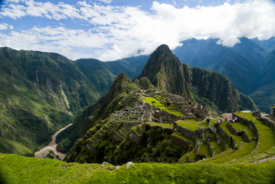
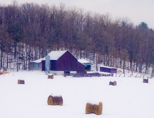 I put up the Christmas tree the other day, uncovering each tissue-wrapped ornament before putting it on the tree. My mother commented on how each one was so unique and that made me reflect on how each ornament was a memory that solidified and evoked a place that I had visited, or a certain place and time in my life.
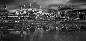
On the tree were ornaments purchased in Peru, and others from Tanzania, Cambodia, St.Thomas, and India. The tiny painted gourd Peruvian cuy (guinea pig), hung side by side with the wee silk elephant I found in Thailand. A German bauble my mother-in-law gave me hung next to a globe found at a French clock-maker’s shop at a town next to the Swiss border and a Pueblo Indian Virgin Mary sent by my parents from Arizona. All of these brought back memories of Christmas eve feasts, times in the Angkor heat or the chill of the Himalayas, and standing on the Serengeti plains.
Two of the dearest decorations were a handmade snowman and a tiny wooden cuckoo clock. The cuckoo reminds me of times with my stepsons and ex-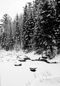 husband out riding the wilds of Central British Columbia. You see, that area is ranching country complete with wolves and bears and miles of undeveloped forest. In the winter it was covered with snow-laden pine and spruce. At Christmas, there was no better way to start the season than to saddle up our horses and head out into that pristine winter land.
We’d take an axe and an old horse blanket with us and head out into the forest, the horses blowing steam through their nostrils as they bounded through hock-deep snow, my sons rosy-cheeked as they raced their horses ahead until they came whooping back to announce that had found the PERFECT tree. That was what the ride was all about. We’d follow them – usually out to some clearing where a smaller tree would stand. My husband would dismount and shake the snow off, getting it all over himself and then, as a family, we’d critique the tree they’d found. If it passed muster, we’d chop the tree down, wrap it in the blanket and tether the blanketed tree to the horn of one saddle before starting our (much slower) ride home dragging the tree behind us. That would bring the official tree into our home and the small cuckoo clock was one of the first ornaments we bought as a family.
The snowman ornament was made by my youngest stepson. We didn’t have a lot of money in those days – at least not for ornaments for the tree – so he and I set out to make some. I still have the small green felt tree I made, but his is special: a stuffed white snowman complete with scarf, and broom and a black top hat all carefully sewn by ten-year-old hands. I smile and think of him, long grown to a man, whenever I find it each year.
 And so my Christmas tree today is a guardian of riches worth more than the presents under it. Those glittering branches hold not only my memories, but also a map of the treasures of my life.
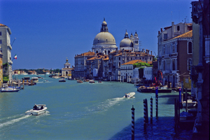
For men like Fra Mauro (see last post), the exploration of the external world led to an understanding of the inner landscape of men. So too, from the triangulation of the world (see post here) came a greater understanding of the internal shape of the earth.
I mentioned previously that in order to determine the shape of the world, a French survey team went to Ecuador and Peru at the same time as a team went to Lapland. Unfortunately for the Peruvian team, the Lapland team discovered the answer to the scientific question long before the Peruvian team ever finished their survey. While in South America, however, the Peruvian team struggled over mountains and through jungles and noted different gravity readings as they took their survey measurements along their route. They surmised that the differences in the readings might reflect the varying landscape and theorized that mountains might be made of less dense material than the lowlands. A good theory, but it took over a hundred years for the matter to be more fully explored and the discovery was made far from South America. It took the British Raj’s need to survey India to bring understanding to what the mass of mountains might mean.
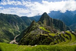
In the mid nineteenth century, the horrendous task of surveying India through triangulation was almost undone by the discovery of an error of some 150 meters between the distance the triangulation measurements computed, and an actual direct surface measurement. To determine what had led to the error, the cartographers involved had to reexamine their assumptions – in this case they had assumed that the mass of the Himalayan Mountains would greatly influence the gravity measurements of their survey instruments. What they found was that they had overestimated the lower mass of the mountains.
This led to a theory of the earth’s crust that still exists today, namely that every (theoretical) column of the earth (from core to outer surface following a theoretical plum line) should have approximately the same mass. Given that tall mountains have a lower mass, they must have an equally large (but low mass) protuberance at the bottom of the earth’s crust to achieve the same mass as denser areas of the earth’s crust. Conversely, under the oceans where the ocean basins are very dense, the earth’s crust would be relatively thin. The theoretical result would be that inside the earth there would be a mirroring of the plains, mountains and ocean valleys we see on the surface, much like a tall iceberg has a large underwater presence to balance it out. Modern science has supported this, by obtaining crust measurements off the coast of South America that show the Andes have roots as deep as 75 kilometers.
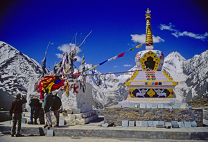
Think of this the next time you are crossing the mountains, staring up at those tall, snow-covered peaks, for they are the frosting, the outer conceit of an iceberg of stone that conceals the deeper reality of the roots of the mountains.
Much like Fra Mauro saw the illusions of men obscure the truth of his map of the world.