The inimitable Joanna Vandervlugt interviewed me about Beneath Malabar Nets
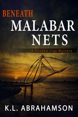
Check out the Podcast HERE.
Check out the Podcast HERE.

We’ve been in Bali ten days now and it has been a wonderful lesson in exploration—both sensory and experiential. For instance, at the moment I’m in my bed listening to a thundering downpour and the quintessential sound of gamelan music played for a Balinese shadow puppet show.
But not every experience has been quite so mesmerizing. At least they haven’t all been quite so easy to enjoy. Take for instance my first experience at my current guesthouse in the tourist mecca of Ubud. Ubud sits on the lower slopes of Bali’s central mountains and is a mecca for artists from around the world. Think wood and stone carving, silver smithing, weaving, painting and just about anything else you can imagine. We arrived at this guesthouse and our host knew of my interest in photography, so he immediately told me that there was a temple ceremony occurring that afternoon at a local community—come see him at three pm and he’d arrange for me to attend.
I showed up with camera in tow and the only way to get there was via motorcycle—him driving and me on the back. Let me just say that my distrust of motorcycles goes way back to my teenaged years and age and wisdom has only confirmed that opinion.
But it was a temple ceremony and I was new to Ubud. Who knew whether I’d get such a chance again. So I slung my leg over the motorbike behind him and drove—sans helmet because he didn’t want to have to carry an extra helmet back—to somewhere in Bali.
And he dropped me off.
Yes, I had his email and phone number on Whatsapp. Yes, I knew the name of the guesthouse and generally where it was in Ubud. But that was all. And oh, yes, I know how to say hello and thank you in Balinese.
But there was this temple ceremony, that it turned out I couldn’t attend because I didn’t have a proper sarong…
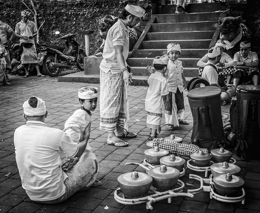
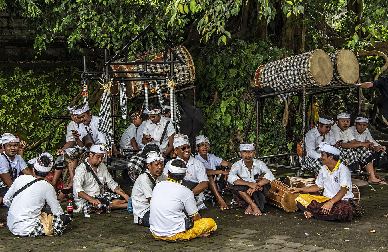
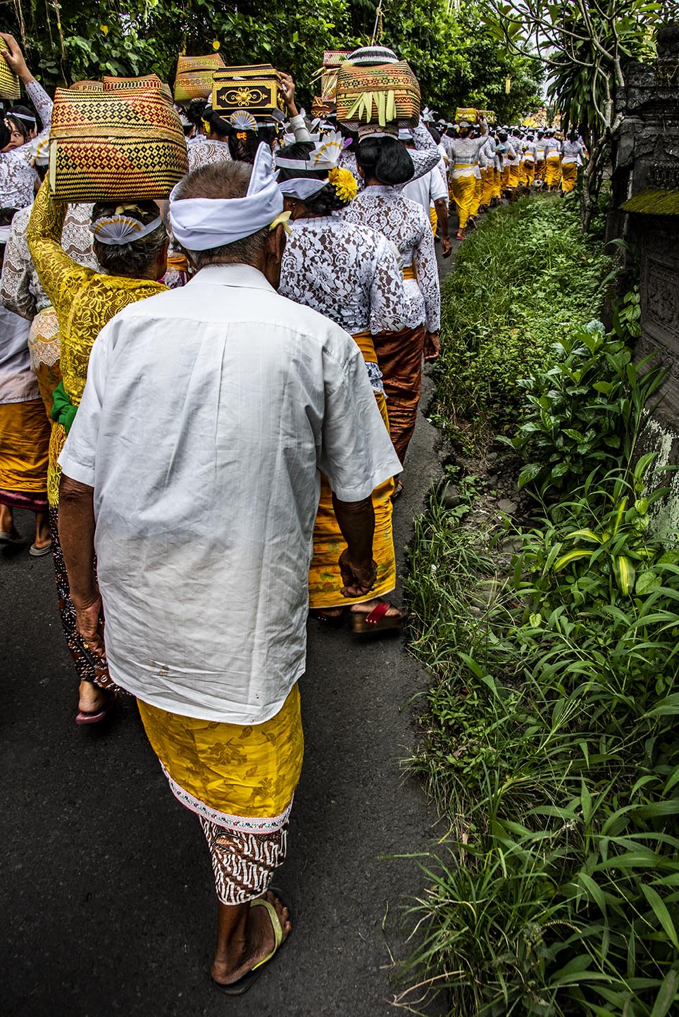
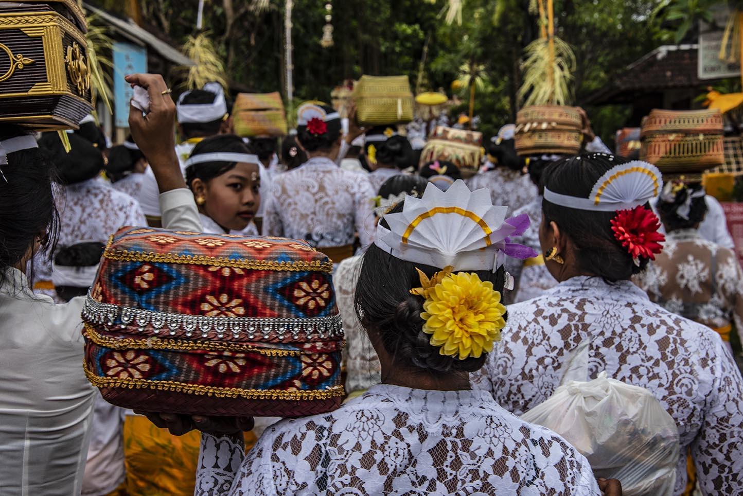
So I hung around outside with the parents with unruly children and the Balinese marching band (think gongs, conches for blowing, and lots and lots of drums.) Luckily, the Balinese are big on processions, because after what sounded from outside the walls like a lovely ceremony, the dignitaries left (would you believe it was the royal family of Ubud?) and were followed by a flood of people.
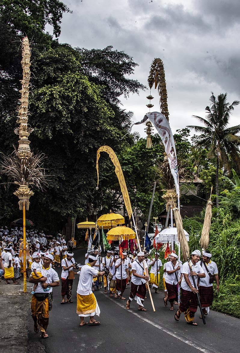
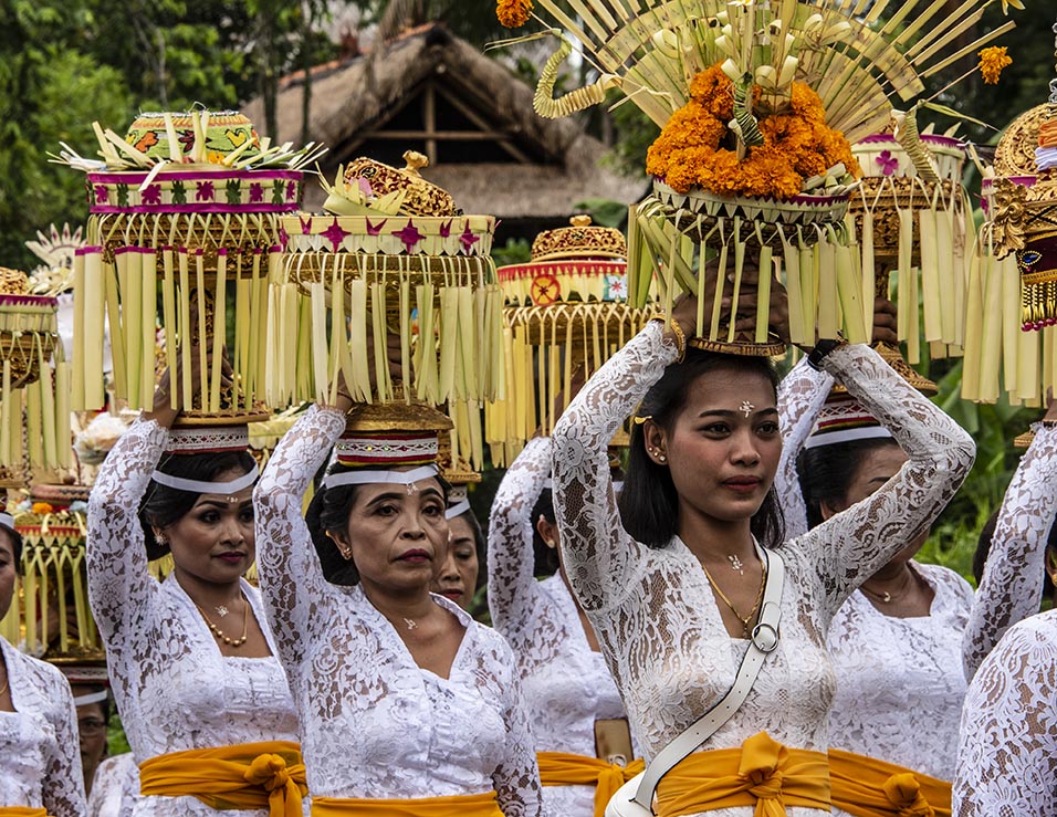
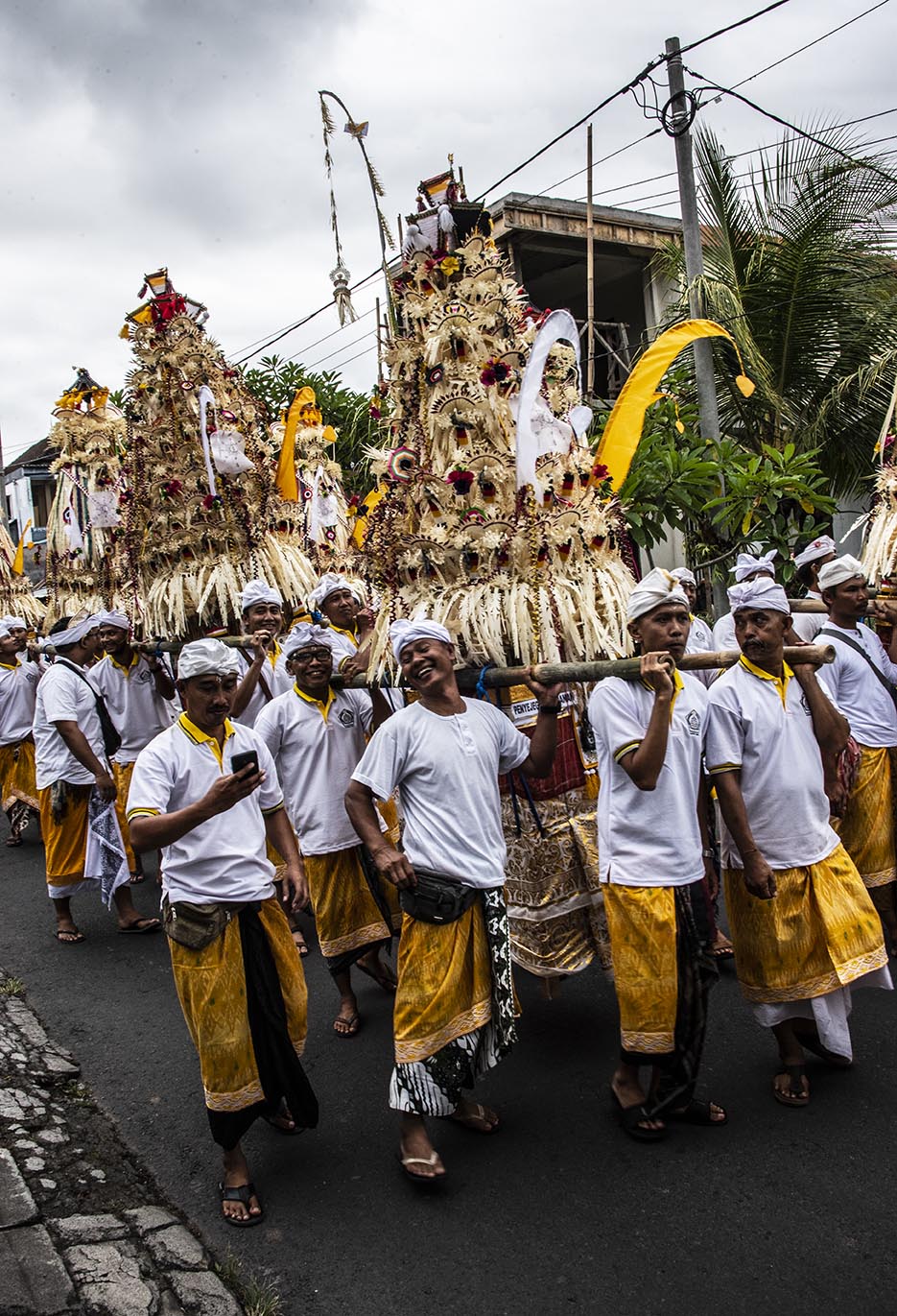
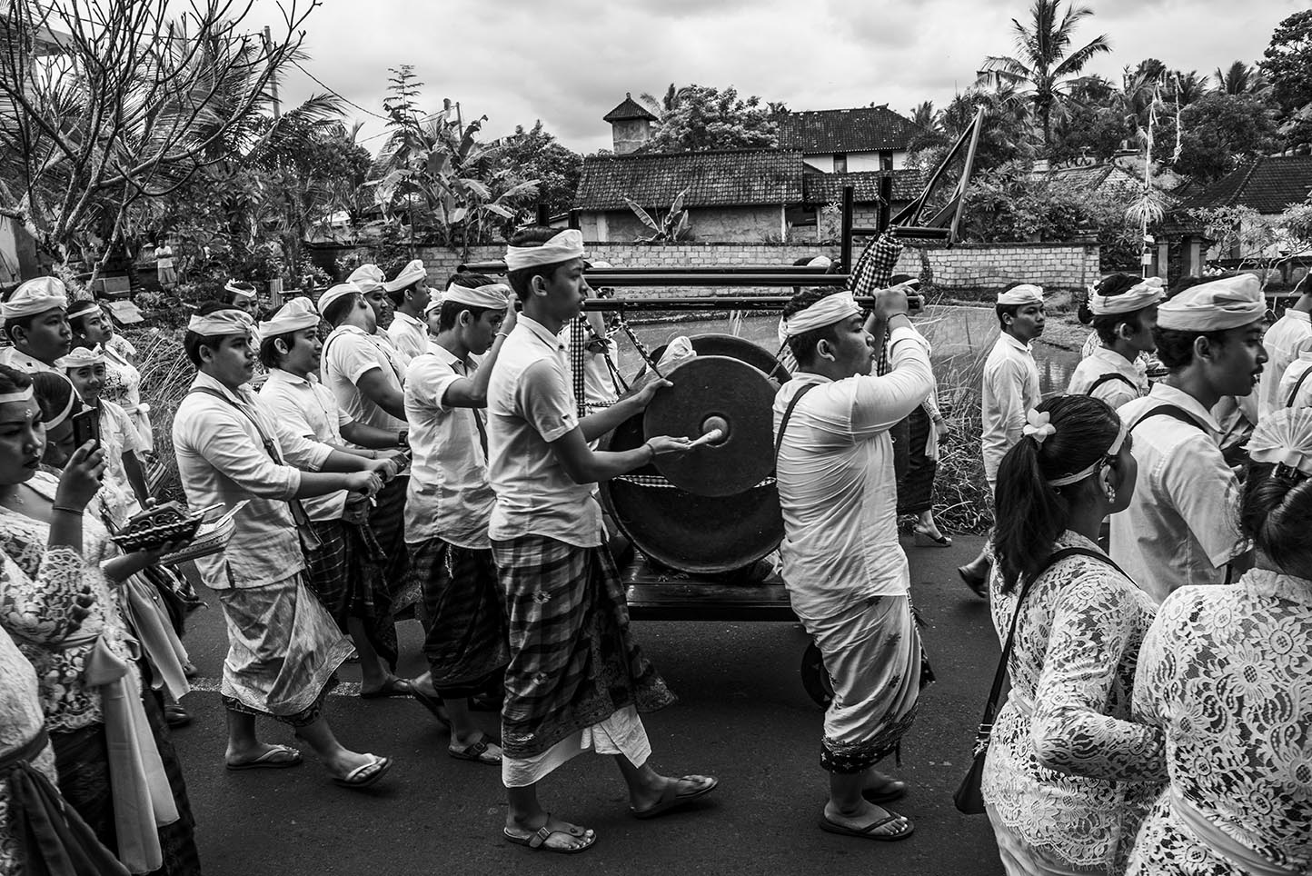
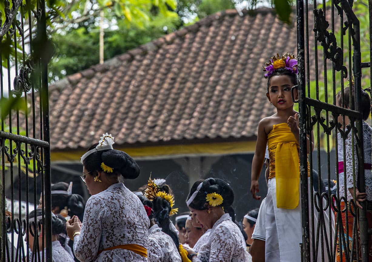
I ran up the road to get a better view and what followed was a village procession. The photos in this post tell the tale. A non-marching band. Children dressed up like princesses. Women carrying offerings on their heads and men carrying even larger offerings on platforms. And all the people in their finest sarongs and sashes. They marched up the road with so much laughter and friendship that I was swept along—until they reached another temple and I was shut out again.
Darned no sarong.
And then I had to figure out how to get home…
From somewhere in Bali.
P.S.
(Yes, after realizing that my Whatsapp messages were being routed via North America so there was a time lag, I finally contacted my wonderful host by phone and he sent his son to rescue me. So I am no longer lost.)
 Starting in January, I’ll be off on a research adventure in Southern India, Bali and Hong Kong. You might recall that Phoebe Clay, my character in my mystery novel, Through Dark Water, ended book one with an interest in global travel. This is my chance to scope out interesting locales for her next adventures. I’m planning to get back to Phoebe and co. and their mysteries on my return from Asia.
During my travels I’ll be posting regular photos and mini stories like those in the travel section of my website so keep an eye open for these on my website and on Facebook.
I traveled to Myanmar (Burma) in 1997 while I was living and working in Thailand. At the time, the country was still mostly closed to foreigners. Only select parts of the country were open. During my month ‘in-country’ (the maximum the visa allowed) I conducted research on the Burmese puppet troupes and stayed at small guesthouses for a better chance of meeting local people. Unfailingly, everyone I met was giving of their time, knowledge and their kindness.
That began my love affair with Burma. (You can read more about my travels here.)
Since then I’ve written a number of novels set in Burma, including the modern, paranormal romance Shades of Moonlight.
In April 2017 Guardbridge Books published Death By Effigy, the first in my historical Aung and Yamin Fantasy Mystery series, in which an aging puppet singer and a mischievous puppet, must solve the murder of the king of the puppets or risk the destruction of the entire troupe.
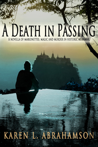
I’m pleased to announce that the second in the series, A Death In Passing, has just been released, continuing the trials and tribulations of Aung, the puppet singer, with his troublesome assistant, Yamin, as they try to solve the murder of Burma’s most powerful spirit dancer.
In all of these books I’ve attempted to be true to the country’s culture and to accurately present the wonderful nature-magic systems (with a few embellishments). Burma seems to be in my blood and I envision more novels set in this wonderful and varied country. Whether historical or modern novels, I hope to capture the country’s magic for readers.
If you’ve traveled in Burma, I’d love to hear how I did.


I’m pleased to announce the publication of a romance novella called ‘The Rescue’. The story is based loosely on the fact that I broke my leg in January just like Amanda did in the story. The difference was, I fell on ice, not wet wood and I never had a handsome search and rescue man come and rescue me. Sigh.
I had to walk out.
I hope you enjoy the story. Here is the blurb:
 The Rescue, by Karen L. McKee
Amanda Ripper escaped a controlling husband who convinced her that she was weak and an invalid. To convince herself that it wasn’t true, she fills her life with friends and hiking and refuses to become involved with anyone again. Then she falls and breaks her leg, reigniting the specter of her old life. Can a handsome man from search and rescue to give Amanda a chance at life again?
Available on Amazon, Smashwords and Kobo.

Exactly one year ago I wrote my first blog about maps and decided that I would write a series on that topic– maps, their history, the people who made them, and how maps have been used by people. I did this because maps are integral to the series of books I write in the Cartographer Universe and I wanted to understand more deeply what maps have meant to humankind.
What I’ve come to understand is that maps can be a truth, a lie and a metaphor. They can present the ‘reality’ of the physical world—the mountains and rivers and roads and cities and can inspire men to superhuman acts just to complete a map. Just as often, though they represent lies or half-truths—the imaginary island of Brasilia, the shifting landscape of Prestor John’s Kingdom or, more overtly, contorted landscapes intended to lure the unwary into towns, gold fields and department stores. And that’s a problem, because we tend to think of maps as representing the truth and we don’t approach maps with a ‘use at your own risk’ mentality or with the realization that any map may only represent the reality that the map’s maker wishes to represent. They’ve been used this way for centuries, so that the modern-day Chinese maps which change the location of major city thoroughfares to stymie the advance of any potential invasion are only an extension of the same tradition that caused British mapmakers to make erroneous maps of the West Coast of Canada (presumably to stymie the work of Spanish spies), and the Portuguese and Dutch Kings who kept secret their routes to the spice islands.

But maps are much more than simply tools to convey or obscure information. Maps are a part of our psyche so deeply engrained that the map metaphor has seeped deep into our culture. Cervantes wrote ‘Journey all over the universe in a map, without the expense and fatigue of travelling, without suffering the inconveniences of heat, cold, hunger, and thirst.’ Shakespeare wrote “In thy face I see the map of honor, truth and loyalty.”

But maps themselves are not truth, but metaphors. Once, in Fra Mauro’s time, they represented the mythical extent of man’s imagination and potential. Once, they represented the adventure, the spirit of mankind in the terra incognita of the empty sections of the map. Nowadays they represent the world as governments want it to be when they represent contested borders (think the current battle over islands between Japan and China, or the oil-rich islands in the South China Sea that three countries claim). Maps are used to represent presidential aspirations, shifts in battlefields, oil pipeline routes, and enemy and friendly countries—not that these presentations are the truth, but they are one truth—the truth that the mapmaker wants us to believe.
In this day and age when maps are no longer produced by a person hunched over vellum and ink, we must remember that many things influence the mapmaker’s pen. Everything from politics, funding sources and the publishing company’s allegiances represent what is filtered onto the page. Which brings me to my final conclusion about maps and the truth. They have always been creatures of the imagination and not of the truth, no matter that they grew out of scientific endeavors, but now that purpose of inciting the imagination is being used with more strategic purpose than ever before. Can we trust maps? No.
As Herman Melville stated so well:
It is not down on any map; true places never are.


I’ve written about how maps created belief systems in the people of old. In ancient days, stories and maps of Prestor John led people to Asia and Africa in search of his kingdom. Mariners believed that the Indian Ocean was a huge inland sea surrounded by Africa that swept down and around to join with Asia. When North America was discovered, maps of the mythical Northwest Passage, led explorers to seek the real passage. But maps do more than that. Maps are sources of propaganda and maps are sources of conflict. You see maps, their systems, omissions and scale (as examples) are often used to take forward propaganda or a dominant world view. They have been used this way close to home in Canada.
For example, for many years maps of Lake Superior were left largely blank, because people believed the lake was very deep. But the truth was that fishermen didn’t want their secret ‘fishing shoals’ mapped for others to find. It was only after military vessels went missing (not to mention the Edmund Fitzgerald) that in 1930 that the Canadian Hydrological survey confirmed that there is a mountain rising in the middle of Lake Superior creating a large shoal. This shoal had been known to American fishermen, but no one had ‘told’ because the area was a magnet for fish.

Maps as propaganda were used extensively in the settling of Canada. The Dominion of Canada turned surveyors maps of soil and rivers into grid maps that were then artistically enhanced with pastoral images of farms and young golden-haired women clad in white dresses. Atlases of Canada were created and sent to Europe and America in hopes of encouraging immigration. The art was focused on meeting the pastoral desires of the Europeans and in particular the British. Slightly different art work was used for maps sent to America. It didn’t matter that the images didn’t reflect the prairie landscape (The images were more of Ontario). It was the dream of the pastoral lifestyle that drew the immigrants that Canada needed.
These same maps with their grid lines were sources of conflict because they established expectations about how people would inhabit the landscape. The grids were set out in sections six miles by six miles, based on latitude and longitude, regardless of the lakes or waterways they crossed. As I mentioned in a previous blog (here) the Metis found the grid pattern foreign because they settled land based on long strips of land that swept back from water courses and that allowed everyone access to water. But immigrant groups from Eastern Europe also had challenges with the grid pattern. They were familiar with more communal, village styles of land allotment, where the land was marked off from the village in a manner more appropriate to communal living. As a result these groups (the Mennonite, Doukhobors, and Hutterites) subverted the grid style by purchasing the land, but then subdividing it according to what worked for them.

Maps were also used as propaganda by commercial entities such as the railroads. Canada’s two railways, Canadian Northern (CN) and Canadian Pacific Railway (CPR) battled for ridership through their maps. Maps were developed that left out or diminished the competitor’s railway. For example, CN created a triangle route map between Edmonton, Jasper National Park and Vancouver that played with scale. In this map CN’s journey through scenic Jasper was presented in large scale so that the route through Jasper leaves little room for any other details, while the rest of British Columbia was presented in small scale that didn’t allow CPR’s rail lines to even exist—according to the map. The interesting thing about this map is that no one then, or even today, notices the scale issues with the map—we accept what the map presents as reality.
So while maps are supposed to be presentations of reality, the big question the map reader has to ask themselves is whose reality (or wishful thinking) are they reading. Sometimes it is helpful to step back from the map and ask what does this map tell up about the people who developed (or paid for) it? Or what was going on at the time it was made? Or Why was this map even made? I think of my local community developers who, like the Dominion of Canada with their maps, are presenting the paved-over reality they would like to have made. The question is whether this is the map of the future we want, or whether, like the Mennonites, Hutterites and Doukhobors, we can subvert it to a better reality.
")
Last week I wrote about characters in the Canadian Cartographic past. I thought I’d continue that theme this week with an illustration of how mapping is not the objective scientific pursuit we all think it to be. Instead, mapping is an exercise influenced by politics, exploitation of resources, culture and religion. Hubris comes into play in there somewhere, too. Mapmakers influence perception through their use of scale, their level of detail and even just by what they choose to put on the map. Determining which maps are actually made is perhaps the penultimate influence on public perception.
One of the most memorable Canadian mapping ‘junkets’ involved an American millionaire by the name of Charles C. Bedaux.
In 1934 Beadaux, then living in France, initiated the Bedaux Sub-Arctic Expedition, that planned to use specially built tractors and horses to traverse, map and cut a road from Edmonton, Alberta, through northern British Columbia to the Pacific Ocean. The 1,800 kilometer route was to go through Fort St. John, Redfern Lake, Sifton Pass and Telegraph Creek. While the media reported that Bedaux claimed the expedition was purely scientific, there were other rumors abounding.

In any event, this strange expedition left Edmonton with a crew of 43 people including Bedaux’s wife, her Spanish maid, and an Italian Countess to tend to Bedaux, along with the usual accoutrements of pate de fois gras, champagne and a gamekeeper. Oh yes, and a movie cameraman to record the adventure. This was not your usual surveying venture, but along with this cavalcade of oddities, were a topnotch group of scientists and surveyors. Poor sods.
Immediately after leaving Edmonton they were caught in rainstorms that slowed their progress and caught them in muskeg, even though Bedaux’s vehicles had extra wheels that were to lift them over the worst obstacles. Bedaux had brought everything with him from French cook pans, lock and tackle to lift the tractors over vertical terrain, and claw-foot bathtubs. All the equipment literally weighed ton.
As the expedition progressed, the situation worsened. The tractors’s problems didn’t get any better and had they to be pulled out by some of the expedition’s 100 pack horses. When even this didn’t help them make better progress, he determined to start divesting himself of equipment. Not the bathtubs and champagne of course, but scientific equipment like the surveyor’s theodolite. The situation became more bizarre as Bedaux railroaded the surveyor’s assistant into becoming his houseboy, and demanded the other scientists become actors in staged moviemaking involving forest fires and staged stampedes of the horses.

Finally, after 14,00 kilometers, Bedaux abandoned the expedition over 400 kilometers from Telegraph Creek. Bedaux returned to France, but the meticulous maps and drawings prepared by the surveyor of the venture, one Frank Swannell, went on eight years later, to lead to the building of the Alaska Highway which followed Bedaux’s route north from Fort St. John.
And Bedaux, well his fate wasn’t quite so memorable. You see one of the rumors about Bedaux was that his venture was really a testing ground for German military transport trucks in alpine conditions. During World War II Bedaux hitched his star to the Third Reich and acted as go-between between the Germans and the Vichy French. It is suggested that he passed information to the Germans, and in 1943 he was captured in North Africa by the Americans. He was brought back to America and charged with trading with the enemy, but in 1944 he overdosed on barbiturates and died.
Thus ended another bit of Canadian cartographic history. But one wonders. Maybe we have the Germans to thank for the Alaska Highway.

In many of my map posts I’ve written of the unusual people who led the map making ventures, whether mystical Frau Mauro of Venice, the ancient Chinese voyager General Zheng He, or the dedicated native British East India Company surveyors who surveyed the Himalayas. Of course Europe and Britain and America have their own cartographic heroes, so I thought I’d take a few moments to mention a couple of religious cartographers who played a huge role in mapping Canada.
Jesuit Father Frencesco Bressani came to New France (Lower Canada) in 1641 as a missionary and with the express plan to measure astronomical eclipses in order to calculate longitude. At age 32, only a few years in-country, he was captured by Iroquois just outside Trois-Rivieres and was tortured, burned, beaten and mutilated for two months. Somehow he survived and was ransomed to the Dutch and returned to France. Regardless of his ordeal, he came back to New France the next year for four years before returning to Italy where, in 1657 he published his map, the Novae Franciae Accurata Delineatro.
This map, considered the rarest of Canadian maps, not only shows Native territory, but is most valued for its many illustrations. These give an astounding view of Native life as well as vivid drawings of the martyrdom of many missionaries, including being slashed with glowing bark, being placed in boiling water and being cut up alive. Dangerous work, cartography. Of course the map comes with controversy. Was Bressani even able to draw, when his own letters indicate that his hands were so badly mutilated that he could no longer do mass properly? (One hand had only one finger left.) Historians believe the map was drawn by one Giovanni Frederico Pesca, in Italian engraver, working on Bressani’s insightful information.

The Jesuits like Bressani were responsible for much of the early mapping of Canada, but in the 1800’s the missions and religious mapping was assumed by the Religious Institute of the Oblates of Mary Immaculate. This order was founded in 1816 in Paris with the motto that meant Right to the ends of the Earth! and they lived up to this when they established their first mission in Canada in 1841 with a focus on Canada’s north along the Mackenzie River Valley. Long-bearded and black robed, the Oblate fathers became well known to the Natives, but none more so than Father Emile Petitot.
Petitot came to the Mackenzie River in 1862 only two weeks after he was ordained. He stayed for twelve years, most of the time travelling with Native companions through the uncharted north from Great Slave Lake to the Arctic Ocean and between the Mackenzie and Laird rivers. He made detailed observations of the Native communities, down to the condition of their teeth and the level of stammerers in specific populations. He learned much of the Native means of living including the guiding marks they placed on river channels to show which were open and which were dead ends. He made maps that set out geographic data of the interior of the northern basin, and discovered the Riviere a Ronciere-Le Noury—a river that geographers denied existed for eighty years, until aerial photography proved Petitot was right.

Petitot’s maps made him something of a celebrity in Paris, Ottawa and London, but he was also watched closely by his superiors. Historians describe Petitot as something of an absent-minded dreamer who longed for long voyages, but who also was apt to freeze his fingers because he’d forget to wear his mittens. As well, his missionary duties went something by the wayside. He spoke native dialects fluently and was accepted by the Native groups he met, but he had some unfortunate predilections towards young native men and was excommunicated at one point. Mental illness also plagued him. He variously predicted the end of the world, proclaimed his superior had murdered Jesus and the Virgin Mary, and could become erratic and violent. During these dark spells he would be tied down and placed under guard to stop him from running naked in the snow. It was not until 1882 that he was quietly placed in a Montreal mental hospital after which he returned to France for good.
Petitot’s departure ushered in an era where the religious orders were no longer so prominent in Canadian cartography. But their memory lives on in the ranks of Canada’s memorable cartographers: the devout, the brave, the mad.

I thought I’d throw a little light on my home and native land in honor of Canada’s 145th birthday on July 1st.
Maps give shape to countries, both real and imagined. I’ve written previously of the long search for St. Brendan’s Island in the Atlantic and how the need to establish Prestor John’s country influenced the maps of Asia and Africa. But beyond creating imaginary countries and geography, there are three real ways that maps can help build a nation and all of these have been used to build Canada. Maps can:
1. Help the populace visualize the their nation and understand their borders;
2. Take a geographic area and turn it into a political abstraction such as the Canadian state, and
3. Mediate relationships between states and their population and can act as a means of ‘erasing’ certain populations from the national and political psyche.

Maps have performed these roles for Canada since before the country was actually born. An example of the first comes from the period when the French and the English were still making their claims on North America. In the early 18th century, between 1713 and 1756, the French and English were engaged in a continuing dispute over what was English and what was French territory. This led to what might be called a war of maps, or at least a war of propaganda perpetuated through maps, with English maps having the audacity to present the French territory as a small area confined between the Ottawa and Saguenay Rivers in present-day Quebec, while the rest of North America – areas that had largely been mapped by French explorers – was claimed to be English. Oddly enough in the fight over what was French and what was English some of the battles, such as the argument over what was ‘Acadia’ (French) and what was ‘Nova Scotia’ (English) both sides presented maps prepared by their opponent. The trouble was, so much erroneous information was included in so many maps, you could pretty much support either argument.

Maps also played a role in defining the border between Canada and United States. Dr. John Mitchell created A Map of the British and French Dominions in North America in 1755 and this was a pivotal map used by both of the fledgling countries in determining their borders. A Virginian, Mitchell became interested in maps as a result of concern over the French encroachment on territories the English had ambitions on. He began to collect information from travelers and publicly available maps, and compiled one of the first maps of North America. He wanted to expose the scale of the French Threat (they had been all the way down the Mississippi and far into the west by this point) to the British public and the colonies. Although his first map was crude, it showed enough promise he was commissioned to create something better by the Lords Commission on Trade and Plantations and was given access to the growing store of maps and charts coming from the new world.
The resulting maps showed a credible presentation of the boundaries of Upper Canada and, when the 1783 boundary negotiations between the United States and Britain began, the map helped to settle that the boundary would bisect the Great Lakes and then continue west. But that didn’t set the boundaries at the 49th parallel. It was another map, created by Jean Palairet, that erroneously showed the 49th parallel as the ‘agreed upon’ boundaries between French America and the Hudson’s Bay company. Although the French had never agreed to the boundary, the strength of a map presenting that fiction led the two countries to accept the 49th as their boundary in reality.
Two years after confederation, the fledgling Canada’s mapmaking had its first brush with making a culture disappear. In 1869, when the government sent surveyors into the prairies to prepare them for settlers, they were charged with measuring off the land, just as their American counterparts had done south of the border. They sought to mark off the land in one mile blocks, but when they came to the “hay privilege” lands of one Andre Nault, they were stopped by a group of Metis led by Louis Riel. You see, these descendents of marriages between native women and French explorers had established their own culture and place on the prairies. They had found that, in the arid landscape, the best way to divide the lands was using long strip land claims that flowed naturally back from each river or stream and thus allowed everyone access to irrigation. They viewed the government surveyors’ placement of each square mile on a map, as effectively wiping out their way of life. We know what happened—the Metis rebelled and Louis Riel was hanged and went down in history as an enemy of Canada. The Metis, like many First Nations people, were left as disenfranchised members of our country.

All of which shows how maps can be used to create or subdue a country—in this case mine. Happy Birthday, Canada. Let’s hope our maps of the future are a little more kind.


