Tag: Writing

“A Good Traveler (or writer) has no Fixed Plans…”
“A Good Traveler (or writer) has no Fixed Plans…”

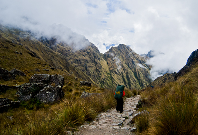
Porter on the Camino Inca. (2011) Photo (c) Karen Abrahamson

I purchased a lovely journal the other day. Though it’s not specifically a travel journal it certainly could be, because all of the quotes in the book relate to travelling, but when I read the complete quote by Lao-Tzu, all I could think of was its applicability to writing. The quote goes thus:

‘A good traveler has no fixed plans and is not intent on arriving.’

As someone who loves to travel, this quote provides a cautionary tale, because it warns that if you focus always on the destination you miss a lot along the way. Personally, I prefer to meander from place to place because you never know when you are going to find some better place to go than the place you intended. If you are always focused on heading somewhere, you have a much greater chance of missing where you are. As the Buddhists suggest, mindfulness of where we are, rather than worrying about the future  (or where we are going) brings much more happiness than the rush, rush, rush of hurried travel. It’s for that reason that I don’t take bus tours. The tours point out what they think you want to know, not what you can really learn just by being there.
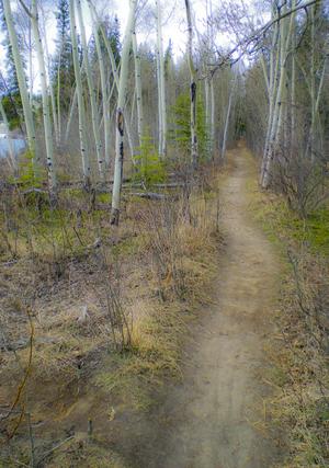
Yukon path, (2008) Photo (c) Karen Abrahamson

But Lao-Tzu’s quote applies equally to writing. The writer who spends all his/her time solely focused on completing a project isn’t really giving themselves the opportunity to enjoy the project. I’m not saying that you should fool around and never finish, I’m suggesting that you should enjoy the process, no matter how difficult it is, and—just like the traveler who takes the time to meander you don’t need to be so end-driven that you can’t enjoy the little sidepaths that your muse sends you down.

I guess what I’m talking about is allowing the story to carry you along, just like the road can. You don’t have to know where you are going exactly, though you may have a vague idea that you would like things to end in a certain way. Some of my best days of writing are when I have allowed the story to carry me away from the story I had intended—those are the mornings I get up and rush to get writing again because I want to know what happens next. The funny thing is that if you allow the little digressions and flashes of insight to lead you, often the ending will turn out to be some place better than what you envisioned. Believe me, if the ending surprises you, it’s going to surprise and charm your reader, too.

So as a recovering ‘plotter’ of novels I think all novelist should allow themselves the freedom to step off the path they are following to explore the new world they’ve created. They might just find it’s bigger and better than they ever imagined.
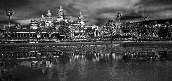
Angkor Wat reflections. (2009) Photo (c) Karen Abrahamson
Knowing Where We Are in the World – and in Story

Knowing Where We Are in the World – and in Story

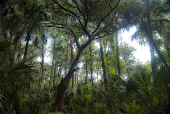
Cypress tree, Northern Everglades (2012) Photo (C) Karen Abrahamson

I’m currently working on two pieces of writing. One is the third novel in the Terra Trilogy and the other is the third installment of the Ice Dragon Series of short stories. Working on these two projects has made me question how I know where I’m going and how do I know where I am in relation to everything else in both these stories. It brings to mind the question of how we know, in our real life, where we are in relation to the rest of the world.

In this day of GPS and mapquest etc. this might seem like a very easy question to answer, but it wasn’t always this way, just like I wasn’t always able to have a sense of where I am in a story. Yes, surveyors took it upon themselves to survey the world. Countries (and scientists) agreed on the prime meridian that impacts all our time zones. But the 20th century has primarily been concerned with improving the precision of mapping and in particular with ensuring the pinpointing of places on the map in relationship to the rest of the world. The US Geological Survey was involved in this through most of the 20th century.

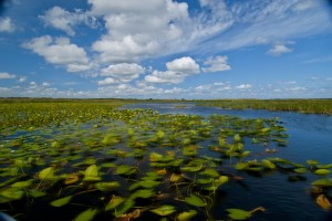
Waterlilies, Northern Everglades (2012) Photo (c) Karen Abrahamson

Why is this important? Well, think about it. Without standard understanding of how everything relates to everything else, weird things happen, like bridges getting built from each shore that don’t meet in the middle, or highways that have weird jogs in them because the measurements allowed the two ends to miss each other. It might not be important to you, but the cost overruns of such mistakes make having a common context for measuring everything important because it stops these types of things from happening.

In North America, the result of the surveying is those nice little brass discs (known as monuments) set in concrete or rock dotting the landscape . Each of these little brass discs serves as a known point for all subsequent surveying in the area. How did they know the individual location of these monuments? They took meticulous measures of distance through triangulation surveys and also measured the azimuth—the direction of Polaris—to set each monument’s position.

Throughout America, broad swaths of land were surveyed independently to create grids of known locations. They measured locations not only horizontally across the landscape, but also vertically, in relation to sea level, but the challenge was knowing that all these grids fit together. The result was the selection of a single monument at a ranch in central Kansas, Meades Ranch, as point zero for all grids across the country. Meades was chosen because it sat centrally in the US and it lay close to the crossing of two major survey lines across the US – one from Canada to Mexico and the other from the Atlantic to Pacific Ocean. Interestingly, today Meades Ranch has been superseded by global positioning that uses the center of the earth as the central point of reference.

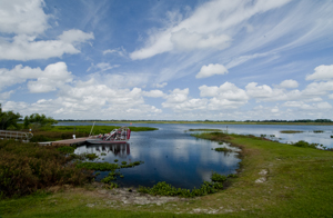
Airboat docked in the Northern Everglades. (2012) Photo (c) Karen Abrahamson

The use of that central point for mapping draws me back to my thoughts on plotting a novel or story. I once heard the wonderful writer, Nancy Kress, talk about plotting. Now I don’t know how you feel about plotting—some people are all for detailed plotting of everything in a novel, while others prefer to fly by the seat of their pants (Pansters) and write into the mist of their imagination. Nancy Kress seemed to offer a third alternative that didn’t hold a writer’s imagination down, but also gave some structure to writers so that all that lovely mist didn’t turn into a dense blinding fog. Ms. Kress suggested that writers need to write down what they think is going to happen in the novel. Just brainstorm them out. Ask yourself what is the beginning (the inciting event) and what is the midpoint (quiet often a reversal of some sort), and how do you think the story will end (the climax)? Once you have those key points identified, you can easily place them on a plot line and them locate all your other plot ideas on either side of the midpoint—a lot like being able to measure your location from Meades Ranch.


Rhumb Lines, Novel Writing and How to get from point A to Point B

Rhumb Lines, Novel Writing and How to get from point A to Point B

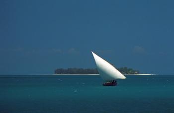
Dhow in coastal waters off Zanzibar Island (1994) Photo (c) Karen Abrahamson

As I mentioned in a previous post, I’m in the midst of a year of writing sequels. Actually it may take two or three years to get through all the sequels needed for my current novels. As I have already mentioned on this blog I’ve found writing my first sequel a bit of a challenge even though I knew where I was going. It seemed that I kept straying off course.

This puts me in mind of the challenges mariners had back before Gerard Mercator created his famous projection in 1569. A projection is a way of taking three dimensional landforms off of a globe and placing them onto a flat surface (a map) while retaining relative conformity of shape and relation between the landforms. What Mercator did was take meridians of latitude and longitude and make them all aim straight north-south or east-west creating 90 degree angles at each intersection. Sure it expanded the landforms closer to the poles, but it also gave mariners a means of plotting courses over long distances.

Picture this overlaid on top of a typical world map with latitude and longitude laid out.

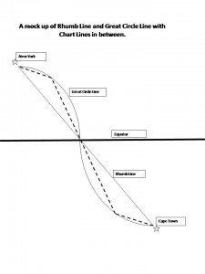
You see, prior to Mercator, mariners shared two fears – bad weather and getting lost. (Actually I share their fears, the latter most particularly when I’m writing.) In the years before Mercator’s projection, mariners had generally confined their sailing to the Mediterranean and coastal waters. The transatlantic voyages to America were done by the stars, but there were no helpful portolano (mariners maps using compass roses to show sailing routes) of the great oceans. Mercator’s grid made sailing the open ocean as easy as sailing the coasts because it gave sailors a means to chart a straight line (a rhumb line) from Point A to Point B across the ocean. From this they could plan their headings and make their voyages.

Of course sailing the distance from Cape Town to New York is about as huge an endeavor as writing a novel (or a sequel) from page one to the end and neither route actually takes a straight line. Sailors travelling that distance recognized that they didn’t travel a flat earth, they travelled a globe and so they added to their calculations, the curve of a great circle that was the largest circle they could draw through a sphere and this route showed the actual shortest distance between two points. Sailors then chose their routes by drawing straight chart lines between the great circle and rhumb line that allowed them to approximate the great circle along the route.

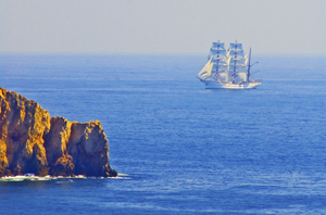
Tall ship off Portuguese coast (2006) Photo (c) Karen Abrahamson

This seems a lot like the process I use when I’m writing. I know where I start and I know where I want to finish (most of the time). The writing process then becomes one of deciding how far to travel from the rhumb line (the plot or the backbone) of the story, for it seems to me that novels have great circles, too. These are the themes you are writing about and you don’t want to allow your plots to take over, so that your story is nothing but plot, but neither do you want your subplots to take you so far out of your way that the story no longer fits within its themes. And that’s where sailing and writing diverge in their process. Sailors use the great circles and rhumb lines to plot their course and they follow it from Point A to Point B. A writer, on the other hand, will use them to plan their novel or their series of novels, but also to look behind and check whether they have wandered too far off course to get to their final destination. This is the challenge in sequels: viewing the second or third book as just one of the charted lines between the rhumb and the great circle, building its way to the ultimate end of the voyage.


What’s in a Map? Aboriginal Maps and Writer’s Dreams

What’s in a Map? Aboriginal Maps and Writer’s Dreams

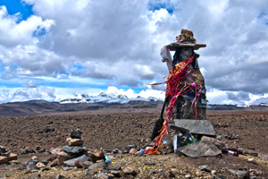
A Huaca, or sacred stone, in the landscape of the Peruvian Altiplano (2011) Photo (c) Karen Abrahamson

Last night I received an article from my local Romance Writers of America chapter about world building for writers and how making a map of a location can help to create your story and your plot. I got thinking about this and how it relates to human history. In particular I got to thinking about how some anthropologists and historians have drawn a line in the sand (the 15th Century) about when true maps came into existence. (See my last post here.) But it got me wondering whether they were short-sighted in their definition.

The authors of this theory have said that prior to the 15th century while people might have made maps, they largely weren’t made for the same purpose of orienting the landscape like maps are used for today. They talked about how maps of older civilizations presented a cosmology, not a spatial map, or were used to show relationships, which could as easily be represented in text or the spoken word. This, they posited, means that earlier map-like creations are not true maps. Whether they are wrong or right is a matter of some debate.

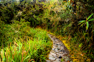
Trail along the Camino Inca, the path to Machu Picchu (2011) Photo (c) Karen Abrahamson

A case in point is Native American cartography. The literature about Native American maps is challenged by the fact that not only is it hard to find maps from pre-European contact (birch bark and leather just don’t stand up to five hundred years of colonization), but most of the records of native maps are colored by the perspectives of those who collected the map. The few maps that do exist require the reader to think of maps in more than one way. For example, records of a Virginian Algonquin map collected by John Smith in 1624 (while he was a prisoner), show a cosmological view of the world, but also a spatial linking of places. The map shows three concentric circles around a fire, with the first circle being a circle of meal representing the Algonquin Territory, the second being an inner circle of corn representing North America, and the third circle of corn representing the edge of the supposedly circular world. To try to understand John Smith’s origins from beyond North America, the Algonquin created a thatched stick island between circle two and three. Clearly this shows a sense of spatial distribution, even if it is not based on any scale a western European would use.

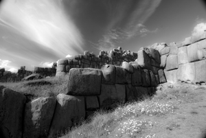
The ruins of Saqcsaywaman, Cusco, once part of the center of the Inca world. (2011) Photo (c) Karen Abrahamson

Another interesting ‘map’ was a gesture used by a Native American Elder to describe the location of his town. The elder held his forefinger and thumb like a not-quite-closed-looped ‘okay’ symbol. The location of his town was between the unclosed tips of the finger and thumb, with Quebec, Montreal, New York, Boston and Halifax all located along the knuckles and joints of the rest of that looped finger set. This again clearly places the Native American town in relation to the major cities. So the question may not be whether Native American’s had maps, but whether they recorded their map information in a different way. Native American communities and living accommodations like the Navajo Hogan, the Pawnee earth lodge and even some longhouses could be said to be map-like in their structural symbolism of the concept of the sky dome or celestial vault providing shelter for a two dimensional geography with the four directions spreading out from a pivotal centre of the house. It might not be written on a piece of paper, but clearly there is a sense of direction and relationship to place within their sacred geography.

Finally, Petroglyphs, a primary source of pre-contact information about Native American culture, have also yielded examples of what could be maps, though there continues to be some debate. Some appear to show river routes and tributaries along with trails. Still other stone paintings appear to represent drive fences (fences used to drive prey animals into capture areas) complete with pictures of the animals that resided in the area.

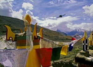
Across the world we look for the sublime meaning of everything. Prayer flags, Tibetan area of Northern India, (2000) Photo (c) Karen Abrahamson

Which brings me back to the RWA article. It spoke about how, for a writer, a map can help you to give a greater sense of place to your writing. The writer will know where the towns and roads and lakes and mountains are in relationship to where the character is. But drawing a map can help the writer to also learn something beyond thethe lay of the land. A writer’s map can help you to understand what monsters live in what areas, what territory belongs to the enemy and what resources there are to harvest, along with your character’s place in the world. This leaves me to think the Native Americans understood modern (writerly) mapping better than the anthropologists and historians think they did, and that the modern writer’s map is based in something much deeper and perhaps more linked to the notion of a sacred human landscape. Both look for something more than just scaled lines on a page to find our way through either our imagination or the world.


A Christmas Map of Place and Time

A Christmas Map of Place and Time

I put up the Christmas tree the other day, uncovering each tissue-wrapped ornament before putting it on the tree. My mother commented on how each one was so unique and that made me reflect on how each ornament was a memory that solidified and evoked a place that I had visited, or a certain place and time in my life.

Angkor across the pool

On the tree were ornaments purchased in Peru, and others from Tanzania, Cambodia, St.Thomas, and India. The tiny painted gourd Peruvian cuy (guinea pig), hung side by side with the wee silk elephant I found in Thailand. A German bauble my mother-in-law gave me hung next to a globe found at a French clock-maker’s shop at a town next to the Swiss border and a Pueblo Indian Virgin Mary sent by my parents from Arizona. All of these brought back memories of Christmas eve feasts, times in the Angkor heat or the chill of the Himalayas, and standing on the Serengeti plains.

Two of the dearest decorations were a handmade snowman and a tiny wooden cuckoo clock. The cuckoo reminds me of times with my stepsons and ex-husband out riding the wilds of Central British Columbia. You see, that area is ranching country complete with wolves and bears and miles of undeveloped forest. In the winter it was covered with snow-laden pine and spruce. At Christmas, there was no better way to start the season than to saddle up our horses and head out into that pristine winter land.

We’d take an axe and an old horse blanket with us and head out into the forest, the horses blowing steam through their nostrils as they bounded through hock-deep snow, my sons rosy-cheeked as they raced their horses ahead until they came whooping back to announce that had found the PERFECT tree. That was what the ride was all about. We’d follow them – usually out to some clearing where a smaller tree would stand. My husband would dismount and shake the snow off, getting it all over himself and then, as a family, we’d critique the tree they’d found. If it passed muster, we’d chop the tree down, wrap it in the blanket and tether the blanketed tree to the horn of one saddle before starting our (much slower) ride home dragging the tree behind us. That would bring the official tree into our home and the small cuckoo clock was one of the first ornaments we bought as a family.

The snowman ornament was made by my youngest stepson. We didn’t have a lot of money in those days – at least not for ornaments for the tree – so he and I set out to make some. I still have the small green felt tree I made, but his is special: a stuffed white snowman complete with scarf, and broom and a black top hat all carefully sewn by ten-year-old hands. I smile and think of him, long grown to a man, whenever I find it each year.

And so my Christmas tree today is a guardian of riches worth more than the presents under it. Those glittering branches hold not only my memories, but also a map of the treasures of my life.

Merry Christmas.

The Roots of the World

The Roots of the World

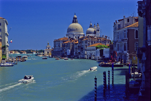
The Grand Canal, Venice (2005) Photo (c) Karen Abrahamson

For men like Fra Mauro (see last post), the exploration of the external world led to an understanding of the inner landscape of men. So too, from the triangulation of the world (see post here) came a greater understanding of the internal shape of the earth.

I mentioned previously that in order to determine the shape of the world, a French survey team went to Ecuador and Peru at the same time as a team went to Lapland. Unfortunately for the Peruvian team, the Lapland team discovered the answer to the scientific question long before the Peruvian team ever finished their survey. While in South America, however, the Peruvian team struggled over mountains and through jungles and noted different gravity readings as they took their survey measurements along their route. They surmised that the differences in the readings might reflect the varying landscape and theorized that mountains might be made of less dense material than the lowlands. A good theory, but it took over a hundred years for the matter to be more fully explored and the discovery was made far from South America. It took the British Raj’s need to survey India to bring understanding to what the mass of mountains might mean.

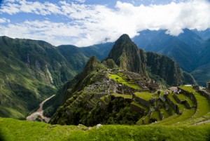
Machu Picchu caught in the coil of the coil of the Urubamba River (2011) Photo (c) Karen Abrahamson

In the mid nineteenth century, the horrendous task of surveying India through triangulation was almost undone by the discovery of an error of some 150 meters between the distance the triangulation measurements computed, and an actual direct surface measurement. To determine what had led to the error, the cartographers involved had to reexamine their assumptions – in this case they had assumed that the mass of the Himalayan Mountains would greatly influence the gravity measurements of their survey instruments. What they found was that they had overestimated the lower mass of the mountains.

This led to a theory of the earth’s crust that still exists today, namely that every (theoretical) column of the earth (from core to outer surface following a theoretical plum line) should have approximately the same mass. Given that tall mountains have a lower mass, they must have an equally large (but low mass) protuberance at the bottom of the earth’s crust to achieve the same mass as denser areas of the earth’s crust. Conversely, under the oceans where the ocean basins are very dense, the earth’s crust would be relatively thin. The theoretical result would be that inside the earth there would be a mirroring of the plains, mountains and ocean valleys we see on the surface, much like a tall iceberg has a large underwater presence to balance it out. Modern science has supported this, by obtaining crust measurements off the coast of South America that show the Andes have roots as deep as 75 kilometers.

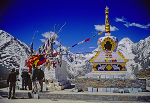
Stupa and Prayer flags at the Manali Summit (2000) Photo (c) Karen Abrahamson

Think of this the next time you are crossing the mountains, staring up at those tall, snow-covered peaks, for they are the frosting, the outer conceit of an iceberg of stone that conceals the deeper reality of the roots of the mountains.

Much like Fra Mauro saw the illusions of men obscure the truth of his map of the world.

A Prince, a Prophecy and a Legend

A Prince, a Prophecy and a Legend

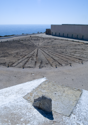
In southern Portugal, at a place called Sagre, I stood on red cliffs, high above an azure ocean and inhaled ocean wind and dust that had blown all the way from Africa. There, in an ancient fortress, laid out amid the scrub grass and rocky ground and seabird guano, laid a thirty foot, circular, roped off area that contained an old wind rose – a collection of ray lines that spread out to all points of a compass. This was the legendary home of Prince Henry the Navigator.

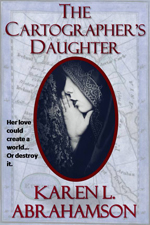
This was a few years back, when I had the good fortune to spend a month traveling around Portugal researching a prince for a book I was writing (The Cartographer’s Daughter). The prince I researched was none other than Prince Henry about whom the entire Portuguese psyche seems to revolve – or else he’s just a key tourist draw. You see everywhere you go in Portugal there are memorials to the old boy’s doings. In Porto there’s a museum that celebrates his birthplace. In Lisbon grand statues stand over the harbor and paintings of him fill the maritime museum. In Lagos another museum waits and elsewhere there are plaques and other statues. Why, you might ask? What did this man very few North Americans have heard of, do to deserve this kind of canonization?

I suppose the answer can be found in the wind rose.

Sagre windrose
The Sagre windrose has led to legends of a cartographer's school at Sagre. (2005) Photo (c) Karen Abrahamson

No, Henry didn’t invent the wind rose. Simply put, this foppish, spendthrift prince could be called the father of the Age of Exploration. Yes, there were many people that contributed to the dawn of new age of Europe, but good Prince Henry had something to prove and the full might of the Knights of Christ, the inheritors of the Knights Templar after they were disbanded, to help him do it. But I run ahead of myself. So who was Prince Henry?

The middle son of the Portuguese king, Henry was born under stars that astrologers proclaimed would devote Henry to ‘great and noble conquests and to uncovering secrets previously unknown to men’. Imbued with this sense of destiny, how could he help but be more than a middle son?

Henry grew up to be an ardent Christian and to become the head of the Knights of Christ. Along with that, came a driving hatred of the Moors and a determination to rid the European continent of them (they still held Granada). It also led to a dream of taking the Crusades across Gibraltar to Tangiers. His drive and his influence over his father led to one of the last European crusades—this one against the Moroccan trade city of Ceuta. The Portuguese won and held the city, but later, when they tried to advance they ended up routed from Tangiers and having to trade Henry’s younger brother for their freedom. This horrible blow some historians lay at Henry’s doorstep, but the loss of his brother was fuel to Henry’s fervor and he spent much of his life trying to revive the crusading fever amongst his cronies. It never came to be, but in the meantime Henry influenced a nation because he began to focus on maritime issues.

As a patron he began sending men on exploration along the African coast. Yes, he may have also been seeking a road to Christian Kings who could help him against the Moors, but his push and his financing, led to Gil Eannes becoming the first man to round Cape Bojador, which previously had been described as the end of the earth due to its difficult currents. With that passage, and with the improved sails and hull structures Henry’s money fostered, he ripped down a psychological barrier and the length and breadth of Africa beckoned. This led to a series of explorations sponsored by Prince Henry. He also fostered the collection of maps and sailors’portolan charts so that navigational information was shared and developed, before they became guarded national secrets.

The old Church at Sagre, (2005) Photograph (c) Karen L. Abrahamson

The interesting thing about Henry is that though we know so much about him, he still remains a man of mystery and legend. Records seem to show that he was an austere man who was deeply religious and sometimes given to mysticism at the same time as he liked to dress in foppish clothes and lavishly over spend the wealth of his estate holdings. He was also a man of learning who funded universities and financed astrologers and physicists and cartographers. But as I stood in Sagre by that wind rose I was struck by the rugged beauty that must have inspired him – that is until I went into the site’s visitor’s centre and they advised me that this fortress in Sagre was never a cartography school, though he did make his home here.

And the wind rose?

Henry’s involvement is just the stuff of legend.

Recent Fantasy

Available HERE,

$1.99

Available HERE,
$3.99

Available HERE $1.99


Recent Mystery


Available HERE
$4.99


Available HERE,

$4.99


Available HERE,

$4.99


Available HERE,
$4.99


Recent Romance

Available HERE, $2.99