Month: July 2012

The Character of Canadian Cartographers
The Character of Canadian Cartographers

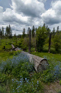
Alpine flowers, the Kane Lakes, B.C. (2012) Photo (c) Karen Abrahamson

In many of my map posts I’ve written of the unusual people who led the map making ventures, whether mystical Frau Mauro of Venice, the ancient Chinese voyager General Zheng He, or the dedicated native British East India Company surveyors who surveyed the Himalayas. Of course Europe and Britain and America have their own cartographic heroes, so I thought I’d take a few moments to mention a couple of religious cartographers who played a huge role in mapping Canada.

Jesuit Father Frencesco Bressani came to New France (Lower Canada) in 1641 as a missionary and with the express plan to measure astronomical eclipses in order to calculate longitude. At age 32, only a few years in-country, he was captured by Iroquois just outside Trois-Rivieres and was tortured, burned, beaten and mutilated for two months. Somehow he survived and was ransomed to the Dutch and returned to France. Regardless of his ordeal, he came back to New France the next year for four years before returning to Italy where, in 1657 he published his map, the Novae Franciae Accurata Delineatro.

This map, considered the rarest of Canadian maps, not only shows Native territory, but is most valued for its many illustrations. These give an astounding view of Native life as well as vivid drawings of the martyrdom of many missionaries, including being slashed with glowing bark, being placed in boiling water and being cut up alive. Dangerous work, cartography.  Of course the map comes with controversy. Was Bressani even able to draw, when his own letters indicate that his hands were so badly mutilated that he could no longer do mass properly? (One hand had only one finger left.) Historians believe the map was drawn by one Giovanni Frederico Pesca, in Italian engraver, working on Bressani’s insightful information.
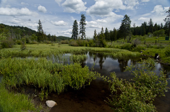
Kane Lakes, (2012) Photo (c) Karen Abrahamson

The Jesuits like Bressani were responsible for much of the early mapping of Canada, but in the 1800’s the missions and religious mapping was assumed by the Religious Institute of the Oblates of Mary Immaculate. This order was founded in 1816 in Paris with the motto that meant Right to the ends of the Earth! and they lived up to this when they established their first mission in Canada in 1841 with a focus on Canada’s north along the Mackenzie River Valley. Long-bearded and black robed, the Oblate fathers became well known to the Natives, but none more so than Father Emile Petitot.

Petitot came to the Mackenzie River in 1862 only two weeks after he was ordained. He stayed for twelve years, most of the time travelling with Native companions through the uncharted north from Great Slave Lake to the Arctic Ocean and between the Mackenzie and Laird rivers. He made detailed observations of the Native communities, down to the condition of their teeth and the level of stammerers in specific populations. He learned much of the Native means of living including the guiding marks they placed on river channels to show which were open and which were dead ends. He made maps that set out geographic data of the interior of the northern basin, and discovered the Riviere a Ronciere-Le Noury—a river that geographers denied existed for eighty years, until aerial photography proved Petitot was right.
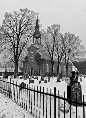
Quebec churchyard. (2005) Photo (c) Karen Abrahamson

Petitot’s maps made him something of a celebrity in Paris, Ottawa and London, but he was also watched closely by his superiors. Historians describe Petitot as something of an absent-minded dreamer who longed for long voyages, but who also was apt to freeze his fingers because he’d forget to wear his mittens. As well, his missionary duties went something by the wayside. He spoke native dialects fluently and was accepted by the Native groups he met, but he had some unfortunate predilections towards young native men and was excommunicated at one point. Mental illness also plagued him. He variously predicted the end of the world,  proclaimed his superior had murdered Jesus and the Virgin Mary, and could become erratic and violent. During these dark spells he would be tied down and placed under guard to stop him from running naked in the snow. It was not until 1882 that he was quietly placed in a Montreal mental hospital after which he returned to France for good.

Petitot’s departure ushered in an era where the religious orders were no longer so prominent in Canadian cartography. But their memory lives on in the ranks of Canada’s memorable cartographers: the devout, the brave, the mad.


Maps, Childhood, Disease and Living Bridges

Maps, Childhood, Disease and Living Bridges

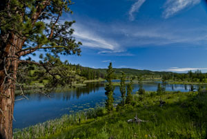
One of the Kane Lakes, Central British Columbia (2012) Photo (c) Karen Abrahamson

Two weeks ago I wrote about the rampant development planned in one of the cities here in the Lower Mainland in British Columbia. They plan to ‘develop’ most of the large wooded acreages remaining in the city into high density housing developments, that, if they are anything like the other development in the city, will strip all trees from the landscape. When I questioned that decision I was told that the land was just too expensive to keep in forest. This week I’m questioning that decision.

You see there is increasing evidence that contact with nature has profound effects on both adults and children, with the impact even greater for children. For example, research indicates that children with attention deficit are better able to concentrate after contact with nature. Children who regularly play in a natural environment have better motor skills and are sick less often. The diverse play opportunities of the natural environment leads to increased collaboration and improved language skills. Outdoor environments are important to children’s development of independence and autonomy. And these are just a few of the developmental benefits of nature for our children.

Doing what kids do. The nieces at Buntzen Lake. (2011) Photo (c) Karen Abrahamson

At the same time, we are seeing the development of what some researchers are calling a ‘childhood of imprisonment’ as opportunities for play in natural surroundings are being paved over and built upon and parents become so concerned about their children’s safety outdoors that play outside has virtually disappeared. Locally we see this with the proliferation of townhouses intended for young families being built with no yards, so that children are forced to play inside, unless a parent is willing to take children whatever distance it takes to get to a park.

If you don’t care about child development, other research (and maps) speaks to the impact of the destruction of natural habitat on the incidence of disease. A recent article in the New York Times pointed out that hot spots of emerging diseases and potential pandemics are where deforestation is occurring. As an example, researchers point out that a 4% increase in deforestation led to a 50% increase in malaria in some parts of the Amazon basin. Closer to home, North American deforestation has led to the increased spread of diseases like West Nile Virus and Lyme Disease, that are spread by robins and mice respectively. In both these cases, the replacement of forest with habitation of agricultural fields, tipped an ecological balance that favored animals and birds without their usual predators. This link takes you to an interesting map that shows that hot spots don’t just abound in other parts of the world. In North American areas of greatest risk exist around most of our largest urban centers—including here in British Columbia.

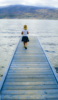
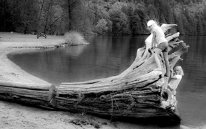
Jo at Okanagan Lake (2011) Photo (c) Karen Abrahamson.

Today’s children live lives far different from what my generation enjoyed when we could go play down the block, in the park, and even in the woods. It used to be that during the summer children escaped outside to play in the fields or the local creek or the woods. Sometimes it was a vigorous game of tag. Other times we sought treasure with our homemade maps. Now children’s indoor lives have them living in a world that is dominated by media. Not only is this a loss for the children, but it is a loss for nature, because children raised without contact with nature and animals will have less reason to care about the natural world. Children’s experience of nature is being limited to T.V. programs like National Geographic and they are growing up thinking that nature is exotic and not learning that nature is right outside their door and that they must care for it.

This should concern all of us, for raising our children away from nature, means that we are separating them from a large part of who and what they are and stealing their access to an important natural legacy. Humans might think they are above, and can control, the environment, but as we see the impact of climate change wreaking havoc across America and the world, perhaps we need to rethink our strong-arm approach dealing with the coming disaster, and instead turn our minds to a more conciliatory approach to nature. It has been done before. As this lovely video about the living bridges of Northeastern India show, sometimes nature provides its own answer to a problem, if we can just value nature enough to listen and hear.

The Living Bridge


Maps, Mergers, Detours and the Other Direction

Maps, Mergers, Detours and the Other Direction

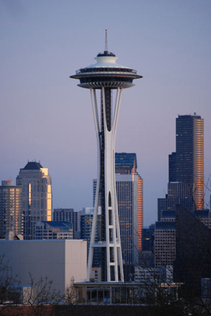
I just got back from Seattle (my OTHER favorite city), from a whirlwind trip to a Clarion party to see my old writing instructor Connie Willis (she teaches a mean reversal and wonderful lessons on plot). I travelled with another of my Clarion classmates (Class of 2001) and we were struck by a few things that got me thinking about maps and directions and foreign countries.

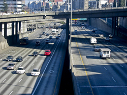
You see, there we were following the directions provided by Google maps (I prefer maps over GPS any day)and we were trying to get from I5 to the Queen Anne area when we discovered that there apparently is different English used for American directions than for Canadian. The American directions told us to merge when to Canadians it was clearly a left hand turn. ( A merge being something you do from an onramp onto a freeway.) In other spots we were told to turn left or right, when clearly to our Canadian eyes it was a merge. Needless to say, while we didn’t get lost, there were times I was seriously glad I wasn’t a driver behind us. I mean what were these crazy foreigners doing?

Of course our trip home wasn’t any easier. Not only did we have to navigate the many one way streets, that area of Seattle seems perennially under construction so we had to deal with detours. The main Lake Washington Bridge was closed which meant we couldn’t easily take a side visit to Redmond, and the downtown was also chewed up by construction so that we had to follow detour signs to get to I5 again. The interesting thing was, if we hadn’t been going to visit friends in Redmond we would have been seriously in trouble, because the detour signs just got us to the highway – headed south instead of back to Vancouver. Later, as we attempted to find our turn off, we had to deal with signs that said X Exit merge left and then, a quarter mile later, X Exit merge right.  Again I was glad of my foreigner license plates that at least gives me some license to be a little confused as I madly slalomed across the highway.

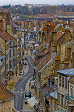
Christmas Street, Besconson, France (2005) Photo (c) Karen Abrahamson

All of this put me in mind of my travels in other countries where charming street signs have tickled my fancy. My favorite continues to be crossroad signs in France:  Paris with an arrow pointing in a certain direction, to Pontarlier, with an arrow pointing in a second direction, and a third sign with an arrow saying Les Autre Direction (the other directions). Maybe it’s just that North Americans have more need for specificity, but these signs always made me snort with laughter. I mean, of course the sign pointed in another direction, the question (for me) was what direction was it? Although I drove many places with my friends I don’t recall ever driving in that direction. So today as I wended my way home through the deceiving streets of greater Seattle I think I may have found myself unknowingly travelling Les Autre Directions. The surprising thing is I got to where I wanted, whether the signs led me there or not.


Mapping the Mind: Birds, the Inuit and Urban Development

Mapping the Mind: Birds, the Inuit and Urban Development

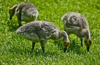
Canada geese goslings. (2012) Photo (c) Karen Abrahamson

Last week I wrote about some of the maps that helped create a country. This week I want to write about maps and development here in my little bit of Canada. You see, recently I attended a City planning meeting about the planned development of said city over the next thirty years. The city planner was there to gain input to the plan, so like I am wont to do, I opened my mouth. I asked whether there were plans included for city parks that were more than playing fields. In particular I asked about retention of trees.

You see the city plan targeted three areas of the city for development. This meant that the areas that currently hold some of the last large acreages with the last stands of mature trees would be logged off and cut up into micro-lots of high-density houses and townhouses. If the development practices I see in other areas of this city are any indication, the landscape will be reduced to a wasteland of ticky-tacky houses and spindly trees planted so they don’t block resident’s views. The aim is to build the highest number of houses on the smallest lot, which doesn’t leave a lot of room for trees. Land costs too much.

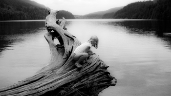
Jo at Buntzen. Children need the opportunity to be close to nature. (2011) Photo (c) Karen Abrahamson

I know, I know. People have to live somewhere, but the prospect of this loss left me so angry I felt poisoned inside. I’ve been trying to figure out how my perspectives have wandered so far into ‘radical’ territory from what now seems to be mainstream. You see, I worry about the other creatures we share this earth with. I worry about the air-cleaning capacity of the trees we’re cutting down. I worry about the birds and the squirrels and the other creatures we’ve displaced with our houses.

The worst part of the episode was that few people in the meeting seemed to share my concern.

A recent survey of birds in Canada, showed a decline of 40% plus across most species. Here in B.C. the decline is 35%, but with every development permit, you can bet the bird population is a little bit less. Over the last ten years that I’ve lived here, the flocks of swallows have decreased so I see less than ten on a morning walk. In my own townhouse complex, the council is continually cutting down lovely mature trees that provide homes to song birds and safety from predatory crows and starlings, in order to improve the view of some homeowner.

So what does this have to do with maps, you’re wondering. Well I recalled reading about Inuit maps and how they are ephemeral things. Each member of an Inuit tribe builds cognitive maps that remember and recognize different things. Shamans remember where malevolent spirits dwell. Hunters carry knowledge on moving over the landscape and the sea, while the women recognized the safest campsites and the sources of berries and seaweed. When asked to draw maps of particular areas, Inuit elders drew proportions skewed with places of greater importance presented larger, and those of lesser importance, drawn smaller. Place names, unlike our western tendency to name places after historical people, are based on a location’s physical, biological or ecological significance. Their names evoke images like ‘the place where the rocks are warm from the bodies of walrus’, or convey not only that a place is flat, but also that in winter the land and sea look continuous. For the Inuit, a map is not just a representation of the world. It becomes a lens that layers meaning on a place and that meaning is carried in place names.

Right now, with the inroads of western culture on the north, the place names that made up these northern cognitive maps are being lost, and placing at risk the understanding of the relationship of the Inuit to the land they inhabit. This seems to be what has happened in this city. People have forgotten the importance of having nature around them, and thus it is being eroded away. The loss of a word, the felling of a woodlot. It happens so gradually and then the knowledge is lost and the trees and birds are gone.

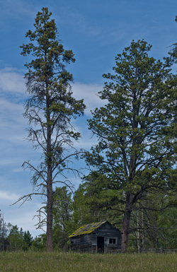
Cabin on the Kane Lake Road, B.C. (2011) Photo (c) Karen Abrahamson

I’ve come to view myself as one of the old ones that carries an old fashioned cognitive map of what my city should look like. Unfortunately no city planner understands what I’m talking about and hat no one but maybe an anthropologist or someone of my generation might understand my anger.

I wonder if the Inuit language contains a name for a silent landscape where no bird sings and all the houses look the same.


Recent Fantasy

Available HERE,

$1.99

Available HERE,
$3.99

Available HERE $1.99


Recent Mystery


Available HERE
$4.99


Available HERE,

$4.99


Available HERE,

$4.99


Available HERE,
$4.99


Recent Romance

Available HERE, $2.99