Tag: America

Boundaries and Goals: The straight edge of the map
Boundaries and Goals: The straight edge of the map

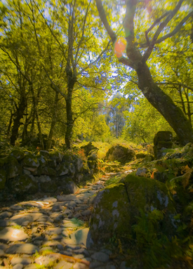
Old Roman Road, Portugal (2005) Photo (c) Karen Abrahamson

I just read a great post by my friend and fellow writer, Matthew Buchman. Matt wrote about goal setting and why he always sets hugely high goals, and how he (usually) berates himself for not reaching those goals instead of celebrating the numerous accomplishments his goals have helped him achieve. He also wrote about how he intends to continue set superhuman goals, because it keeps him going, pursuing the dreams he has for his writing. This got me thinking about goals and maps, because what is a goal, anyway, but a map of where you are trying to go? You set your goals farther and you’ll probably go farther. You set easy to accomplish goals and you might not reach the brass ring you really wanted to achieve.

This made me think about the boundaries we place around our lives and how the mapmakers of North America have perhaps influenced how we think. I’m talking about the surveyors who first set boundaries across the landscape. At first, North American surveyors took a metes and bounds approach to surveying, much the same as is used in England. A metes and bounds description might be something like, Beginning at the cherry tree growing where Hazy Creek joins the Swift River, north along Swift River 200 rods to the stone wall next to Cascade bridge bordering the road, then West along the road to a lightning-struck maple at the corner of Christopher Hopper’s place, thence, south toward Hazy Creek where a cairn has been set next to the ford, and thence eastward along Hazy Creek to the beginning place.
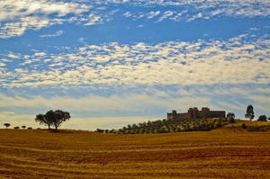
HIlltop Fortress, Alentejo, Portugal (2005) Photo Karen Abrahamson

This approach to placing boundaries relative to the landscape, shifted with the survey of the Mason-Dixon line, to an approach dependent upon accurate readings of latitude, and on a process of taking horizontal measure with a chain and surveyors level and frequent (every 10 degrees or 17.5 kilometers) astronomical observations. They even made careful adjustments for the earth’s curvature.

Surveyors subsequent to Mason and Dixon used similar methods as they moved forward to comply with the Land Ordinance Act of 1785, which modified a proposal originally made by Thomas Jefferson, to use the principle of rectangular surveys, instead of the irregular metes and bounds, to partition the landscape. Congress envisioned a series of townships along the Ohio River and up to the great lakes and so on westward. As a result, teams of surveyors headed west with axemen chopping a line through the forest. Of course the Indians had other thoughts about the measuring of the land which they thought of theirs. But the surveyors kept coming and the trees fell as the surveys were made and the lands of America became something new: a checkerboard landscape of straight lines and right angles as exemplified by the four corner meeting if Utah, Colorado, New Mexico and Arizona and as seen on any map of America.
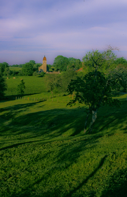
French village spire (2004) Photo Karen Abrahamson

How does this relate to goals? Well all these straight lines got me wondering if setting too-clear boundaries might also set boundaries in our minds. It got me wondering if Matt’s ideas of setting goals that almost surely surpass our abilities (read boundaries) might actually make us reach farther.

With that in mind, I’ve modified my annual writing goals as follows:


Original:

  • Write 30 pages a week
  • Write four novels (or three if one is a fat fantasy)
  • Post one blog a week
  • Publish at least one new short story and three novels
  • Work on craft of openings and voice

Revised writing goals:

  • Write 30 pages a week
  • Write four novels (or three if one is a fat fantasy)
  • Post one blog a week
  • Publish 25 items (Novels and short stories) in 2012
  • Work on craft of openings and voice.
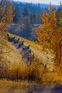
Snake fence along the Kane Lake Road, British Columbia, (2006) Photo(c) Karen Abrahamson

The thought of publishing 25 items fills me with fear because it means I have to write those stories or novels. I knew I could accomplish the 3-4 novels, but I don’t know if I can accomplish this. So I’ve stretched beyond those neat little borders I set for myself. I’m back into the wild spaces marked by metes and bounds. And you know what? If you fly over all those neatly surveyed spaces, you’ll find that fence lines and roads and buildings generally follow more natural paths anyway. So here’s to breaking boundaries and going to those new places nature takes us.


The World is Flat: An ode to Columbus and all erroneous beliefs

The World is Flat: An ode to Columbus and all erroneous beliefs

The shapes of the world’s continents have changed ever since the time of the supercontinent, Pangaea. We’ve all seen the renditions of the continents shifting and South America unzipping from the edge of western Africa. Just looking at a map of the world it’s possible to see how the pieces of the earth fit together once. It may even be possible to conceive of how the continents might look millions of years in the future as the tectonic plates shift and move under and over each other. We think we know this now, but other ages of people thought they had the world’s shape figured out, too.

Contrary to popular belief, it didn’t take Columbus’s discovery of America to prove to the world’s thinkers that the earth wasn’t flat. Yes, in some parts of the world the belief was that the earth was a disc travelling on the back of a giant turtle, but back at the time of the Greeks and Egyptians and even before them, in China, great thinkers postulated that the world was round. They used logic and observation of the sun’s movement and shadows, as well as the way ships sink beneath the horizon to mathematically prove the earth’s general shape. What they didn’t know was the earth’s size. But that’s another story. They did, however, also theorize that the southern part of the earth were too hot for any human to inhabit. Happily for our friends south of the equator, they were wrong.

It was the Middle Ages that led to the belief that the world was flat. Maps became conveyers of religious dogma, as opposed to a representation of world. I’ll talk on this later, but as the world moved out of the Middle Ages into the Age of Discovery, the debate began about the shape of the solar system and whether it was terra centric (the sun and moon and planets revolving around the earth) or sol centric (the earth and all the other planets revolving around the sun). At the same time as these debates raged, people also debated the shape of the world’s continents. The prevailing belief seemed to be that Asia not only extended far to the east, but that it then hooked down and around the Indian Ocean to connect with the as-yet-undiscovered Cape of Africa, leaving the Indian Ocean as a land-locked sea.

What’s most interesting, is how human beliefs shaped the world around us. Think of the generations who grew up with these various beliefs. To them, the world WAS flat or the Indian Ocean WAS landlocked, or we really DID rely on a turtle to hold the whole thing up. That strength of belief colored all the beliefs of the early exploration of the east coast of whatever it was that Columbus discovered. first they believed it was the east coast of Asia. Then they believed it was a thin rind of a place, like a reef, that they could sail through. The maps show this. They show the ill-fated North West Passage, too – something that may finally exist if global warming continues its work.

In all of these cases it was the strength of their generation’s belief in what they’d drawn on their maps that kept explorers coming back to what became known as the Americas – and dying – again and again. When other beliefs gradually overtook the old ones, we gradually learned that what Columbus had really discovered was two new continents. Those layers of beliefs gradually reshaped the maps and thus the world we live in, much as my Cartos characters can believe and draw a new world into existence .

Which makes me wonder about the power of beliefs even today, when those who believe in a flat earth and those who believe in a round earth still wear away at each other like tectonic plates. Is it possible for such disparate beliefs to live side by side, or do these people actually inhabit two separate worlds?

And Columbus? He might have ‘proved’ that the earth was round, but he went to his grave believing that what he’d found was the backdoor to Asia, thus demonstrating that even an icon like Columbus could be blinded by his map of the world.

Recent Fantasy

Available HERE,

$1.99

Available HERE,
$3.99

Available HERE $1.99


Recent Mystery


Available HERE
$4.99


Available HERE,

$4.99


Available HERE,

$4.99


Available HERE,
$4.99


Recent Romance

Available HERE, $2.99