Tag: Travel

Maps, Highways, and Their Imprint on The World
Maps, Highways, and Their Imprint on The World

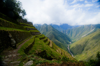
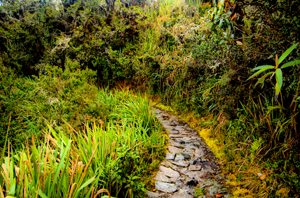
Path through the rain forest on the Camino Inca, Peru (2011) Photo (c) Karen Abrahamson

The ancient T.O. maps didn’t represent reality, but they did map the reality of the Christian spirit at the time. Portolan Charts gave a realistic representation of coastlines and the work of the Indian spy/cartographers, placed rivers on the maps well before aerial mapping existed.

One of the last bastions of ‘unmapped’ territory was the Amazon basin of Brazil. In 1799 Alexander von Humboldt, the son of a Prussian baron, spent five years travelling from Venezuela’s Orinoco river through the Amazon, collecting specimens and surveying. Afterwards he produced 33 volumes of maps and illustrations. That was the last mapping for over a hundred and fifty years except for the occasional scientific or rubber company exploration.

Until 1970.

That’s when the Brazilian government got the idea to construct a highway from the Atlantic Coast, across 5,000 kilometers (about 3,400 miles) of rainforest to the Peruvian border. The construction was a nightmare due to a dearth of maps. The rainforest had too many clouds and—gee, rain in a rainforest?—for aerial mapping to work. The result was construction following ground-based surveyors who were barely ahead of the bulldozers and this led to the construction having to cross the same river multiple times leading to enormous unforeseen costs.
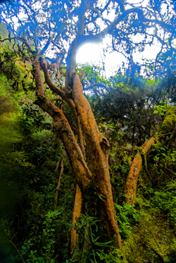
Cloud Forest tree along Camino Inca, Peru (2011) Photo (c) Karen Abrahamson

Enter the cartographers. In this case it was cartographers and the invention of side-looking radar (SLAR). SLAR is an improvement on the radar that helped safe Great Britain during the Battle of Britain. It’s the invention that allows radar to be shot out the side of an aircraft to take long horizontal pictures of the landscape. This technology can ‘see’ through clouds and trees to the landforms. With the help of computers, SLAR can provide accurate pictures of the rise and fall of the landscape.

The survey team with their aircraft arrived in Brazil on the summer of 1971. In just under a year SLAR mapped the Amazon in 32-kilometer-wide swaths which lead to the first detailed maps of the Amazon and an understanding that this huge territory wasn’t the previously-thought Amazon “basin”. Instead they found that only about 20% of the area was lowlands, with most of the landscape being hilly and mountainous.

This ‘sped up’ the construction of the highway which was completed in 2011 except for a single bridge in the Peruvian part of the road. But what has this meant for the area? For some, it replaces weeks of travel on dirt roads to a relatively short drive. For others it promises income from a potential huge influx of tourists. But what it also means is environmental degradation.

Brazil has a long history of environmental issues springing directly from road-building into this relatively delicate biosphere. Previous road building shows that almost 90% of deforestation lies within 50 kilometers of a road (about 23miles). Timber and mineral extraction are followed by hydroelectric dam development and the destruction this causes.

What’s disturbing is that the Amazon is truly the lungs of the world and cartography has provided the data needed to seriously damage those lungs. It places a different perspective on maps; one that undermines the beauty of what I’ve always thought and suggests the need for ethical standards that stand up to the push of corporate greed.
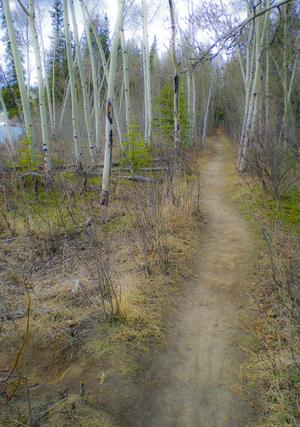
Path along the Yukon River. The quiet places like this are the ones lost in rampant development. (2010) Photo (c) Karen Abrahamson

There are means to ameliorate the potential destructiveness of developments like the Transoceanic Highway or the construction of pipelines like the proposed Northern Gateway pipeline through British Columbia, but it requires people like cartographers, citizens, and government officials to demand agreements that protect the environment BEFORE, planning starts. Otherwise ‘progress’ can just as easily lead to widespread destruction like what is happening in the Amazon.

The new maps of the Amazon not only map progress, but also the destruction of a reality. Unlike the T.O. maps of the Christians that cemented the Christian spirit firmly in Jerusalem, these maps not only mark destruction of biodiversity, but they record the destruction of the spirit of the indigenous people.
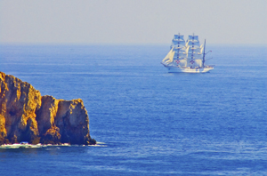


Faith, Maps and Portolan Charts

Faith, Maps and Portolan Charts

Okay, I’m anachronism. It’s Easter Sunday and so I’m writing about faith—well, a little bit of faith—faith and maps.

As I’ve said, I like maps and will continue to use them. Though many people are turning more and more to GPS systems in their vehicles, I still have my trusty book of street maps of the metropolitan area where I live. When I pull out my yellowing, dog-eared map book I’m reminded of the volumes of Portolan charts of old, that were the predecessors of the Mercator projection I spoke of HERE.

Portolan charts were mariner charts, used by sailors to navigate the Mediterranean and then the coasts of Africa and Asia. The earliest existing portolan chart dates from 1290, but records as early as 1270 talk of a captain pulling out charts to convince a frightened king that their ship really could reach land during a terrible storm. Portolan charts have distinctive features, most noticeably the rhumb lines and compass roses that gave sailors bearings to set their sailing headings. These rhumb lines set out the four cardinal directions and the principle wind directions (North, Northeast, East, Southeast, South, Southwest, West and Northwest) as well as the eight half-winds (NNE, ENE, etc.) Portolan maps also had detailed, careful place names along the coast, color coding of places to show importance, and standard ways of showing rocks and shoals, while overemphasizing bays and headlands—all important information for sailors trying to reach safe harbor. This is very different from the predecessor of the Portolan, the medieval mappamundi , which generally had East at the top, and Jerusalem at the centre without any detail. The mappamundi were there to represent a way of thinking for the faithful; all they really needed to know was the location of Jerusalem in relation to where they lived. By contrast, the portolan set out in detail the way to make your way in the world.

Yes, there were issues with the portolan charts. They used a rough scale, but had none of the accuracy the Mercator Projection provided. Still, they served their purpose.

No one knows who made the first portolan chart, but researchers have shown that those we know about were copied, some by tracing (they can tell by small pinpricks left in the vellum, and some by simple eyeballing). Portolan charts were also generally written on vellum—sheep or calf skin prepared in such a way that the narrow end of the beast (toward the neck) could fit the narrowing of the Mediterranean. The vellum could handle the rigors of sailing better than paper could and vellum could role up for easy storage or could be made into volumes of portolan charts. Of course, because they had different makers, different parts of the world were drawn using different scales which made it a challenge to draw up larger maps of the world.

But portolan fell out of use with the advent of the Mercator Projection because, while the portolan charts were good for the Mediterranean and coastal shorelines, they were not as good for great sea voyages where the Mercator Projection provided relatively easy ways to chart a route from places like South Africa to New York.

So the beautiful, utilitarian portolan chart fell out of use, just like my map book has fallen out of favor in comparison to those tiny black box GPS units and smart phones that help gadget users to get from point A to point B. To me, it feels like civilization has taken a great leap forward by stepping back. No longer are we worried about great sea voyages (Mercator maps), or even the details of where such and such a place sits along the coast in relation to where we are (Portolan charts). Now we simply input our destination and trust the GPS to tell us which headings to take, much like medieval civilization trusted their priests to tell them how to live in relation to Jerusalem. Which makes me wonder whether we might have stepped right back to the days of the mappamundi, where our sense of direction is directly related to our faith—but today it’s our faith in technology.

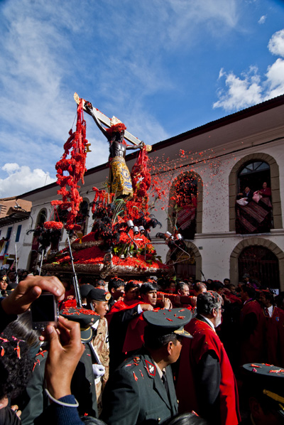
The Easter Procession in Cuzco, Peru. Flower petals are thrown whihc have, over time, stained the Christ figure black. (2010) Photo (c) Karen Abrahamson


The Satisfaction of Maps

The Satisfaction of Maps

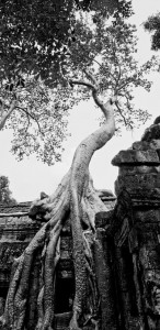
A wonderful fromage tree at Angkor ruins (2008) Photo (c) Karen Abrahamson

As I said way back when I started blogging about maps, some of my favorite early memories are of looking at maps with my family as we started out on some adventure, or as I fantasized about places around the world that I wanted to see. I guess that experience made me a map fan. In reaction to my blog about whether maps should be in books, a few blog readers reminded me that they also like to read maps and in particular find satisfaction in maps contained in books because those maps offer the opportunity to better understand the relationship and distances between places written about in the book. The readers enjoyed following along with the characters as they moved across the landscape.

This enjoyment with following voyages isn’t limited to readers. I recently lost an afternoon playing with the Facebook Cities I’ve Visited app. I think Facebook and Tripadvisor are on to something there – the need to record and understand just where we’ve been in relation to where we are right now.

I mentioned previously that I always carry a map when I travel and mark my journey down for my future enjoyment. As a writer, taken in conjunction with my journals, these maps always help me remember the places I’ve been or travelled through and provide a cartographic representation of terrain that my aging brain cells might have forgotten. But maps aren’t just used by me during my journeys. My family always hauls out the atlas and follows along as I wander. On my last trip, to Peru, a network of writer friends around North America followed along as I did sent in my blogs like an itinerant reporter. I suppose the satisfaction for them, was not only that they could follow along, but that they could also get a sense of the relationship of where I was to their location.

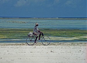
Shell seller on the west coast of Zanzibar (1994) Photo (c) Karen Abrahamson

Because although maps represent a greater world, they are also are very egocentric creations. By this I mean that maps are drawn by the creator not necessarily to draw reality, but to draw their reality. Case in point is a lovely 1886 Imperial Federation Map if the World Showing the Extent of the British Empire which shows Britain at the centre of the map (much as the medieval T/O maps showed Jerusalem at the centre of the known world). The wonderful map uses the Meracator projection which nicely enlarges landmasses in the northern hemisphere (including Britain) and also includes mythic Atlas holding aloft the world which is straddled by lithesome Britannia who is surrounded and adored by the lesser ‘races’ (read colonies), all peering up at Britannia’s greatness. Not simply a map it seems, but also a satisfying cartographic representation of the way Brits at that time wanted to view the world and themselves.

To some degree I think the Cities I’ve Visited acts something like the 1886 map: although we aren’t placing ourselves above the world, it gives us comfort with our place in the world. We create our representation of the places we’ve touched and maybe that gives them more reality for us. Perhaps that satisfaction also includes a little reassurance of our place in the world?

So when I was done with Cities I’ve Visited, I was very satisfied that I’d trod so many places in the world, but also fairly embarrassed. I felt almost like I was competing with some cyber-other to show that my vision of the world was broader because I’d been more places. Was it really a competition? The App said the average person has visited 17 cities. I was at 247 and I stopped when I started to feel really stupid (not to mention that I’d wasted a good chunk of the afternoon).

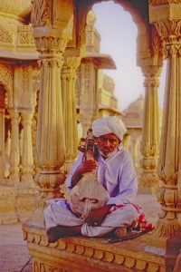
Muscian at tombs above Jaisalmer, India (2000) Photo (c) Karen Abrahamson

The whole experience reminded me of too many tourists I’ve laughed over who arrive at a place, leap out of the tour bus, take a photo and then leave to drive like mad to the next place and the next photo. That phenomena always put me in mind of a mission to collect places like notches on a belt – or like a dog leaving photographic spoor like doggie–do reminders of where they’ve been.

It makes me wonder if our egocentric need for maps is something like our need to collect, buy and own – as a means to quell our unquenchable need for satisfaction.


New Short Fiction

New Short Fiction

Two new short stories are now available on Amazon.com and Smashwords.

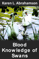
A small child, a string of pearls and a colony of swans converge in this short story of family life gone wrong. In Bella’s world of beautiful swans, her mother is the most beautiful creature of all. But swans abandon Bella every year and now her mother may abandon her, too. In a world filled with magic, what’s a child to do?

Amazon

Smashwords


Lost in Rajasthan, the home of camels, hevalis, ornate men’s turbans and women draped in mirror-embossed saris, freelance journalist, Lena, must deal with strange customs and two men who profess to love her. Choosing the right path can be as convoluted as the twists on a Rajasthani turban.

Amazon

Smashwords

Mapping Dark Matter – Walking Like an Inca

Mapping Dark Matter – Walking Like an Inca

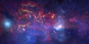
A recent Facebook posting referred me to an article about dark matter and how astronomers are mapping dark matter through space by identifying how light distorts as it travels through the invisible web of the dark. Scientists hope that, by mapping dark matter’s distribution through the sky, they can gain a better understanding of this substance and the underlying physics of the universe.

Reading this article reminded me of my recent trip to Peru and the unique Incan astronomy. Most of us are taught that the Incan’s worshiped the sun, and indeed the sun was a deity to the nobles. But beyond that worship, the Inca used their astronomical studies to not only follow the sun, moon and stars, but also to map the dark parts of the sky. They even had a special word for those places: ‘Yana Phuyu’, or dark clouds – the vacant places in the sky.

Huinay Huayna, Forever Young, hung above the Urubumba River (2011) Photo (c) Karen Abrahamson
Huinay Huayna, Forever Young, hung above the Urubamba River (2011) Photo (c) Karen Abrahamson

The Inca believed the Milky Way was a great river and the Yana Phuyu were animals called Pachatira that came from mother earth to drink at its side. These dark clouds were known and tracked across the sky and watched with interest. There was the fox, the black llama with her child, the serpent, the toad, the partridge. Each had their place in the sky and each was watched for signs of what would happen on earth. As the black llama descended from the sky she would lower her head and drink from the oceans to stop flooding. The toad, Hanaptu, rose in the sky, when the toads came out of hibernation, and Azoq, the fox rose during the summer solstice when foxes gave birth. For that was the strength of Inca astronomy, they truly believed ‘as above so below’. They watched the heavens and foretold the seasons and the rains by when certain animals appeared over the horizon or climbed the sky and, according to legends, major ecological events like devastating earthquakes and floods, along with the ages of the world.

But the Inca did more than that. They saw the heavens as a map of their world, with the great river of the Andes, the Rio Vilconota (aka the Urubamba) as the terrestrial version of the Milky Way. They recognized hundreds of holy sites (Huacas) around their empire that often were related to special days of the year and the places where the rising and falling sun was observed.

Today, stories of the skies are still taught to children in Inca villages. In Quechua they teach how the llamas in the fields watch the heavenly llama for news of the rains. They tell tales of the moon and his wife and how the ‘fall’ of the Moon’s wife led to the pumpkin-color of the soil in the Amazon. So though we will never know the true depths of Inca astronomical knowledge – too much was lost to the Spanish conquest – we do know that the Inca were much like the scientists of today: They mapped the heavens as a means to understand the connections of the universe around them.

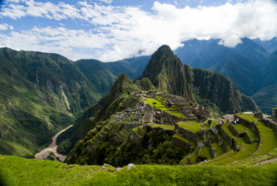
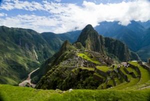
Machu Picchu caught in the coil of the coil of the Urubamba River (2011) Photo (c) Karen Abrahamson


A Christmas Map of Place and Time

A Christmas Map of Place and Time

I put up the Christmas tree the other day, uncovering each tissue-wrapped ornament before putting it on the tree. My mother commented on how each one was so unique and that made me reflect on how each ornament was a memory that solidified and evoked a place that I had visited, or a certain place and time in my life.

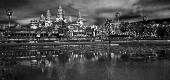
Angkor across the pool

On the tree were ornaments purchased in Peru, and others from Tanzania, Cambodia, St.Thomas, and India. The tiny painted gourd Peruvian cuy (guinea pig), hung side by side with the wee silk elephant I found in Thailand. A German bauble my mother-in-law gave me hung next to a globe found at a French clock-maker’s shop at a town next to the Swiss border and a Pueblo Indian Virgin Mary sent by my parents from Arizona. All of these brought back memories of Christmas eve feasts, times in the Angkor heat or the chill of the Himalayas, and standing on the Serengeti plains.

Two of the dearest decorations were a handmade snowman and a tiny wooden cuckoo clock. The cuckoo reminds me of times with my stepsons and ex-husband out riding the wilds of Central British Columbia. You see, that area is ranching country complete with wolves and bears and miles of undeveloped forest. In the winter it was covered with snow-laden pine and spruce. At Christmas, there was no better way to start the season than to saddle up our horses and head out into that pristine winter land.

We’d take an axe and an old horse blanket with us and head out into the forest, the horses blowing steam through their nostrils as they bounded through hock-deep snow, my sons rosy-cheeked as they raced their horses ahead until they came whooping back to announce that had found the PERFECT tree. That was what the ride was all about. We’d follow them – usually out to some clearing where a smaller tree would stand. My husband would dismount and shake the snow off, getting it all over himself and then, as a family, we’d critique the tree they’d found. If it passed muster, we’d chop the tree down, wrap it in the blanket and tether the blanketed tree to the horn of one saddle before starting our (much slower) ride home dragging the tree behind us. That would bring the official tree into our home and the small cuckoo clock was one of the first ornaments we bought as a family.

The snowman ornament was made by my youngest stepson. We didn’t have a lot of money in those days – at least not for ornaments for the tree – so he and I set out to make some. I still have the small green felt tree I made, but his is special: a stuffed white snowman complete with scarf, and broom and a black top hat all carefully sewn by ten-year-old hands. I smile and think of him, long grown to a man, whenever I find it each year.

And so my Christmas tree today is a guardian of riches worth more than the presents under it. Those glittering branches hold not only my memories, but also a map of the treasures of my life.

Merry Christmas.

Spy Lands –Who really discovered the coasts of America

Spy Lands –Who really discovered the coasts of America

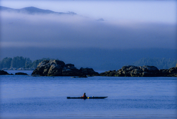
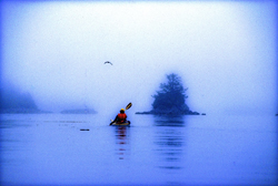
Kayaking the west coast of Vancouver Island, Photo (c) Karen Abrahamson

I mentioned last week about spies and maps and government subterfuge as aspects of maps that we rarely think about. Municipal governments still fool residents with streets on maps that are planned, but haven’t been built. Map makers take liberties with place names and add imaginary towns and streets that reflect their biases for and against university football teams. But in the past spies were frequently involved in cartographic subterfuge.

For instance, most of us were schooled that Captain Cook was the first European to lay eyes on the north western coast of North America. However there is mounting evidence that the English privateer (government sanctioned pirate) Sir Francis Drake, not Cook, first saw the coast of Oregon, Washington and British Columbia between 1577 and 1580 – 160 years before Cook’s journey.

Why isn’t this known?

First of all because some historians are hard pressed to let go of old ideas, but second of all because Drake’s journey was likely suppressed and evidence of it hidden, because of disputes with the Spanish that were, later, going to erupt into war. Drake is confirmed to have travelled as far north as Mendocino, California, the farthest north the Spanish had been, but a 412 year old map commemorating Drakes circumnavigation of the globe shows details of the coast of British Columbia that no one could have known unless they had been there. Additionally, archeological evidence – 1571 British coins and equipment – have been found in Oregon and Victoria, B.C. gardens, so that Drake is believed to have travelled as far north as Prince of Wales Island in Alaska. Finally, Drake’s cousin confessed under torture to the Spanish, that a fabled North Pacific island, Nova Albion, had been discovered by Drake and claimed for England 29 years before Samuel Champlain founded Quebec and before there was a Virginia on any map. This is believed to have been Vancouver Island, kept secret.

A further example of cartographic spies, deals with those icons, Christopher Columbus and John Cabot. Columbus, we’re taught, discovered the Americas while looking for China. Cabot’s fame is due to his first North American landfall by a European. Or at least that’s what we’re taught. But in a 1498 letter that was penned just months after Cabot’s historic return from Newfoundland, a spy in England wrote to Columbus and talked about earlier voyages by men from Bristol to the same place Cabot had been and that these earlier voyages had been to an “Island of Brasil” and that Cabot’s landfall “is believed to be the mainland that the men from Bristol found”. The spy’s letter also mentions that these voyages from Bristol were well known to Columbus – something that is further supported because Columbus had spent time in Bristol and Iceland in the 1470s – almost 20 years before he managed to convince the Spanish monarchy to fund his explorations. Did Columbus use this knowledge to convince Isabella? Did he use it to calm his crew on his long crossing?

We may never know, and even if we do, will it matter? For Columbus IS an icon that history won’t forget, but what this shows is how secrets and spies permeate the European history of maps, so that who really ‘discovered’ the coasts of America may never be known. Of course, just talk to a First Nations/Native American person and they’ll tell you we’ve got it all wrong anyway. North America had been ‘discovered’ long before any European left home.

The Place That Wasn’t There

The Place That Wasn’t There

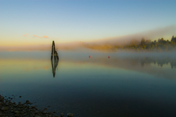
Mist on the Fraser River (2009) Photo (c) Karen Abrahamson

I fell off the map this week – at least that was what it felt like when I learned that I’d been removed from the intercom list at my townhouse complex. It doesn’t sound like much – a simple omission when they were doing the complex list – but think about it. To the outside world I no longer existed in this location. I inhabited an invisible place outside of the normal world that happened to be located between the house number below me and the one above – much like the safe house in Harry Potter but without the overt magic. I was gone, and so was my home and all the mementos I’ve collected from across the world. And of course my cats.

I’ve experienced something similar before, when I worked in the interior of British Columbia in a small town that was a long ways away from anywhere. When my agency’s reporting relationship shifted from one region to another, all the paperwork connections seemed to disappear and no one contacted us – it was actually quite a nice change. But it was also like we inhabited some huge fog bank that filled a space in the center of the province that no one knew existed. Our own personal twilight zone.

Kayaking the Broken Islands (1996) Photo (c) Karen Abrahamson

Such phenomena isn’t only in my imagination. Cartographers have been erasing or omitting bits of the landscape from their maps since before Prince Henry, when choice harbors and trade routes were secrets worth killing for. In order to gain a truer picture of the world, it became common practice for Kings to confiscate the log books and charts of each ship that came to harbor in order to copy them down before the sailors took ship again.

During the time of the early Portuguese spice trade, the location of, the Moluccas, the five tiny islands that were the sole source of nutmeg, mace and cloves, were closely guarded secrets. True maps of the eastern Indian Ocean were treated as highly classified documents (and few exist today) due to the possibility that the Portuguese were violating a Papal bull which gave the Spanish sovereignty over all lands west of a longitudinal line running 100 leagues west of the Cape Verde Islands (in the Atlantic).

During the age of exploration and when Spain, France and England were vying for the Americas and the Northwest Passage, maps were made that purposely misrepresented the landscape in case they fell into (and sometimes purposely intended for) the enemies’ hands. Such maps were intended to deter exploration by competitor nations because the harbor, the river, the inhabitable, productive land wasn’t there.

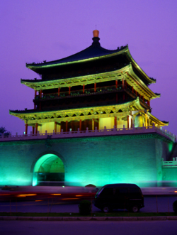
Xi'an tower (1998) Photo (c) Karen Abrahamson

Even today we see maps shift reality so that places exist differently than what you would find ‘if you were on the ground’. Road maps often include streets that are planned, but have never been built, or don’t describe that the street crossing that looks so direct on the map, can’t be made. A recent internet report showed that Chinese government maps of cities often change the position of major streets. Why? For military purposes. The government has apparently fallen back on the ancient practice of redrawing reality to stop potential invasion or intelligence gathering.

Happily, I’ve been replaced on the list of existing residents of my complex and so my home and I have been returned to reality. There is no longer a fog where my house once stood and my cats and I are all okay.

The Roots of the World

The Roots of the World

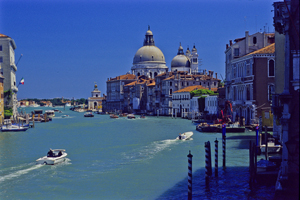
The Grand Canal, Venice (2005) Photo (c) Karen Abrahamson

For men like Fra Mauro (see last post), the exploration of the external world led to an understanding of the inner landscape of men. So too, from the triangulation of the world (see post here) came a greater understanding of the internal shape of the earth.

I mentioned previously that in order to determine the shape of the world, a French survey team went to Ecuador and Peru at the same time as a team went to Lapland. Unfortunately for the Peruvian team, the Lapland team discovered the answer to the scientific question long before the Peruvian team ever finished their survey. While in South America, however, the Peruvian team struggled over mountains and through jungles and noted different gravity readings as they took their survey measurements along their route. They surmised that the differences in the readings might reflect the varying landscape and theorized that mountains might be made of less dense material than the lowlands. A good theory, but it took over a hundred years for the matter to be more fully explored and the discovery was made far from South America. It took the British Raj’s need to survey India to bring understanding to what the mass of mountains might mean.

Machu Picchu caught in the coil of the coil of the Urubamba River (2011) Photo (c) Karen Abrahamson

In the mid nineteenth century, the horrendous task of surveying India through triangulation was almost undone by the discovery of an error of some 150 meters between the distance the triangulation measurements computed, and an actual direct surface measurement. To determine what had led to the error, the cartographers involved had to reexamine their assumptions – in this case they had assumed that the mass of the Himalayan Mountains would greatly influence the gravity measurements of their survey instruments. What they found was that they had overestimated the lower mass of the mountains.

This led to a theory of the earth’s crust that still exists today, namely that every (theoretical) column of the earth (from core to outer surface following a theoretical plum line) should have approximately the same mass. Given that tall mountains have a lower mass, they must have an equally large (but low mass) protuberance at the bottom of the earth’s crust to achieve the same mass as denser areas of the earth’s crust. Conversely, under the oceans where the ocean basins are very dense, the earth’s crust would be relatively thin. The theoretical result would be that inside the earth there would be a mirroring of the plains, mountains and ocean valleys we see on the surface, much like a tall iceberg has a large underwater presence to balance it out. Modern science has supported this, by obtaining crust measurements off the coast of South America that show the Andes have roots as deep as 75 kilometers.

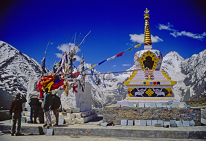
Stupa and Prayer flags at the Manali Summit (2000) Photo (c) Karen Abrahamson

Think of this the next time you are crossing the mountains, staring up at those tall, snow-covered peaks, for they are the frosting, the outer conceit of an iceberg of stone that conceals the deeper reality of the roots of the mountains.

Much like Fra Mauro saw the illusions of men obscure the truth of his map of the world.

Powell’s Books: A glimpse inside the cartographer’s mind

Powell’s Books: A glimpse inside the cartographer’s mind

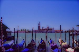
Gondolas, Venice (2004) Photo (c) Karen Abrahamson

The other day at Powell’s Books (Portland), I came across a wonderful little book called “The Mapmaker’s Dream” by James Cowan. The book is the translation of the diary of Fra Mauro, a sixteenth century Venetian monk and cartographer who set out to make a perfect mappamundi (map of the world) though he had never stepped outside the confines of his cloisters. Instead he gathered travelers’ tales through exchanges of letters or interviews of missionaries, merchants and soldiers travelling through Venice. His task became well known and he received envoys from as far afield as the court of the Chinese Emperor. Not only was this book astounding for the fact that word of his venture travelled so far in the 16th century, but the information he collected and the workings of his mind fascinated me.

Yes, his travelers brought stories of the Cyclopedes, beings in the southern hemisphere with only one huge foot that they used for hopping and also for shade when the sun in the antipodes became too fierce, but envoys also brought other tales that caused good Fra Mauro much reflection. This was what captured my attention for they showed a keenness of mind and a shifting view of the world much like new age philosophers. This seemed strange for his time; given Fra Mauro was a devout Catholic.

His encounters left him pondering whether the soul could possibly transmigrate into another person upon the death of the body and whether we are ‘all drifting towards a more complete life in someone else’. The visit of an old Jewish merchant from Rhodes left him contemplating how the loss of place (in the holy land) ‘condemned the man to inhabit his loss forever’ and how the rootless person came to inhabit a region of his own mind instead.

Schwedigon pagoda
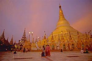
Holy Schwedigon pagoda at sunset, Yangon, Myanmar (Photo (C) Karen Abrahamson)

Visits from others left him considering how venerated holy relics become something more because of that veneration, and how those objects take on their own life because they unite an idea that men aspire to. They left him wondering at cultures that worshiped Satan and yet were not evil, and others that determined their actions and their future through the calls of seven forest birds.

But most of all he wrote of the minds of travelers. He was struck by the notion that travelers not only travelled with their bodies, but also that they travelled in their minds and were transformed by that travel or, alternatively, transformed the place they had been. He wrote of the journeys of envoys sent to find the mythic kingdom of Prestor John and looked at the evidence of such a kingdom – the long letter still held in the Vatican archives that describes a kingdom so perfect it could not possibly exist. Fra Mauro concluded that the reason the search for Prestor John’s kingdom became all consuming, was not just the desire for aid against the Moslem hordes, but the desire to know that it was possible for paradise to exist on earth. Travelers longed to become ‘slaves’ to Prestor John’s perfection and bounty. But the country of Prestor John would never be found because it was only built on dreams.

Buddha face, Sukhothai
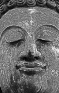
Buddha face, ruins of the ancient capital of Sukhothai (1997) Photo (c) Karen Abrahamson

Ultimately, Fra Mauro realized the challenge of creating a perfect map arose because each man’s perceptions of place were different and any ‘perfect’ map must capture not only the land forms, but also the forms of the world created by men’s minds.

The lowly monk of Venice completed his life’s work, but today no trace of his perfect mappamundi exists, except in references in the pages of his journal. Perhaps, like the worlds he described, it faded away to become the world as we know it today, but more importantly what his journal shows is a man of deep thought who’s Sixteenth Century perspectives still resonate with readers today.

Thank you, Powell’s, for this gift.

Recent Fantasy

Available HERE,

$1.99

Available HERE,
$3.99

Available HERE $1.99


Recent Mystery


Available HERE
$4.99


Available HERE,

$4.99


Available HERE,

$4.99


Available HERE,
$4.99


Recent Romance

Available HERE, $2.99