I’m excited to announce the Phoebe Clay mystery series with book one set on the cold waters of Canada’s Inside Passage.
School teacher Phoebe Clay had to retire after a terrible school shooting at her high school. Always known as the person to call when a mystery troubled her academic world, now she takes her crime solving skills to a larger stage.
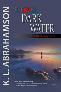
Through Dark Water, puts Phoebe on a kayaking trip to see the resident killer whales of Coastal British Columbia, Canada. When a whale turns up dead on the first day of the trip it only sets the stage for murder and mayhem on a more human scale.
When star investigative reporter Kaitlin ‘Seattle’ Blackwood arrives in Cambodia to look for her missing father, she drops right into the middle of the mystery her father left behind. To make matters worse, two strangers try to abduct her and the one man she had hoped never to see again rescues her. B.J. McCallum¾ ex-lover, ex-man of her dreams, ex-photojournalist¾ almost ruined her career when his exploded. He comes complete with his own heap of troubles: a murdered monk, stolen rubies and missing orphans, all might be linked to her father’s disappearance. Can Kaitlin and B.J. quit fighting long enough to solve the case and survive in a country where people have a habit of disappearing?
Once again, Karen L. McKee hits just the right note of humor as she leads readers on a romantic adventure, this time through the exotic, flooded landscapes of Cambodia during monsoon season. Shadow Play is a cross between Romancing the Stone and Raiders of the Lost Ark, a fantastic romp with wonderful characters and an authentic setting.
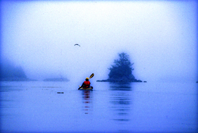
Kayaking the west coast. (1996) Photo (c) Karen Abrahamson
This past week I was supposed to be on the coast of Oregon with a group of writers learning about marketing books to bookstores. I was really looking forward to the trip and being with a group of great friends. I had everything packed and ready to be loaded into my car. My cats were primed and ready to for the trip. (They always travel with me, and the hotel where I stay at has known these boys since they were babies—it’s like a second home).
Then Ben, the larger of the two boys got sick and not just throwing up, but a total shut down. He quit eating (a VERY big thing for this guy) and drinking and became very quiet and cooperative. Now you have to know Ben. This is a cat that pulls paintings off walls and statues off shelves just to get your attention. When he took a downturn I ended up taking him to the emergency veterinarian. The next day more vets and more bills and at that point the I was still holding up hope that he might recover and I might still head to my course a day late.
Not to be.
Ben.
More tests, more bills and by this point I was administering subcutaneous fluids twice a day, force feeding three times and day and wrestling pills down his throat twice a day. It’s a wonder he’s still speaking to me. How do you spell stress?
The point I’m making here is that all my expectations were dashed and so I had to totally regroup and refocus myself from a week that I had booked off from work to a week working and caring for sick cats (yes, Ben’s brother got the same bug). It was jarring. It was unpleasant not least because I had a sick cat, but also because I wasn’t doing what my mind had expected. I raise this because it brought home something important writers need to think about, which is reader expectation.
Reader expectation is what the reader is expecting to experience in a book. For instance, if J.R.R. Tolkien had written a shoot-‘em-up Science Fiction book as a follow-up to the Lord of the Rings, think about how disappointed the Lord of the Rings fan would have been when they bought the book. Same goes for the reader who picks up a book that has a cover and blurb that looks like a suspense story, but when they get reading they find it’s women’s fiction. Or the reader whose book spends an immense amount of time early on lovingly describing the gun the hero owns, but by the end of the book the gun has never been used or even appeared in the story again. Each of these authors has violated reader expectations.
Shiva trying to catch a fly in Oregon.
A few days ago I was talking with a writer friend of mine. He was bummed out because his editor at a New York publisher had turned down book two of his two book contract and my friend couldn’t understand what that had happened. In discussion with the writer he advised that book one was a lavish fantasy involving the Jewish kabala. Book two was a comedic superhero novel. Anyone see a problem here? Apparently his editor did, because the publishing house had ‘bought’ my friend as an author of lavish Jewish fantasies, but his second novel failed to deliver this in every respect. The publishing house likely turned the book down out of concern for reader expectations. Basically my writer friend was asking to his readers to give up the expectations he had created through his first book and start all over again. I suggest that readers don’t like to do this anymore than I wanted to give up my week in Oregon.
In all of these cases the author failed to meet reader expectations and as a result the reader would have as dissatisfying an experience as I have had this week. Yes, the book(s) may still have been well written. My writer friends second book was undoubtedly wonderful (he’s a great writer), but it wasn’t what the publisher was banking on the reader wanting. He should have written another Jewish fantasy. He should have written under a different name for the superhero novel. Not that all our books have to be the same, but if we want to establish a career as a writer, we need to establish a brand. We might have several brands for different kinds of books written under different names. For instance my romance novels are under Karen L. McKee, while my fantasy/SF is written under Karen L. Abrahamson. It helps reader know what they are getting and this helps meet reader expectation.
So as writers we need to make sure that we don’t put our readers through the experience I’ve had this week. With two sick cats, I definitely didn’t get what I’d thought I bought when I booked the week off.
(and in case you were interested, the boys are both on the mend.
Porter on the Camino Inca. (2011) Photo (c) Karen Abrahamson
I purchased a lovely journal the other day. Though it’s not specifically a travel journal it certainly could be, because all of the quotes in the book relate to travelling, but when I read the complete quote by Lao-Tzu, all I could think of was its applicability to writing. The quote goes thus:
‘A good traveler has no fixed plans and is not intent on arriving.’
As someone who loves to travel, this quote provides a cautionary tale, because it warns that if you focus always on the destination you miss a lot along the way. Personally, I prefer to meander from place to place because you never know when you are going to find some better place to go than the place you intended. If you are always focused on heading somewhere, you have a much greater chance of missing where you are. As the Buddhists suggest, mindfulness of where we are, rather than worrying about the future (or where we are going) brings much more happiness than the rush, rush, rush of hurried travel. It’s for that reason that I don’t take bus tours. The tours point out what they think you want to know, not what you can really learn just by being there.
Yukon path, (2008) Photo (c) Karen Abrahamson
But Lao-Tzu’s quote applies equally to writing. The writer who spends all his/her time solely focused on completing a project isn’t really giving themselves the opportunity to enjoy the project. I’m not saying that you should fool around and never finish, I’m suggesting that you should enjoy the process, no matter how difficult it is, and—just like the traveler who takes the time to meander you don’t need to be so end-driven that you can’t enjoy the little sidepaths that your muse sends you down.
I guess what I’m talking about is allowing the story to carry you along, just like the road can. You don’t have to know where you are going exactly, though you may have a vague idea that you would like things to end in a certain way. Some of my best days of writing are when I have allowed the story to carry me away from the story I had intended—those are the mornings I get up and rush to get writing again because I want to know what happens next. The funny thing is that if you allow the little digressions and flashes of insight to lead you, often the ending will turn out to be some place better than what you envisioned. Believe me, if the ending surprises you, it’s going to surprise and charm your reader, too.
So as a recovering ‘plotter’ of novels I think all novelist should allow themselves the freedom to step off the path they are following to explore the new world they’ve created. They might just find it’s bigger and better than they ever imagined.
Angkor Wat reflections. (2009) Photo (c) Karen Abrahamson
Rajasthani girls with Mendhi on their hands. (2000) Photo (c) Karen Abrahamson
Exactly one year ago I wrote my first blog about maps and decided that I would write a series on that topic– maps, their history, the people who made them, and how maps have been used by people. I did this because maps are integral to the series of books I write in the Cartographer Universe and I wanted to understand more deeply what maps have meant to humankind.
What I’ve come to understand is that maps can be a truth, a lie and a metaphor. They can present the ‘reality’ of the physical world—the mountains and rivers and roads and cities and can inspire men to superhuman acts just to complete a map. Just as often, though they represent lies or half-truths—the imaginary island of Brasilia, the shifting landscape of Prestor John’s Kingdom or, more overtly, contorted landscapes intended to lure the unwary into towns, gold fields and department stores. And that’s a problem, because we tend to think of maps as representing the truth and we don’t approach maps with a ‘use at your own risk’ mentality or with the realization that any map may only represent the reality that the map’s maker wishes to represent. They’ve been used this way for centuries, so that the modern-day Chinese maps which change the location of major city thoroughfares to stymie the advance of any potential invasion are only an extension of the same tradition that caused British mapmakers to make erroneous maps of the West Coast of Canada (presumably to stymie the work of Spanish spies), and the Portuguese and Dutch Kings who kept secret their routes to the spice islands.
Ship off the Portuguese Algarve, (2005) Photo (c) Karen Abrahamson
But maps are much more than simply tools to convey or obscure information. Maps are a part of our psyche so deeply engrained that the map metaphor has seeped deep into our culture. Cervantes wrote ‘Journey all over the universe in a map, without the expense and fatigue of travelling, without suffering the inconveniences of heat, cold, hunger, and thirst.’ Shakespeare wrote “In thy face I see the map of honor, truth and loyalty.”
The Camino Inca Trail to the sacred city of Machu Picchu. (2011) Photo (c) Karen Abrahamson
But maps themselves are not truth, but metaphors. Once, in Fra Mauro’s time, they represented the mythical extent of man’s imagination and potential. Once, they represented the adventure, the spirit of mankind in the terra incognita of the empty sections of the map. Nowadays they represent the world as governments want it to be when they represent contested borders (think the current battle over islands between Japan and China, or the oil-rich islands in the South China Sea that three countries claim). Maps are used to represent presidential aspirations, shifts in battlefields, oil pipeline routes, and enemy and friendly countries—not that these presentations are the truth, but they are one truth—the truth that the mapmaker wants us to believe.
In this day and age when maps are no longer produced by a person hunched over vellum and ink, we must remember that many things influence the mapmaker’s pen. Everything from politics, funding sources and the publishing company’s allegiances represent what is filtered onto the page. Which brings me to my final conclusion about maps and the truth. They have always been creatures of the imagination and not of the truth, no matter that they grew out of scientific endeavors, but now that purpose of inciting the imagination is being used with more strategic purpose than ever before. Can we trust maps? No.
As Herman Melville stated so well:
It is not down on any map; true places never are.
Porto boats at dawn , Porto, Portugal. (2005) Photo (c) Karen L. Abrahamson
Most of the maps I’ve written about over the past year have been maps setting out the geographic formations of the world—regardless of how skewed the map-maker might have made the map in order to influence the beliefs of others. But some maps are made to represent truth and to save populations from dangers, so today we’re going to look at a specific type of map—those used to convey earthquake danger. I’ve been researching this because it relates specifically to the current novel I am writing called Aftershock.
Most of us are familiar with California’s San Andreas fault, the 800 mile long fault that stretches northwest-southeast in California and that brings Los Angeles (west of the fault) two inches closer to San Francisco (east of the fault) each year. This much-talked about fault line has been the subject of disaster movies and books, and also of reams of geological research. The damage caused by the fault’s quakes led the State of California to have the San Andreas and other surface faults mapped and to require disclosure of proximity to fault lines in any residential real estate dealings in the state. The trouble is, that even though these maps are available, most people – even those who have lived in proximity to a faults line seem uninformed about the dangers and new buyers of homes are positively unaware of their proximity to faults even though they sign disclosures in their ‘offer to purchase’ agreements. Why? Because maps and the language around them can either be used to convey danger or to minimize it. In the case of the California real estate disclosures they say that the house is in the San Andreas zone, but they don’t specifically use the language ‘earthquake fault zone’.
Cypress knees and trees, Orlando (2012) Photo (c) Karean Abrahamson
Another example or earthquake danger maps, and one dear to my heart (given I live on the south coast of British Columbia, Canada), are the ones that show the Ring of Fire around the Pacific Ocean basin. Nothing brings home the dangerousness of the place I live as seeing the numerous dots presenting quakes over 4.0 magnitude in recent history around the Pacific. You see, there are so many dots that a thick black line extends around virtually all of the Pacific except for the stretch bordering the Antarctic and a small section of North America – the part of the coast where I live. Okay, so there hasn’t been a moderately sized quake here in the past 20-30 years (yes, Seattle has had one, but not here, so far). In fact there hasn’t been a really big one here in a heck of a lot longer than that. But historical evidence and that ring of dots around the ocean says that there’s a very good chance one will happen one of these days. Around here we grow up being told to be earthquake prepared. Are we? Given the number of schools that haven’t been seismically upgraded, I’d say ‘no’, even though the maps are there to show us the danger.
So why do we refuse to listen to the maps? A likely answer lays in another part of America. Right in the heartland of the U.S., where Missouri, Tennessee, Arkansas and Kentucky meet, in 1811/12 near the small community of New Madrid, a series of massive earthquakes (magnitude 7.5 and 8) wiped out entire fledgling towns, sent sand and water geysering into the air and lifted huge chunks of the landscape. The only thing that stopped huge loss of life was the fact that few people lived there.
Research into the quake says this type of quake will happen again. The trouble is the quake zone isn’t at the edge of a tectonic plate and there isn’t something like really a visible fault line to show where the quake will occur because these quakes occur far underground—that’s also why they are so devastating—and so life in the Midwest has mostly been focused on the danger of tornadoes, rather than the lurking danger right underfoot.
Sunrise over Porto, Portugal. (2005) Photo (c) Karen Abrahamson.
The trouble with this type of deep earthquake is that shockwaves travel farther and wreak more damage. In fact, geologists predict that such a quake today would be felt from Colorado to Washington D.C. and could wipe out most of the country’s central infrastructure.
As a result when, in 1990 a prominent inventor named Iben Browning predicted a major quake would occur in the New Madrid fault zone between December 1 and 5th of that year, the media promulgation of maps showing concentric areas of damage seriously impacting cities like St. Louis, Nashville, Birmingham, Little Rock, Jackson and Chicago started to get people taking the danger seriously. Children were kept home from school during the danger days. T.V. crews descended on the area like flies on road kill and everyone held their breath.
When nothing happened, of course finally people began to listen to the scientists who had previously laid out why the big one wasn’t likely to happen at that exact place and time. But the maps had done their damage. They’d laid out a ‘cartography of danger’ that hadn’t arisen. As a result, even though the states of Kentucky, Missouri, Arkansas and Tennessee try to prepare people for earthquakes because the risk of the big one still exists, they have an even more uphill battle than they do in California or here in the Pacific Northwest. You see, seeing a fault line on a map may not bring home the importance of believing, but when what you believe the danger presented on the map and then nothing happens, you’re less likely to believe in future danger.
So when the big one does hit, it will be Aftershock, indeed.
A pile of bricks is all that remains in earthquake-prone Peru. The ruins of Huaca Pucllana, Miraflores, Peru. (2011) Photo (c) Karen Abrahamson.
One of the Kane Lakes, Central British Columbia (2012) Photo (c) Karen Abrahamson
I’ve mentioned previously how maps are actually an argument on paper to convey, or propagate, a specific belief system. A good example of this was seen in the late 1800s during the famed Klondike Gold Rush that lured many a man (and woman) north to what was then viewed as the last frontier on the continent.
In the early 1880s little was known of the geography and geological wealth of the north but, extrapolating from gold strikes in places like Cassiar, British Columbia, there were rumors abounding of what might be found. As a result of the lack of real information, the Geological Survey of Canada sent surveyors north and by 1887 a report, with maps, had been completed that outlined the territory’s geological features and mining prospects as well as its geographical features. The report went so far as to predict gold finds in the Yukon and in 1896 that came true, with the discovery of placer gold on Rabbit Creek.
The resulting gold rush led to a demand for maps of the area. When the Geological Survey ran out of official maps, private companies and cities and towns took over. All of them wanted their piece of the Klondike pie, so many cities and private operators developed maps of the Klondike that presented their city, or their route as the best-easiest-most direct (you choose which) way to get to the north. They couldn’t all be right, so of course, they lied or at least doctored the truth to be in their favor.
Old farmstead, Yukon (2009) Photo (c) Karen Abrahamson
Case in point were maps that gave the impression it was only two or three days from Edmonton to the Klondike, because the prospector just had to navigate two waterways and they would arrive at their destination. Other maps skewed the projection of the earth (a projection is used to take the landforms of a round earth and place them on a flat map. Every projection skews the land formations to some degree, but different projections can be used to make different part of the land look larger or smaller). These new maps emphasized the huge distances of some routes and made others look shorter. Of course they also failed to mention things like mountain barriers or the high costs associated with steamer passage across lakes that blocked the short way to the promised land.
Which brings me back once more to the Northern Gateway Pipeline. While Enbridge and the Canadian Government show maps of the pipeline route and claim that it will be built to withstand the rigors of northern British Columbia and will pose limited risk to the landscape, the fact is that they haven’t even allowed a full environmental assessment of the area the pipeline proposes to cross. The trouble is, we’re unlikely to ever have such an assessment, because the Canadian Government has failed to provide its scientists with the resources (time, staff, funding) to complete such an assessment within the time the Government’s process now allots.
As a result the rhetoric on safety and responsibility we’re hearing from the Canadian Government sounds an awful lot like the maps to the Klondike from Edmonton. A road trip of two to three days of easy travel.
Right. And we’re supposed to believe it.
The government seems to be hoping that, just like gold on the Klondike did to prospectors, black gold to be sold to China will inflame our imaginations and distort our knowledge of geography – and make us believe anything.
Not going to happen, Mr. Prime Minister.
Old homestead, Yukon (2009) Photo (c) Karen Abrahamson
One of the lovely old buildings along Water Street, Port Townsend. (2012) Photo (c) Karen Abrahamson
This past week a good friend and I embarked on one of those memorable institutions of Americana (or Canadiana—we are both Canucks)—the road trip. Not that it was one of those great ventures across the continent like so many novelists have captured. No this was a small road trip—actually more of a mini or micro-mini road trip all the way from Vancouver, Canada, to Port Townsend, Washington. Why did we go? Just like any other road trip, we went because it was there and because it was a point on a map that we hadn’t visited before.
Road trips seem like an important part of our North American culture. Maybe it’s our love of the automobile or maybe it’s the distances, but I know people who think nothing of hopping in their car and driving for days on end just to visit a friend, or to be able to stand on a point of land and look out at the Pacific Ocean. Yes, they might have been able to fly to the location quicker and more conveniently, but the road trip makes the process of getting there just as important as the arrival.
Boat pulled onto dock at Coupeville, Whidbey Island. (2012) Photo (c) Karen Abrahamson
My first road trips were in the back of my parents’ black Ford sedan, travelling across the continent not once, not twice, but at least five or six times because my dad was posted at a military base on one side of the continent and ‘home’ was always on the other side. Dad would drive and mom would ride shot gun and play navigator with the road map. For summer holidays we took road trips from the Pacific Northwest to Utah and California or Montana. Those were memorable trips and brought home at a young age, just how huge the continent was and the diversity of all the places there were to visit and all the different people you could meet along the way. We’d play games of spotting license plates from other places, and I’d count the horses I saw in the fields.
My first independent road trip was right out of high school when, with two friends, we drove to Mexico and back in a Ford van affectionately known as the Dorf. At eighteen it was adventure and an announcement of independence to the world. It took all three of us to places we’d never been before, following the map down the coast and back up I5. We got lost travelling at night playing leapfrog with the long haul truckers and then turning off when exhaustion made us look for a place to sleep in the Van. We got chased off by locals and scared by someone prowling around us and ended up taking turns and travelling right straight through from central California to home in one sitting following the long straight road laid out on the map for us.
Lovely old Heritage house, cum B and B, Port Townsend. (2012) Photo (c) Karen Abrahamson
What is it about the road trip that draws most of us to such a trip at some point in our lives? Is it simply the love for the automobile and the feel of power that wheels us away from the moorings of our life, or is the call to adventure that dreamers dream of and writers write about? Or is it the vestigial need to explore that remains like a tailbone in our psyche?
Wooden boat hull reflections. Port Townsend has a long history of wooden boat building. (2012) Photo (c) Karen Abrahamson
Either way, my friend and I explored the heritage byways and backwaters of Whidbey Island before climbing on a ferry and crossing to Port Townsend. We followed the city map of heritage houses and explored the town before heading on our way again looking for opportunities to fall of the map before climbing back on again to eventually find our way home. At one point our trusty map failed us and it took a kind trucker and his GPS to put us straight again, but that’s the nice thing about road trips: you meet nice people most of the time. When we got home my friend and I were both ready for another, longer trip. We’re already scanning the maps for new places we haven’t seen. Any recommendations?
A Port Townsend cat makes us welcome by licking the window. (2012) Photo (C0 Karen Abrahamson
Mystical Dunvegan and the Northern Gateway Pipeline
Along Kane Lake Road, British Columbia (2012) Photo (c) Karen Abrahamson
The furor in British Columbia about the proposed Northern Gateway Pipeline got a little bit more interesting this past week. First of all we had Enbridge providing the public with maps of the coastal route to be used by oil tankers. Those maps conveniently left out all the islands and difficult narrow ocean channels those same tankers would have to navigate. Then we had the announcement by a B.C. newspaper mogul that he was exploring the potential for building an oil refinery on the Northwest coast of BC. His rationale was that with so many people concerned about oil tankers travelling the treacherous and pristine British Columbia waterways, why not process the oil in BC, create new jobs, and only ship processed gas and diesel. This would alleviate some of the concerns over a potential oil spill as both gasoline and diesel are easier to clean up and don’t pollute like oil does. Of course the reaction has been mixed. Even the oil companies aren’t sure they like his alternative, but Enbridge’s maps and the newspaper mogul’s vision put me in mind of the ‘town’ of Dunvegan.
I say ‘town’ with parentheses because Dunvegan was never actually built, but in the saga of Canadian maps it has a place of ignominy. You see, as the Dominion of Canada was busily surveying and dividing the country to encourage development it led to a boom in land speculation. These high stakes games were trying to anticipate where the next great land boom was going to take place. Dunvegan seemed like a likely place.
Located six hundred and fifty kilometers north of Edmonton, Alberta, Dunvegan was a convergence point for a number of native trails and a regular route for explorers and map makers. Indians camped there. Two creeks met there. A fort was built at the location and provided a jumping off point and point of safety for missionaries, explorers and homesteaders. Dunvegan became one of those mystical places on the map like Finisterre was to the pilgrims on the Camino de Santiago in Spain and France.
So much did Dunvegan enter the public consciousness of the day that it was included in the name of the first railroad to the Peace River in British Columbia, the Edmonton-Dunvegan and British Columbia Railroad. The trouble was, the railway never actually ran to Dunvegan. This was never mentioned in all the real estate material selling land to Englishmen and Easterners. Nope, the material and the maps showed the rail running to the town. Along with the railway the maps showed wharves along the waterways and development. But that wasn’t the only problem with Dunvegan. The many maps of the town being used to sell the land to the unwary, showed quarter sections of land without bothering to mention the topography. Think vertical cliffs and steep drops. Though the land was sold to many, not one lot was built upon because of the many difficulties.
Kayaking Clayoquot Sound, British Columbia (1996) Photo Karen Abrahamson
Which brings me back to the proposal for a pipeline and a world class oil refinery on the north coast of British Columbia. Sure, you could build the refinery, or you can talk about it, but such a refinery is dependent upon a pipeline across the same type of terrain that turned back the land investors in Dunvegan. I like to think that unlike the unsuspecting purchasers of land in Dunvegan, the British Columbia public won’t be taken in by maps and rhetoric that enhance non-existent amenities and that minimize the dangers that do.
 Through Dark Water